
Albemarle Sound: Voyage Through Centuries Part I
Water Rules the Land
If you live on the coastal plain in northeast North Carolina you are probably not far from far from a river or a creek, and you like it that way, though sometimes your feet get wet.
A wide, flat coastal plain ribbons the southeast Atlantic coast from Virginia through Georgia and into Florida. Meandering through it are rivers and streams that cascade from mountains to sea. Here, fresh and salt water mingle to create estuaries, some of the richest environments on earth.
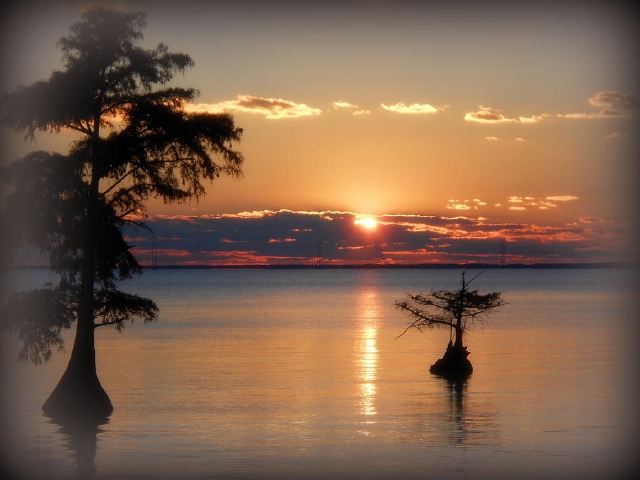
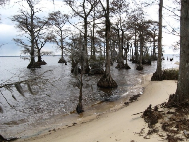
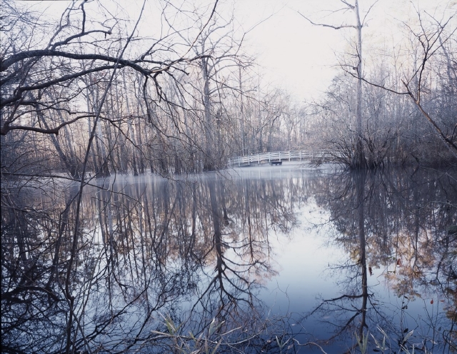
Albemarle Sound, among the richest waters on earth. Photo by Toni Abdnour
Back in time, pretty much everyone who lived here had a marsh or a swamp or a river or a creek in their backyard. But then there was progress, and creeks and marshes became nuisances. They were cast into culverts or grew up as shopping centers or smothered under trash heaps. In a few years nobody remembered they ever existed.
Millions of acres were lost. But here, in this corner of the world, though very much has been lost or altered since colonization, there remains a dynamic, quietly beautiful mosaic of swamp, marsh, river and creek that can teach us a lot about the rhythms of seasons, waters and wildlife, and where, when the moon is hiding, you can still see the glory of a night sky from a wild place.
For centuries, Albemarle Sound and the coastal plain were givers of life to Native Americans and early settlers. This is the story about a land, how it was, how people changed it, and what the future may bring. In many ways it is a reflection of the waves of change that rippled across our country as it became a nation.
But the Waters Can Deceive
On a clear windless day, you can see forever across Albemarle Sound or enjoy the dazzle of waves on the Outer Banks. You are struck by the beauty and the peace. Do not be fooled. The rages of water have influenced Albemarle history from first discovery.
Albemarle Sound is cradled by a barrier beach that snugs it in, no harbor, no easy port of call. But the ocean outside is relentless, and it is as much a part of the story as the land itself.
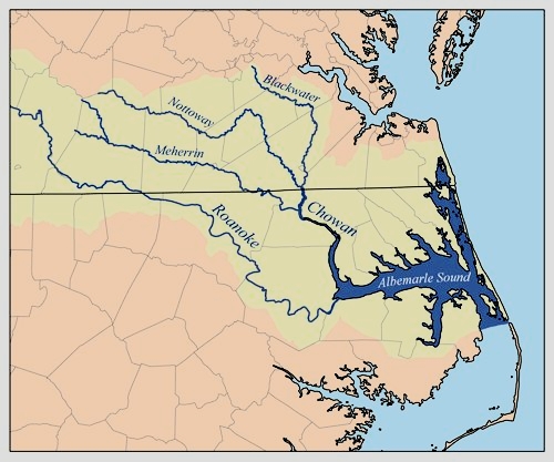
Let’s begin with a few maps to orient you to where and what the Albemarle Sound and its environs are like. The first map shows the area in northeast North Carolina that we will be talking about, tucked directly below the Virginia state line. It is part of a vast, watery system that drains wide swathes of land in two states.

Map of Albemarle Sound and rivers that feed it, from the Virginia border south. South of the Sound lies the Albemarle-Pamlico Peninsula. To the east are the barrier islands called the Outer Banks that flank the Atlantic Ocean. Artwork by Elaine Roth
Freshe Water with Great Store of Fishe
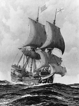
When explorers sailed up Albemarle Sound in 1586, they rode out gale winds, skirmished with Native Americans and faced near starvation as they navigated the fifty-five mile-long stretch of water. Yet what they found,“freshe water with great store of fishe, pleased them greatly.

The arrival of the English, showing barrier islands with several inlets, Roanoke Island, and the wide Albemarle Sound running toward the top (west). Shipwrecks around inlets were common (noted here as warning to future mariners?) Theodore de Bry engraving from John White watercolor 1590, compiled from voyages 1584-88.
Explorers could not immediately embrace the scope of the waters they were venturing into. Nor could they navigate them today in quite the same way as they did four centuries ago.
Rivers and the Dynamics of Change
Waters have risen, islands drowned, shorelines eroded, inlets closed (or opened). This land is a study in quick change. Unlike mountains whose risings and crumblings take eons, change along the coast can take place within our life spans, indeed within moments of our lives.
Let’s pause a moment to look at the dynamics of change before a hurricane comes along to re-arrange land once again. We’ll take a brief look at the rivers in the Albemarle, then we’ll look at the larger picture.
Nine rivers flow into Albemarle Sound. They drain an impressive 18,000 square miles in two states, with 350 miles of navigable water. Unreckoned miles of shoreline along creeks, bays and bottomlands fringe the rivers, quiet hideaways for wonderfully diverse wildlife.
Two of the rivers, the Chowan and the Roanoke contribute most of the fresh water that flows into the Sound. They are fed by tributaries that stretch miles into Virginia, which means that far-distant land uses along them can affect the vitality of the Sound.
Albemarle Watershed with river basins in yellow. Pamlico Sound (light blue, not labeled) meets Albemarle Sound at Oregon Inlet. Graphic from Wikipedia, possibly K. Musser 2007
The Albemarle-Pamlico Estuary
The Sound and its rivers are part of an even larger system. Albemarle Sound merges with Pamlico Sound to the south, which drains 10,000 square miles. Together, the two Sounds and their rivers are known as the Albemarle-Pamlico Estuary.
The entire drainage area of the Albemarle-Pamlico Estuary is 28,000 square miles and straddles two states, an area that’s slightly less than the states of Massachusetts, New Hampshire and Vermont combined.
This estuary is the second largest estuary in the country, a cradle of life, as we shall see.
(Chesapeake Bay in Maryland and Virginia is the largest estuary in the country.)
An estuary is a place where rivers meet the sea, where fresh water and salt water mix. Inlets along the barrier beach give passage to sea water into rivers and sounds.
But inlets are fickle. They can be blasted open by a hurricane or silted in, even displaced by relentless currents.
Oregon Inlet and Long Shore Currents
History records several inlets along the barrier beach. Today, a single inlet, Oregon Inlet, brings salt water into the Albemarle-Pamlico system.
Let’s look a little more closely at this magnificent landmark on the barrier beach.
In 1846 a fierce, slow-moving hurricane carved it open (along with Hatteras Inlet further south). It is named after the first boat that rode out that storm and reported on the new inlet.
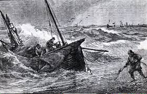
Commercial fishermen, recreational fishermen, pleasure cruisers, anyone who knows the inlet say it’s the most treacherous along the east coast. Dredging maintains navigational channels, but they are quickly shoaled in or displaced by unpredictable currents.
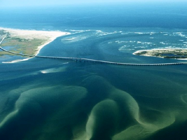
Oregon Inlet and its restless shoals, hazardous to fishing vessels and charter boats, has been the target of endless debates about costly jetties and groins to “stabilize” it. This is a classic example of nature holding sway over man. Stay tuned. Oregon Inlet Task Force
Long shore currents are at work, too, propelling Oregon Inlet inexorably south — about two miles in almost two centuries. Long shore currents sliding along the coast at an angle can also close inlets or make them too narrow for navigation.
Before navigational aids, captains often had difficulty locating inlets that may have shifted or closed since their last voyages. Sometimes they were tricked by a mirage of low beach, discovering the error too late.
Graveyard of the Atlantic this watery province is called. Latest count: about a thousand ships sunk since 1851. Many more, uncounted, have sunk into oblivion.
There is good reason for this maritime mischief. It’s brewed by a pair of opposing currents that turn rowdy as they round the Outer Banks.
The Gulf Stream begins in Florida and flows north, its warm waters splitting as it heads toward northern Europe or the Canary Islands. The cold-current Labrador originates in the Arctic Ocean and hugs the coast. They meet and do a violent hip-bump around Cape Hatteras, where the barrier island makes an abrupt turn to the southwest.

Two currents that skirt the barrier islands cause much of the turbulence in this part of the Atlantic Ocean. WNCT 9 Weather
Diamond Shoals off Cape Hatteras are fearsome waters for ships but fabulous waters for deep sea fishing.
During World War II Germany was well aware of military possibilities off Cape Hatteras, soon to be called Torpedo Junction. In 1942 more than 65 U-boats were deployed to torpedo merchant vessels and their military escorts. Within six months 397 ships were lost with 5,000 souls in this most dangerous place for merchant ships in the world, according to a US Navy report.
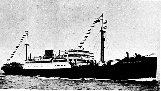
This 452-foot-long passenger-freighter City of New York, torpedoed in 1942, sank in ten minutes. Passengers, including a newborn baby, and crew were rescued by the USS Jesse Roper, a World War I naval destroyer. Photo: National Archives
The Barrier Beaches
About now you may be wondering how stormy currents and capricious inlets might affect life in Albemarle territory. Barrier beaches on the frontlines of waves might give some protection from a stormy Atlantic Ocean, but they were also barriers to transportation and trade.
There is no fine harbor between Chesapeake Bay in southeastern Virginia and the port of Wilmington at the southern tip of North Carolina.
Captains of sailing ships and steamers could choose the safety of landing in Chesapeake Bay or James River, which would add days of travel south to North Carolina. Or they could save time and take a chance on maneuvering unpredictable inlets and rough seas. Many times saving time was not a worthy choice.
Hurricanes
And finally, hurricanes stir up the mix with winds, waves, drenching rains, overwash, embedded tornados, storm surge and flooding. Cape Hatteras is the spot on the Atlantic seaboard most targeted by tropical storms and hurricanes. If a hurricane heads for Hatteras, it will surely, in some way, affect the Albemarle region.

Historical tracks of hurricanes over the past 150 years. NOAA
Each storm leaves a distinct signature. In 2003 Hurricane Isabel drove a path north directly through the Albemarle with 100 mph winds causing massive destruction to crops and farms. Few homes were spared damage from flooding, high winds, and tree falls.
Hurricane Floyd, coming on the heels of Hurricane Dennis, brought 500-year floods in 1999. The record-breaking floods put entire towns underwater and killed 52 people in North Carolina.
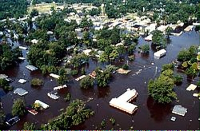
Inland flooding caused by Hurricane Floyd. Aerial photo by J. Jordan of the US Army Corps of Engineers.
If you live through a hurricane you don’t forget it. For a long time afterwards, people tell stories. Such is the case with the San Ciriaco Hurricane of 1899 that first devastated Puerto Rico and then flattened the southern Outer Banks with high winds and flooding before finally limping toward Ireland.
It is considered the worst storm ever to hit the Atlantic coast. Residents had had enough. They packed up their belongings and moved inland, but they still commemorate the anniversary with exhibits, crafts, traditional music and — storytelling.
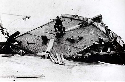
Rasmus Midgett sits atop the wreckage of the three-masted Priscilla after the San Ciriaco Hurricane in 1899, the longest hurricane ever, at 36 days. He singlehandedly rescued ten men from the sinking craft, including three wounded that he had to carry to shore. It is considered the most daring rescue ever. NC Division of Archives photo
Lighthouses and Life Saving Stations
By the 18th century several lighthouses warned sailors of dangerous waters. Each lighthouse has its distinctive day-mark, or painted pattern, and night-mark, or beacon pattern. During warm months, hurricanes and tropical cyclones do the battering; nor’easters take over during winter, though there is always the exception.

Hatteras light, the most enduring landmark on the Outer Banks, being moved 2900 feet from the shore in 1999 to avoid the encroaching ocean. Today it lies about 1500 feet from shore. National Park Service photo
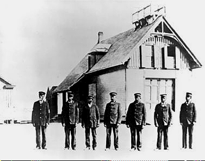
Lighthouses weren’t enough. By 1848 life saving stations up and down the beach were manned by heroic crews who, during the worst of weather, rowed repeatedly through crashing waves in small dories to rescue survivors.
Later, special boom buoys and motor-driven boats were used. Today, the Chicamacomico Life Saving Station is a museum on the Outer Banks commemorating the heroism of these courageous men.
The Graveyard of the Atlantic Museum in Hatteras tells the story of North Carolina’s treacherous coast and high concentration of shipwrecks
The all-black crew of the Pea Island Life Saving Station, with their captain, Richard Etheridge far left, who ran a tight company of life-savers. c. 1890. US Coast Guard photo
Albemarle Sound: Capricious Waters
Now let us take a look at picture-postcard Albemarle Sound to find out why it has never particularly become a sailor’s paradise.
The Sound is governed by sweep of wind, not lunar tide. Winds from the south will drive water to the north, for example, while northerly winds will drive water from the north shore to the south shore. When the winds turn, as they do, and water heads back, the Sound can seem like a sloshing bathtub. When winds run high, this can make for adventurous boating and minor but temporary flooding on one side or another.
Depths in the Sound can run from negligible near shore to a maximum of 25 feet. Winds and sudden blows can create choppy seas that turn a pleasure outing into a boater’s distress in a matter of minutes.

A fine day for parasailing above water smooth as glass. But. . .(Unattributed, Internet)
Albemarle Sound is part of the Atlantic Intracoastal Waterway. Experienced ship captains who must make the short trip across the Sound during their travels have a healthy respect for the Sound’s erratic temperament.
…the Sound can have its rough moments. Here, a sailboat is waiting for rescue. Photo from OBX Today
Near shore, the Sound is threaded with shoals and bars, products of currents and old, drowned shorelines as sea level rose over millennia. Sailing ships must have run aground once too often, because, early on, duties were imposed on ship owners to maintain beacons and stakes in the water as navigational aids.
The Baldcypress and the Osprey
Marsh and swamp forest buttress the shores, protect the land against storms. Testimony to sunken and eroded shorelines are stranded baldcypress trees. Their seeds germinate on land where they grow best in moist soils.
For a long time, they will tolerate a watery existence, but as sea level rises and water floods the land, waves will continue to erode the shoreline and leave the cypress in deep water until they finally fail.
Bald cypress along an eroded beach. Note the gnarled “knees” arising like middle-earth gnomes near trees to the right. Their function is still the subject of speculation. Once they were sawed off for use by arts-and-crafters, but today the practice is illegal. US Fish and Wildlife Service photo
All along the Sound, osprey are attracted to craggy, independent old cypress. Here they build penthouse nests called aeries and raise their young. They return from points south each spring when the shadbush blooms, which means the shad are running and fishing is good. The skies are filled with their aerial displays and high-pitched keening.
They are faithful to the same nest year after year, enlarging and refurbishing until it becomes a mansion in the sky. Unless, of course, their stranded foundation of a cypress creaks and gives way to the watery environment it did not choose in the first place. Then the osprey must seek a new home and rebuild: another unscripted result of living with the uncertainties of a dynamic environment.
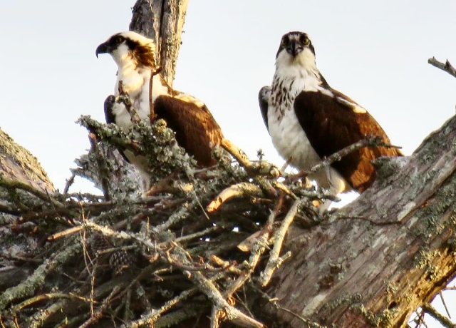
A pair of ospreys on their nest. Photo by Donna Smith
Albemarle Sound: Voyage Through Centuries Part II
Estuaries: Cradle of Life
What is an estuary? In simplest terms, it is a place where fresh water from rivers mixes with salt water from the sea. Under quiet conditions, “lighter” fresh water will float atop “heavier” salt water. But tides, currents and winds cause mixing, and that is the secret to the vitality of an estuary.
An astonishing miracle plays out in estuaries each spring with a cast of millions, no billions or trillions, or more.

Shorelines of estuaries are often fringed by wetlands like these in game lands along the Roanoke River near Albemarle Sound. NCWetlands.org
It begins with phytoplankton. These tiny plants, such feeble swimmers they can only drift at the mercy of tide and current, are the wellspring of life in the waters of the world.
Spring sunshine penetrates shallow water. Water temperatures rise, maybe to 50 degrees.
Currents of fresh and salt water mix and layer and mix again. It’s never quite the same each year. During rainy seasons more fresh water flows from the land; during dry seasons, salt water moves further west in the Sound. But the miracle plays out.
Decayed remnants of past lives dissolve into nutrients that create a soup in churning waters. Phytoplankon begin to stir. They make food from these nutrients with the help of sunlight.
They divide and multiply. Or they reproduce and multiply. Or they break apart and multiply. They multiply. They multiply. They feed zooplankton and small shrimp that become food for the fish who will come.

Artistic montage showing the great variety of phyto- or plant plankton. Zooplankton and other aquatic animals feed on phytoplankton. The entire aquatic food web depends on these tiny plants that drift with tides and digest the past and move to sunlight. Internet, unattributed
Great Shoells of Herrings
And the fish did come, hustling in from the ocean through inlets along the barrier beach. When water temperatures rise to about 60 degrees, and plankton are on the move, fish would teem by the millions from their ocean homes through inlets into Sounds and up rivers.
In 1612, William Strachey noted “great Shoells of Herrings” in North Carolina. Swimming upstream in a frenzy against river currents, adult fish would seek the quiet inlets or coves where they had been born, and there they would spawn.
Unless they were eaten first. These small fish, at the bottom of the food chain, feed the world. Every imaginable fish or shellfish with a big enough mouth eats herring or shad, including man. Herring and shad are nutritious, oily, bony fish with white flesh, traditionally eaten bone-in.
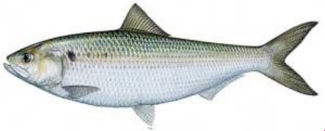
American shad, relative of the herring, about two feet long, begin migrating when they are about three years old but are not sexually mature until their fourth or fifth year. Their life span is about eight or nine years. Images above and below are from the Raleigh Ecological Service Field Office
Hickory shad came first, in mid- to late-February, then alewives in March. Blueback herring and American shad would follow in three or four weeks, one group pacing another, each taking its turn, streaming in for the great spawning adventure.
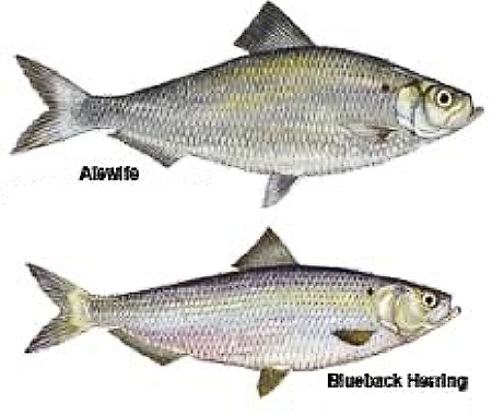
Two species of herring, alewife and blueback, small fish, under a foot, were once caught by the millions, as were shad. Like shad and striped bass, they live in the ocean most of the year but migrate to fresh water to spawn. They are called anadromous, from the Greek meaning up running.
Striped bass (or rockfish) spawn along with shad and herring (if they are not eating them or any other creature they can find) from April to mid-June. When their eggs hatch, the young depend on river currents to keep them afloat while they drift downstream to feast on a ready-made food supply of plankton and fry.

Striped Bass, top dog, will eat all the fish shown above. Spawning is a tumultuous affair involving several males and one female. Fishermen call the wild spawning “rockfish fights.” Some romance! Adults will be back in the ocean by summer, males first, followed by females. Photo by Steven Johnson
At the same time, Atlantic croaker and spot are spawning in the ocean. Their youngsters drift into the Sound through those tumultuous inlets and settle in shallow bays and coves to feed.
For centuries, this upwelling of new life, powered by plankton, this multitude of fish hurrying to spawn, was one of the grandest celebrations of springtime witnessed and welcomed by multitudes who hurried to dip their nets into the water.
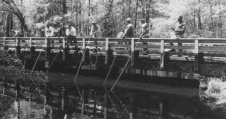
Fishermen cast their net baskets off a bridge in Martin County late 19th century
The Sound is also host to resident fish who lead less tumultuous lives. They are bottom-feeders and stay here year-round. As traditional catches of herring and striped bass declined, catfish and perch became valuable resources.
Blue Crabs and Underwater Grasses
Blue crabs make their homes in the Sound, too. The female can release eggs several times a season, up to three million in her short life, making the blue crab fishery one of North Carolina’s most valuable.

Male crabs, called jimmies, have the most meat, though she-crab soup is a delicacy. A commercial crabber lays down hundreds of wire pots on lines that can stretch for miles, marked with ID buoys. Pots are checked at least every 5 days. Internet photo, unattributed
Crabs spawn in spring and summer. Depending on sex, molting and stages of growth they range the Sound seeking waters of varying salinity. If you are out on the Sound in summer, you can follow long lines of traps that commercial and recreational fishermen bait with shrimp heads or menhaden. Catches that will go to local markets or be shipped as far away as New York City.

Blue crab in underwater meadow of grasses. These grasses play vital roles in protecting fish and buffering shorelines against storms. Photo by Jay Fleming/Getty Images
Crabs and fish find food and hiding places in meadows of grasses growing in soft sediments and shallow waters where sunlight can penetrate. Few of us notice these plants (unless they foul the propeller of a pleasure boat). Even fewer of us realize how much they contribute to life in the Sound.
As submerged grasses take in nutrients and produce food for themselves, they absorb carbon dioxide and release oxygen. Oxygen levels remain high for young, actively growing fish, water stays clear, and tied-up nutrients slow growth of unwanted algae.
Water Fowl and Wildlife Refuges
If fish take center stage in spring, wildfowl take center stage during fall migrations. Wildlife refuges, wetlands and harvested croplands are winter destinations for thousands of migrating waterfowl: Canada and snow geese, tundra swan and ducks.
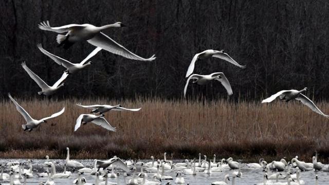
Tundra swans over the Albemarle-Pamlico peninsula. Photo by Tom Earnhardt, called the Steward of North Carolina Outdoors for his work as an environmental lawyer, writer, and co-producer of the PBS television series Exploring North Carolina
The south shore of Albemarle Sound is one of their last outposts. They once frequented wetlands along the eastern seaboard, but ancestral winter homes disappeared into airfields and cities. Leigh, a friend-now-gone spoke of throngs of wildfowl darkening the skies for hours as they passed over his house each fall when he was a youngster.
As changes to the land pushed congregations farther south, their numbers shrank. Today, the spectacle of thousands of birds feeding, loafing, and flying at will renews faith in the survival of wildlife and the environment.
They don’t visit for long. They arrive in December for the winter party, as they have for eons, leaving their summer homes on lakes in Alaska and Canada, commuting thousands of miles to easy living in their winter vacation spots. By March, they will have begun the return trip to the Arctic tundra, the great migratory flocks, ready to mate and raise young who will accompany them on their flight south next winter.

Thousands of northern pintail ducks winter in Alligator River National Wildlife Refuge waters. US Fish and Wildlife Service photo
Easy Living: Summer Homes in Swamp, Forest and Field
During spring and summer, the more diminutive “Kermit” frog takes over creeks and ditches throughout the coastal plain. The nasal queenk queenk queenk of mating green tree frogs rises through the night.
They are acrobats, leaping with grace to catch their meals, depending on large toepads for reliable holdfasts when they land. During the day you can find these light-weights snoozing on green leaves, perfectly camouflaged.

Green tree frog. Photo by Todd Pierson
Heron and osprey, alligators and snakes, brown bear and white-tailed deer, neotropical song birds and water fowl are all creatures that call the swamps, forests and fields that surround Albemarle Sound their homes.

Great Blue Heron soars over water on a cloudy day. Internet photo, unattributed
Into this remote Eden, English settlers would plant a civilization.
Albemarle Sound: Voyage through Centuries Part III
The History and the Mystery of the Lost Colony
In July, 1587, 115 English settlers and one American Indian stepped ashore on Roanoke Island. Roanoke Island lies just inside the barrier beach, near the mouth of Albemarle Sound.
Queen Elizabeth had given Sir Walter Raleigh exclusive rights to a huge, vaguely defined tract of remote, heathen and barbarous lands in the new world with a proviso that he establish a permanent English presence by 1591.
(Archaeological digs show that these heathen and barbarous people had been occupying Roanoke Island for 1500 years before the colonists arrived, since the time of Christ. This was a technicality of no immediate concern as long as everybody played nice.)
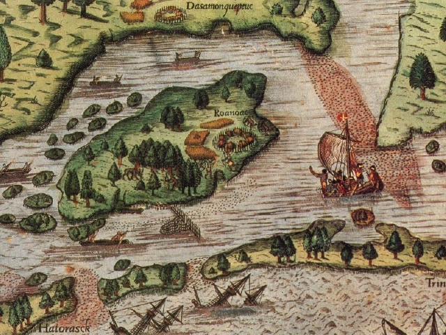
Enlarged portion of White/DeBry artwork showing the barrier beach, settlement at Roanoke Island, fishing weir, Indians canoeing, shoals of fish entering inlets, and foundering ships
Initial Explorations
The newcomers had no way of knowing that their destinies would become tangled in the rivalry of two great world powers: England and Spain.
And they were not the first to settle Roanoke Island. They were coming onto an island where explorers led by Ralph Lane had already trespassed.
Three years prior, Raleigh had sent a group to reconnoiter the Albemarle and Chesapeake area to find a base of operations for privateering.
Queen Elizabeth was opposed to outright war with Spain, but she coveted the gold that Spanish ships ferried across the ocean from their colonies in Central and South America. She strongly encouraged her seamen to become privateers. (Pirates with permission and percentages.)
How much more convenient it would be if privateers could intercept Spanish ships from a colony in the New World!
Algonquian Indians offered the seafarers food and friendship and taught them how to survive in the wilderness. Short-sightedly, Lane and his adventurers repaid the kindness with arrogance.
The colony was soon foundering from famine, storm, and disputes with American Indians now hostile to the fractiously needy white man, once thought to be godlike but who spread smallpox.
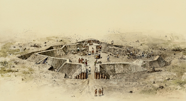
Deteriorating relations with the Secota tribe caused Ralph Lane and his men to erect an earthwork fort in 1585. Archaeologists have located its exact dimensions and replicated it on the Fort Raleigh site in Manteo. National Park Service diagram
Supplying colonies with necessities from abroad was always a logistical nightmare. Lane’s men might not have been so desperate if a long-awaited provisioning ship had not mired in an inlet. Unable to enter quiet waters, the ship lay at anchor in the ocean, battered until it finally sank.
The break point, however, was a terrible storm that lasted four days, flattening the island and wrecking ships. The troops had had enough. When Sir Francis Drake, the English explorer stopped by in 1586 after raiding Spanish ships, they wasted no time accepting his invitation of a sail home. Unfortunately, collections and diaries (priceless to us today) had to be jettisoned. (Writer’s guess: loot from privateering took precedence over collections of plants and animals and and records of discoveries.)
Great Expectations
Despite the hard circumstances, the trip turned out to be a huge propaganda success. The soil is the most plentiful, sweet, fruitful and wholesome of all the world … The earth bringeth forth all things in abundance, as in the first creation, without toil or labor, gushed a returning captain.
Investors swooned over visions of an idyllic land and Spanish gold. They clamored for shares in the enterprise. ( Lack of a safe harbor and incipient war with Spain would eventually lead to unfulfilled expectations.)
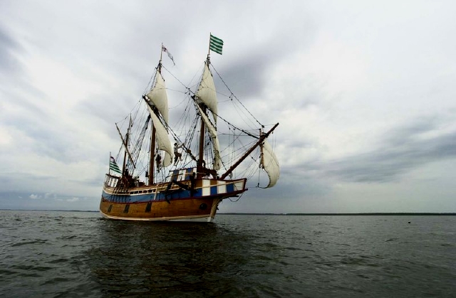
Elizabeth II, replica of ship that carried colonists to Roanoke Island, is a working vessel that gives tours in season. Photo by Drew Wilson, Virginian Pilot
There were two men in Lane’s party who took a more thoughtful approach. Each of them appreciated the wisdom of the natives and saw the potential for colonizing the land and developing its natural resources for England.
Thomas Hariot was a scientist, and John White was a painter, a map maker and a keen observer. White’s artwork and maps give us the first historical glimpse into native life in a new world.
Hariot’s book, A Brief and True Report of the New Found Land of Virginia was the first book about the land and its people written by someone who had actually spent time here. White’s artwork and Hariot’s book stimulated continued interest.
The Colonists Sail, A Baby is Born
Sir Walter Raleigh helped John White put together a community of men, women and children, families mostly middle class hoping to jump a rung, who would brave this new world. Their original destination was Chesapeake, hospitable and safe, but during what may have been a mutiny, the Navigator, ordered sailors to leave the group on Roanoke Island.
The nominal reason? It was too late in the season to go on to Chesapeake and return to England before winter. The more likely reason? Privateering.
Sailors would happily follow these orders; often their only pay was a share in the proceeds from high seas adventures, much more financially rewarding than ferrying colonists.
As Governor of the colony, John White objected. He was overruled.
Almost immediately after the settlers landed there was a birth and a death.
A colonist collecting shellfish along the Sound was killed by American Indians . . .
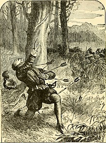
Dramatic rendering of the Death of George Howe, unknown artist
. . .And a baby girl was born to Eleanor Dare, John White’s daughter. She would be the first English child born in the New World.
The baby was named Virginia Dare in honor of the Virgin Queen, and the land was named Virginia.
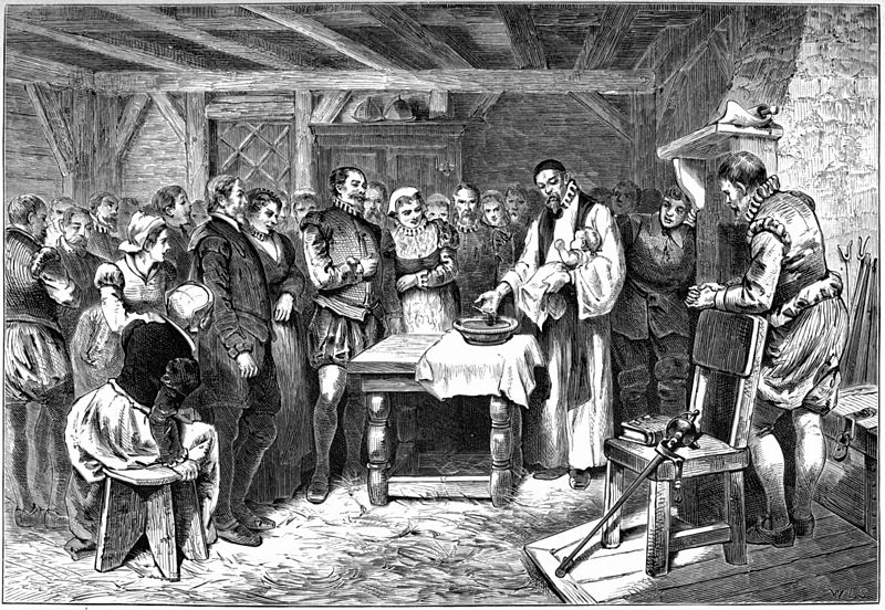
Baptism of Virginia Dare, illustration by William A. Crafts, 1876. The comfortable quarters depicted was typical of renderings by English artists who could not imagine the raw circumstances the settlers faced in a new world
A Colony in Need
The settlers were low on supplies. They had arrived at the end of the growing season so there was no time to plant crops — if they had any inkling of what they should be planting.
John White reluctantly left his family and the new settlement to gather provisions from England. He expected to return the following year.
In the days of sailing ships, it took more than two months to cross the ocean, that is, if your ship was lucky and was not blown off course or smashed by storms or boarded by pirates or detoured by a Captain who hankered for privateering — or caught in a war.
Imminent war with Spain took precedence over carrying anxiously-looked-for supplies to a beleaguered colony. Queen Elizabeth issued a stay of shipping in preparation for invasion by the invincible fleetes made by the King of Spain: the infamous Spanish Armada. All ships were commandeered for an ad hoc English flotilla.
Still, John White managed to locate a pair of dinky pinnaces that had been rejected for military service. Barely seaworthy, they were attacked by French pirates who playd extreemely upon us with their shot, hitting White in the side of the buttoke and robbing us of all our victuals, powder, weapons and provision… The expedition was aborted and the ships limped back to England.
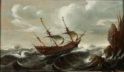
Dutch Pinnace in Rough Seas by Cornelis Verbeek, 1625
Finally, in March 1590, threat of Spanish invasion had passed and White was able to set sail again with two ships equipped by Raleigh. The voyage took almost six months; privateering and sea battles took precedence and doubled cruising time.
It was too dark to navigate the shoaled inlets when they arrived, so White and his party shouted and sang folk songs and sounded trumpets to reassure the colonists. Nobody answered, but a column of smoke gave hope.
Bad weather and capricious currents made threading the inlet from the Atlantic Ocean into Albemarle Sound hazardous. During the landing, seven of the chiefest (mariners) were drowned.
Governor John White had finally reached Roanoke Island, on August 18th, 1590, his granddaughter’s third birthday.
An Empty Settlement
Unknown to White, crops had probably failed during his three year absence. Tree rings show extreme drought in the southeast from 1587 through 1589. Colonists were likely dependent on largesse from Indians that could be unreliable if their crops were failing, too.
White found no one. The smoke had apparently come from dead grass and trees. Chests that he had buried were unearthed, his belongings scattered, my books torne from the covers, … my pictures and mappes rotten and spoyled with rayne, and my armour almost eaten through with rust. Scattered dwellings were in ruins, but White found no signs of strife.
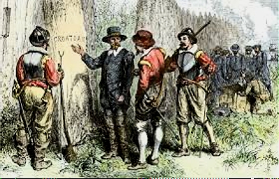
CROATOAN
They had all recognized what a slender thread connected them, one to the other, and to their survival in the wilderness. Before John White left, some of the settlers agreed to make their way to Chesapeake; others would stay and await White’s return. If they had to vacate the island, they promised to leave a sign for him.
CROATOAN, carved into a wooden post, was that sign. I greatly joyed that I had found a certain token of their being at Croatoan where Manteo was born and the Savages of the Island [are] our friends.., White wrote.
High expectations! Let us see why John White had such hope for the colonists in Manteo’s care.
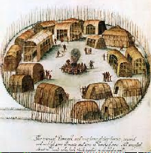
John White watercolor of Algonquian village, Pomeiock, probably similar in layout to Croatoan, c. 1585
Manteo
Manteo, you may now have gathered, was the Native American travelling with the English. He is memorialized in the name of the town where Fort Raleigh is located.
(The name of one other Native American, Wanchese, is memorialized on Roanoke Island. Like Manteo, Wanchese, had spent time in England. Though he was initially on friendly terms with the English, he grew increasingly mistrustful and ultimately hostile. In fact, he was one of the group who attacked George Howe.)
Manteo was special. He learned how to speak English. He was impressed by English technology. He worked with Hariot to record Native American language and customs. He was presented to investors at Raleigh’s home in full (English) costume. He befriended Ralph Lane during his explorations. He assisted John White in establishing the colony. He was an interpreter and peacemaker on Roanoke Island.
He was both an oddity and a tool for the English, but genuinely respected, especially by John White and the colonists. A month after the colonists landed, Manteo was christened in Roanoak, and called Lord thereof. . . in reward of his faithful service.
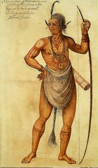
Water color by John White of an Algonquian chief, not necessarily Manteo
Manteo was royalty. He was chief of the Croatoans, a small tribe who lived on Hatteras Island. His mother was royalty, too. She was, for lack of a less awkward term, chieftainess of a tribe. (In Algonquian communities it was not unusual for women to hold high office.)
The word on the post gave hope. It would appear that the colonists had left Roanoke Island to join the Croatoans.
But like the Lost Colonists, Manteo would fade into history.
Croatan and the Mystery
It was only a fifty miles south to Croatoan on Hatteras Island. John White would have liked to make the sail. But the drownings of critical mariners and the loss of one of the ship’s anchors (the fourth on this particular voyage), and bad weather made sailors impatient to head back to England.
John White would never find the colony nor see his family again.The loss of the colony was a personal tragedy for White from which he did not fully recover. He never returned to the New World. Resigned, he wrote to a friend that he must give over the fate of the colonists and his family to the merciful help of the Almighty, whom I most humbly beseech to helpe and comfort them.
Searches for survivors were futile, though one Jamestown colonist wrote that he had seen an Indian boy whose hair was a perfect yellow with reasonable white skin. . .a Miracle amongst all Savages.
Meanwhile, the mystique of the Lost Colony cast a spell that exists today. All sorts of theories short of alien abduction have been advanced to explain the disappearance of the colonists.
They were murdered by hostile Indians. They were prisoners of the Spaniards. They died of famine or disease. They left the area to settle elsewhere.
Artifacts and Archeological Work
Under the auspices of the Croatoan Archeological Society in Buxton, an archaeologist from England and volunteers have uncovered thousands of artifacts on Hatteras Island.
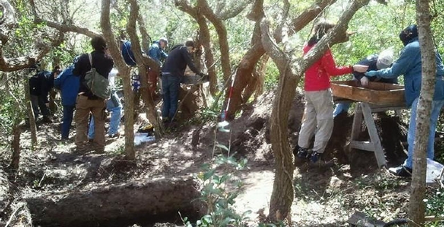
Lost Colony archaeological site on Hatteras Island. Croatoan Archaeological Society
They show a clear mix of Native American and English pieces, copper rings, sword handles, earrings, a Nuremberg token, writing slates, glass, that appear to date back to the time of the Roanoke colony. Many are displayed in the Hatteras Public Library.
Co-founder of the Society and author of The Lost Colony and Hatteras Island, Scott Dawson, stresses that it is a story of brotherhood and friendship rather than violence and hatred. . . a story that leads to assimilation and family.
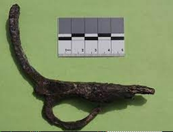
Hilt from a sword probably owned by an upper class individual unearthed at Hatteras Island site. Croatoan Archaeologist Society
Two sites, called X and Y, have also been worked in Bertie County near the mouth of the Chowan River. Motivating this archaeological dig is the belief that colonists may have sailed west in Albemarle Sound toward the Roanoke River. This was Tuscarora territory, and these tribes were known to be hostile to the white invaders. However, there seems to be evidence that English settlers had successfully set up housekeeping.
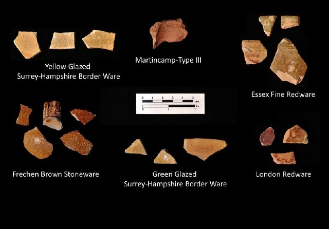
Sixteenth century English pottery found in Bertie County sites, dig sponsored by Lost Colony Foundation
Had John White not been caught between war and weather, his quest might have ended happily. We can only speculate and wonder.
The history and the mystery of the Lost Colony is kept alive by nightly performances in summer overlooking the water and by exhibits at the Fort Raleigh National Historic Site.
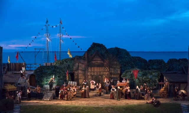
Lost Colony Outdoor Drama on Roanoke Island has been performed since 1937. Carol Highsmith photo, 1946, Library of Congress
Albemarle Sound: Voyage Through Centuries Part IV
Early Settlement: Survival, Self-sufficiency, Rebellion, Disease
Less than a century after the first English families stepped ashore on Roanoke Island, steady streams of pioneers were betting on hope.
They were settling along the north shore of Albemarle Sound. They had little inkling of the adventure ahead (reports from explorers were always glowing) nor how self-reliant they would become, nor how hard it would be.
Hunters, fur trappers, Indian traders, the solos of civilization, had boldly explored before, reaping marginal rewards. They understood the reality of life in the New World.
England, heady with anticipation for its rewards, awaited big returns from her wilderness colonies founded on land she did not own.
Why Did People Come?
Some immigrants were leaving an intolerable life. Some wanted to get rich. Some wanted to worship freely. Some came to avoid being hanged.
If you couldn’t afford passage, or if you were offered the choice of hanging or banishment, you came as an indentured servant, bound to a master for a certain number of years.
You might hope to learn a trade and you might hope to receive freedom dues at the end of your tenure: money, clothes, seeds, a gun, or maybe even a piece of land. Servitude could be a path to new beginnings, or it could be a dead end with overwork, early death, poverty, or continual re-indenturing to stay alive.
Some had no choice. They came as slaves, chattel bound forever to planters, many from Barbados sugar cane plantations.
Few came with the desire to enrich England’s coffers.
But First They Had to Get Here
Albemarle Sound has no safe harbor. A barrier beach spells the lash of the Atlantic Ocean, but inlets are notoriously dangerous. So ships routinely sailed into Chesapeake Bay to disembark along the James River.
The James River is the largest and most southerly river shown in Virginia. The Elizabeth and Nansemond Rivers flow south from the James River.
From there, settlers who wanted to go south had their choice of travel on two rivers, the Elizabeth and the Nansemond, which, according to propaganda-of-the-day will convey you into Carolana, so that this (James) River is a Haven to both Colonies.
Well, maybe. To get to North Carolina from the James River would require another 80 miles or so of hard traveling. First an upstream row on one of the two rivers on a flatboat or other small craft.
Then miles of slogging on Indian trails, many along rises through the Great Dismal Swamp (greatly whittled down today). Alternatively, a traveller could head west over land toward the Blackwater River, then navigate the Chowan River downstream.
Quaker missionaries William Edmundson and George Fox were overwhelmed by the trip in 1670. Edmundson, whose guide got lost, was sorely foiled in swamps and rivers. And Fox wrote that he was overwearied by the time he got to Carolina, having travelled hard through the Woods and over many Bogs and Swamps.
The Great Dismal Swamp, land that had to be gotten around or through to get to North Carolina from Virginia. From the Encyclopedia of Forlorn Places
Half a century later the land was still impassible. Surveyor William Byrd described it as a miserable morass where nothing can inhabit. (Except runaway slaves who forged clandestine communities in the tangle.) By 1796 there would be a canal through it, initially proposed by George Washington, dug by slaves.
Survival
Surely the seeds of familiar grains, wheat, rye, oats and barley, would prosper here, since the climate and soil were so felicitous. They did not. Fortunately, there was corn.
Algonquians had adopted Three Sisters farming, complementary planting of maize, beans and squash that sprang from the Iroquois creation myth. An Algonquian named Squanto shared the technique with Jamestown settlers.

Inspiration for the practice may have come from myth, but it was efficient, practical, nutritious and sustainable. GardenCityHarvest website
Plantings were mounded for drainage and minimally tilled. Corn stalks supported bean vines. Squash hugged the ground, kept it moist, cool and weed-free. Herring or menhaden and maybe some ashes were buried for fertilizer. Bacteria in root nodules of beans fixed nitrogen in soil. A truly remarkable way of farming.
We don’t hear much about beans and squash, but corn saved the colonists. They used every part of the plant. Kernels, dried, roasted, ground or green, kept people alive. Leaves and stalks were fodder for livestock. Husks were woven into baskets, brooms or chair seats, or used to pad mattresses and collars for draft animals. Cobs became kindling and, of course, pipes. And corn liquor saved people from drinking bad water.
John Lawson was an explorer in the 1700s, a kind of self-appointed reporter who gave a pretty accurate, if optimistic, picture of the land. . . .Mild winters and a fertile Soil beyond Expectation produced everything that was planted to a prodigious increase. . .
He was less impressed with the homesteaders: he never saw one Acre of Land managed as it ought to be…and were the planters as negligent in their Husbandry in Europe as they are in Carolina their Land would produce nothing but Weeds and Straw. . .
We can make a couple of inferences from that quote. First, Lawson had a different perspective from the farmer. He was briefly observing, not continually laboring under the grindstone of the wilderness. Second, virgin soil, gift of the great forests had been building over centuries. It gave freely to the farmer, no prodding needed (though eventually it would give out from overwork).
Their methods might have been less-than-casual by Lawson’s standards, but eventually the colonists produced so much corn that New England sent vessels here to pick up cargoes of it, and wheat, too, that finally succeeded as a cash crop. (Stony soil and short growing seasons limited production up north.)
Those early days were often rough, especially if crops fell short and the winter was long. Then colonists traded with American Indians, or waited for supply ships, or went on half rations until spring.
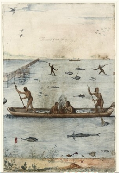
“The Manner of their fishing,” composite drawing by John White c.1585 showing labyrinthine brush weirs, spears and nets and a variety of fish including a horseshoe crab, whose eggs were eaten by Native Americans
Springtime brought the great fish migrations, and great joy, for with fresh fish came giddy salvation. Colonists learned from the Native Americans how to fish the rivers and salt the herring, small fish, to preserve them through the winter in buckets and barrels. Meals would consist of fried salt herring and cornbread washed down with yaupon tea. Three times a day.

Leaves and twigs of yaupon holly contain caffeine. Those cups of tea must have kept the colonists going all day long. Photo by Will Cook
(Yaupon holly is a robust, pest-free holly native to the coastal plain. The botanical name, Ilex vomitoria, comes from Native American rituals of drinking huge quantities, then purging before battle. In gardens today, its dwarf form is an excellent substitute for boxwood hedges.)
Self-Sufficiency
Scattered homesteads, isolated by swamp, produced self-sufficiency. Clearing, planting and harvesting were done with primitive tools: hoes, scythes, shovels and axes for the first hundred years until plows eased manual labor.
The great forests gave them skins and furs, especially deerskins, but birds and animals threatened crops. Bounties on wolves and wildcats gave incentive for extermination.
Households produced their own food, drink, clothing (homespun of flax and cotton). They built their own homes, furniture and boats, planted gardens and orchards with apples and peaches for good eating and prodigious quantities of liquor.
Dunghill fowl (chickens) provided food and feathers for beds, and stocks of bees provided wax for candles and sweet treats. Corn was pounded by hand, until grist mills in the 1700s produced a smoother product for a small fee. (One early traveler commented that there wasn’t much difference between corn meal for the family and fodder for the horses.)
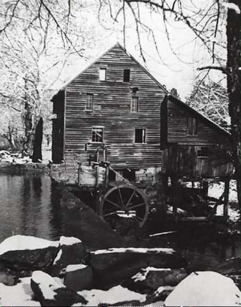
Yates Mill, constructed in the 1750’s, is an example of grist mills of the time. Grist mills soon became centers of community life. Photo ca 1942. NC Museum of History
Farm animals fattened quickly. Cattle, horses, sheep and swine bred easily and spent the mild winters outdoors on their own. Before the Revolution, Carolinians grudgingly exported farm animals to stingy Virginians. Once the Revolution freed up trade, produce was sold up north instead, to New Jersey and Pennsylvania, at fairer prices.
As homesteads prospered, families purchased ready-made clothing, shoes, sugar, salt, molasses, and rum from ships that came in from England and the West Indies.
Colonists had little money, so they bartered with each other for goods and services. Debts and fines were paid with country commodities: Indian corn, tobacco, wheat, port, or deerskins.
In time, a sort of division of labor for profit worked its way through society and particular skills were marketed: boat building and milling, for example.
As society became more complex, gold and silver coin and paper money supplanted barter and country goods.
Early Relations with Native Americans
Initially, most contact between the two civilizations was amicable. One village, for instance, introduced explorers to roasting eares and Sturgeon.
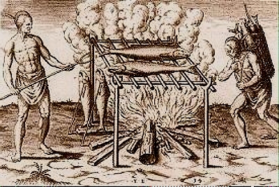
Indian method of roasting fish. John White drawing, Theodore deBry engraving, 1586
There are recorded instances of trust and personal favors.
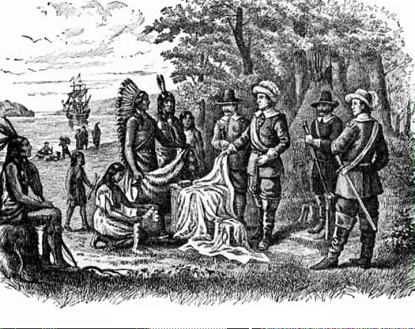
In the 1650s the King of the Roanoke Indians brought his son to the home of Virginia legislator Francis Yeardley to learn to speak out of the book and to make a writing. Yeardley provided a carpenter and workmen to build an English house furnished with English utensils and chattels for his chieftain friend.
Yeardley soon purchased land along three great rivers from the Roanokes for 200 pounds sterling. The deal was sealed with delivery of a turf of the earth with an arrow shot into it.
The Duke of Albemarle and the Lords Proprietors
Governing this sprawling southern territory was a headache for the Virginia colony, especially with threats from the Spanish, who were nipping from the south.
Enter George Monk, 2nd Duke of Albemarle, brilliant leader of armies, adroit political strategist, and loyal friend of exiled King Charles II. After a decade of Commonwealth rule under dour Oliver Cromwell, England was ready for a change. Monarchy? Or anarchy? The Duke of Albemarle lobbied hard for monarchy until parliament finally agreed.
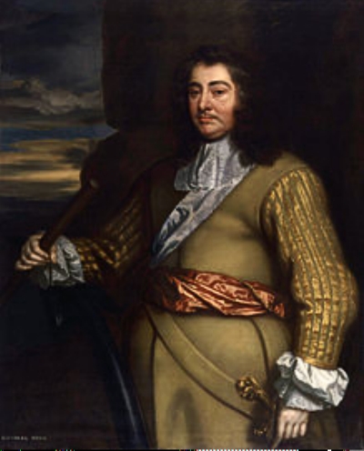
George Monck, 2nd Duke of Albemarle
In 1660 King Charles II, the Merry Monarch to his subjects, came out of exile to take the throne. He owed big favors to the Duke and supporters. He had an eye for empire that would bring guineas to satisfy debts and allow for kingly frivolities like theatre and lavish parties.
Three years later, he signed the Charter for the Province of Carolina, his land (Carolus is Latin for Charles), naming eight supporters as Lords Proprietors. They would rule the tract that would become North and South Carolina by committee from the comforts of England. The Duke of Albemarle, the oldest, was named first palatine, titular CEO in today’s parlance.

Lords Proprietors seal, with coat of arms on one side and inverted cornucopia with Indians on the other side. Translated, the motto reads The Taming Makes the Land
The motto on the seal, The Taming Makes the Land, embodies the English approach to land, used or abused, as an avenue to wealth.
Nobody truly understood what was going on here. The King and cronies remained in England with their wilderness fantasies stirred by glowing reports from explorers who never seemed to mention the muck, the snakes, the bramble and the bugs.
The Proprietors envisioned elaborate courts, feudal manors, and silk. One detail was missing. They needed people to work to turn their visions into reality. Never mind that survival here was a full-time calling in over-drive.
They gave settlers religious freedom, not because of a holy conversion to tolerance, but because Methodists, Presbyterians and Quakers were stable bodies that could populate the new land, and reduced the number of religious infidels at home.
To further swell the ranks of laborers, English judges routinely meted out death sentences for trifles, then benevolently commuted sentences to indeterminate indenture in the colonies.
To attract investors, the Mother Country — temporarily — waived the Navigation Acts that would tax goods and bind colonial shipping to England exclusively — a rasp of a burr that would lead to Revolution.
It was grand-scale venture capitalism. Tobacco was Aztec gold to investors. They would be sure to assemble the manpower to produce enough to satisfy a Mother Country that craved this novel opiate.
Planters with capital could purchase large tracts of land at bargain rates. Acreage granted was based on numbers of servants and slaves in tow, a tidy incentive that exploded into another two hundred years of bondage.
It all sounded so promising. But nobody was happy. Not the Proprietors who were getting complaints instead of tax money. Not the settlers who were paying higher quitrents than their neighbors in other colonies. And for what? Widespread corruption, broken promises, haphazard governance and lack of protection from American Indians and Spanish invaders.(A gritty attitude toward justice and fairness was seeding in.)
Culpeper’s Rebellion
England decided to enforce the Navigation Acts. The goal of trading in the 17th century was to import as little as possible, export as much as possible, make as much money as possible and hoard the profits. It’s an economic policy known as mercantilism.
Example of British sailing ship of the 1600s, the Mayflower by Paul Strayer
Colonists were limited to shipping only raw materials only to England and only in English ships. England would send finished products back to the colonists for purchase at high prices. Taxes were levied on every transaction, at every turn, even on goods shipped between colonies.
Albemarle residents were irate. Tobacco was their cash crop, but it had to be sold to New England first because their small ships navigated Albemarle inlets easily. Cargo was then loaded onto larger English ships.
Layers of new taxes took the profits out of tobacco, at a time when hurricanes, drought and hard rains caused years of bad crops. (The Albemarle would never realize the tobacco bonanzas of southern Virginia and central North Carolina.)
They decided to send an envoy to England to plead their cause in person.
They chose a sympathetic former governor, Peter Carteret, to articulate their concerns: they were isolated by swamps with poor roads, cut off from sea trade by the barrier beach, they needed more help.
The Proprietors knew that governance had been lax and laws enforced without rigor. But they also feared their charter might be revoked if the Navigation Acts were ignored, for these were the embodiment of English law on the high seas.
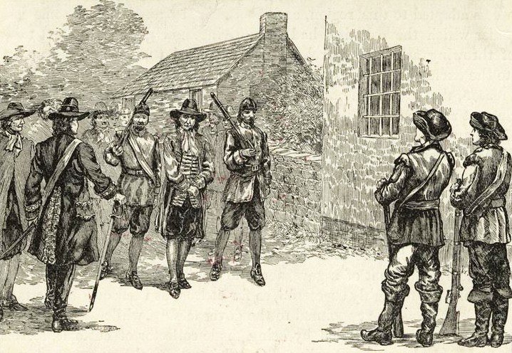
Artist’s imaginings of the Culpeper Rebellion. Pretty civilized, as rebellions go. WilliamDentonblog
What else could angry settlers do? In 1677 they rebelled. It was a small rebellion. The idea of cutting ties with England was never entertained. But the rebellion lasted for two years and it epitomized the spirit that would propel the colonists toward independence a century later.
In historical accounts, Thomas Miller comes off as a rigid bureaucrat with a midget mind and a classic talent for ruffling feathers. As customs collector in an agitated colony, he was zealous about seizing illegally imported goods and imposing fines.
When the chance came, he appointed himself interim governor and proceeded to interfere with elections and imprison opponents, including George Durant, a prominent and highly regarded settler. This was not a good move.
Miller traveled with armed guards who apparently lost their nerve when forty armed colonists confronted them and jailed their leader. They did not fire a shot. The revolt was bloodless.
It was called Culpeper’s Rebellion. John Culpeper was a renegade who had been thrown out of Charles Town and who had the reputation of a troublemaker who enjoyed a good fight. He was the leader and took over as governor, presumably ruling to the satisfaction of his peers for a time.
Meanwhile, Miller escaped and fled to England to spill the beans. Culpeper followed to make his case and was tried for treason. One of the proprietors pointed out that colonists had a right to riot over poor governance, that Miller was not governor and his abuses were intolerable. Nobody was particularly keen on bad publicity about the colonies. Culpeper was acquitted and sailed back to a hero’s welcome.
The presence of the next royal governor was supposed to awe the colonists because he was also a Lord Proprietor. Not so. As one historian observed, in Albemarle, a Lord Proprietor was no more regarded than a ballad-singer.
Seth Sothel proved himself to be one of the dirtiest knaves that ever held office in America. Colonists truly revolted this time. They accused Sothel of drunkenness, robbery and tyranny. They imprisoned him, tried and convicted him and banished him from the colony.
Self-Government
In the long run, England did the colonies a favor. You might call it benign neglect. The Proprietors’ lack of interest in the particulars of running a colony gave colonists the independence to settle matters in their own way and to their satisfaction, Governor Sothel’s banishment being a prime example.
About a decade after the Proprietors laid down a general code of laws envisioning themselves as lords of the manor with colonists as fiefs, they put together a more pragmatic set of rules that would authorize colonial justices to administer county functions.
Since most people could not read, justices came from community leaders. These were the tiny but visible elite who held the best land and ran the best farms.
Here is what the justices were responsible for: adjudicating minor civil and criminal cases, probating wills, registering cattlemarks, supervising orphans, opening roads, contracting for bridges, establishing ferries, overseeing public buildings, such as courthouse and jail, paying jurors, acquiring weights and measures, stocking the powder magazine, levying taxes, and maintaining control over expenditures.
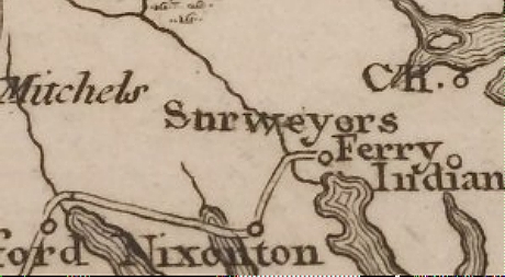
Detail from 1790 map based on 1733 Moseley map showing ferry crossings on the Pasquotank River that would have been managed by the justices. NC Maps Blog
Justices also entertained petitions for roads, appointed juries to determine routes, designated a company and surveyor to build roads, and an overseer to maintain them. Swampy terrain, negligent overseers, and curmudgeonly landowners invariably delayed progress, but by the eve of the Revolution a rudimentary highway system with bridal paths and bridges had been created.
Good practical experience that would lay groundwork for managing a young country.
Noxious Disease
In 1729, the Lords Proprietors sold their rights to King George II and North Carolina became a royal colony. By this time, Native American populations had shrunk.
Tribes who traded regularly with the English were devastated by smallpox. Only about 500 natives were left in the Albemarle; deaths were as high as 90 per cent in some tribes.
Unknown European artist’s imaginative rendering of trading that spread smallpox and other diseases. (Note: Women handled business affairs in Algonquin tribes, so the woman should be central, not subservient, in this trading tableau)
Immigrants carried with them a cauldron of diseases. The English brought smallpox, measles, tuberculosis, diphtheria, whooping cough and influenza. African slaves from the West Indies brought malaria and yellow fever. Parasites of shipboard rats contributed typhus, and contaminated water spread typhoid fever.
By 1755 the brew of wretched diseases must have gotten out of hand, because the colony restricted tainted imports and passed the Distempered Act to bar immigrants who suffered from malignant infectious distempers.
Within a few years, investors and merchants began complaining that these restrictions interfered with profits and recruitment of fresh labor. The Act was repealed in 1760.
(Though indigenous diseases affected Native Americans, I could find no noteworthy records of Native American diseases being traded to colonists.)
A Rosy Outlook?
Despite diseases and taxes, the next century would be a prosperous one for eastern North Carolina, with rapid growth plucked from land rich in resources. By the decade of the Revolution, the entire colony had grown from 21,000 in the 1600s to about 250,000 in 1780, 80,000 of whom were slaves.
Though plantation life was expanding, most of the land was worked by independent yeomen who were able to cobble together a reasonably comfortable life by farming, fishing, and hunting, with maybe some logging for extra income. They were a sturdy, self-sufficient lot, able to improvise, wise in the wild ways of the land, unflinching in a fight, but with a neighborliness and generosity that continues to this day.

Idyllic afternoon on the water, unknown artist
As crossroads grew into towns and cities, or remained rural, place names once derived from names of Native American tribes blended with names given by the English to their settlements. Reading them is to reflect on the heritage and history of the Albemarle.
Albemarle Sound: Voyage through Centuries Part V
The Inevitable Road to Independence
It took a lot for colonists in eastern North Carolina to consider revolt. All they wanted was fair treatment. Don’t exploit us. Give us some say. We’ll be loyal subjects.
But royal governors, no matter how capable, were born to silver-spoon aristocracy and tone-deafened by uncompromising loyalty to a patronising English system. Parliament expected the colonists to pay off England’s debts from past wars with Indians, plus some extra in appreciation.
In the end it came down to money.
Taxes Taxes Taxes
If nothing else, England was resourceful in thinking up ways to get the colonists to pony up. The Navigation Acts. The Sugar Act. The Stamp Act, The Townshend Acts. The Tea Act. And finally, The Intolerable Acts (retribution for dumping tea in Boston Harbor).
Charles Townshend (author of those Acts) stated the English position neatly, with a liberal dollop of cloying benevolence.
Now, will these Americans, children planted by our care, nourished by our indulgence until grown to a degree of strength and opulence, protected by our arms, will they grudge to contribute a mite to relieve us from the heavy weight of that burden which we lie under for their defense?
And here Americans thought they were the ones bearing the burden.
The Stamp Act and Angry Colonists
The Stamp Act in 1765 lit the fuse. It pitted angry colonists against England and its governors.

Depending on the document, stamps were applied according to a schedule of values
A stamp or British seal had to be purchased for every newspaper, pamphlet, contract, or other legal document. Effectively, no goods could be transported without using these stamps.
Governor William Tryon, who had just settled in at New Bern, the state capital, signaled unswerving support for The Stamp Act.
Rebellion flared in North Carolina and every other colony. Tax collectors were bullied into resigning. Crowds — mobs — gathered in cities (five hundred in Wilmington, North Carolina) to mourn the death of Liberty in solemn processions.
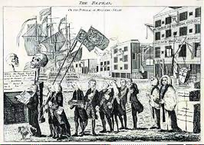
Cartoon example of a procession mourning the death of Liberty. Wikipedia
Governors and tax collectors, were hung or burned or decapitated or a mix-and-match in effigy. In Wilmington, the victim is never precisely named, instead called that Honourable Gentleman).
The colonists organized a Stamp Act Congress to petition for repeal (though North Carolina did not attend because the Governor refused to convene the colonial Assembly to elect delegates.)
Sons and Daughters of Liberty formed among working classes. Sons enforced boycotts on imported goods. Daughters made the boycotts work, spinning homespun and brewing herbs to replace tea.

The skull and crossbones became the common symbol of the death of a free press as a result of The Stamp Act (left)
After a year of futile attempts at enforcement and complaints from English merchants about boycotts and losses, Parliament repealed The Stamp Act. But face-saving retaliation was needed. That’s when the Townshend Acts were passed, taxing certain exports instead.
How did the colonies become so united in their opposition? Never under-estimate the power of a Free Press. Printers of independent newspapers published slogans, reported ideas and events, established networks. News and views traveled as fast as a horse could fly from town to town, colony to colony.
The Royal Governors and Defiance
In the midst of the frenzy, Governor Tryon decided to build a Georgian-style brick palace that mirrored the suggested majesty of his position. One architectural writer called it a monument of opulence and elegance extraordinary in the American colonies. More taxes were levied.
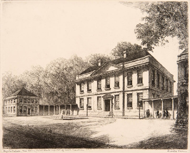
Tryon Palace, a complex of buildings, shown here in a 1950 etching in paper by Louis Orr, is open to the public for tours and programs. NC Museum of Art
(At least colonists got quality for their shillings; the unfinished palace withstood the Hurricane of 1769 that leveled two-thirds of New Bern.)
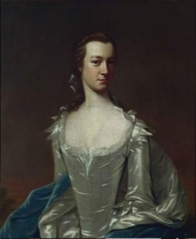
Margaret Wake Tryon, wealthy, learned, accomplished, in regal attire befitting a colonial Governor’s wife. Wake County is named in her honor. Unknown artist. Wikipedia
Then, still mired in conflict and controversy, Tryon left the mayhem here to become Governor of New York. The next governor would have to deal with hostility in the colonial Assembly and with sharp anger over a failed rebellion by back country dissidents, the Regulators, some of whom had been hanged after tangling with standing militia over taxes.
Amiable, hardworking, but equally tone-deaf Josiah Martin (who owned several plantations) became the new governor and began to fill the palace with collectibles and live the high life.
He brought his family to Hillsborough to avoid mosquito-season along the coast. There were dinner parties and tea parties, horseback rides and drives. The town was filled with the rich and the beautiful.
Martin skirmished continually with the colonial Assembly. When they proved intransigent, he finally dissolved the group. Not-so-amiably, he began building a loyalist force.

Amiable Josiah Martin used his tact to pacify the Regulators but he had no idea of the turbulence to come in his colony. carolana.com
In 1773, the judicial system collapsed. Cases would be decided by military tribunal instead of civil magistrate. North Carolina colonists were incensed. Radicals began to call for separation.
The Tea Act
On top of this, came the Tea Act in 1773. Why in the world should the colonists complain about this Act? reasoned the English. This was not a tax. Colonists were already paying taxes on tea, but now, colonial merchants, middlemen in the tea-trade, would be cut out of their profits. Instead, profits would go to the financially troubled East India Company.
England, still blinkered, assumed that nobody would notice and those unruly colonists would hush their irritating cacophany of complaints.
Colonial merchants and their profits were not so easily parted. The ruffians dumped East India tea in Boston Harbor! Now upper class merchants and planters were united with middle-class Sons and Daughters of Liberty.
The Intolerable Acts, Boycotts and Generosity
Tempers might have cooled and saner minds prevailed, but England replied with the Coercive Acts, called the Intolerable Acts by the colonies, that closed the port of Boston and rescinded the Massachusetts charter until the tea was paid for. This was the final insult that united patriots up and down the coast.
In North Carolina a group of patriots formed the first Provincial Congress in Summer 1774 and called for a formal boycott of all British goods to be enforced by counties in the colony.
This action in North Carolina is widely accepted as the first formal declaration of defiance of British rule in the colonies.
(Later, in October 1774 the First Continental Congress would call for a boycott of British goods by all colonies.)
Women from the town of Edenton (located near the Chowan River) formed their own Tea Party and signed a pledge to boycott British goods. North Carolina and other colonies sent food and supplies to their beleaguered northern neighbor.
The town of Hertford (located on the Perquimans River) shipped 2097 bushels of corn, 22 barrels of flour, and 17 barrels of pork.
Boston’s Committee of Donations, thankful, wrote that the losses, sufferings, and distresses…are really great…not easy to be conceived. Particularly after Parliament enacted the Restraining Act directly against New England: no fishing on traditional grounds and no trading with any other country except England.
Informed by a patriotic free press that reinforced a single theme, colonies and communities were hardening their opposition against England and, significantly, opening their hearts in spontaneous generosity to their comrades.
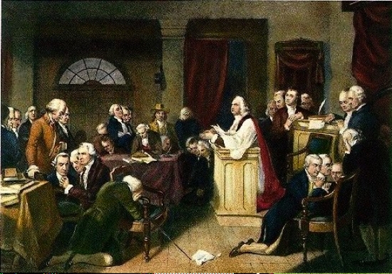
Prayer during a meeting of the First Continental Congress that met in Sept/Oct 1774 and voted to retaliate against the Intolerable Acts by boycotting British products. Bostonteapartyship.com
A Governor Flees
The fuse was sizzling. By 1775 the Second Continental Congress had ordered counties to set up Committees of Safety that gradually intimidated and weakened the power of royal governors.
Fearing for his life, Governor Martin abdicated, fleeing the palace in a coach one night to take refuge in the safety of Fort Johnston near Wilmington, which he described as a wretched little place.
Governor Martin would eventually be fingered as the instigator of a plot to arm slaves against the colonists.
From secure exile on the HMS Cruizer, he denounced the Safety Committees and determined to restore royal authority. He organized Loyalists, enlisting Scottish Highlanders, whose ancestors were known for their fierceness in battle, and who were loyal to the Crown.
The Lexington and Concord of the South
The Battle of Moore’s Creek Bridge in February, 1776 near Wilmington in eastern Carolina was brief, maybe only three minutes long. Yet it was pivotal. It has been called the Lexington and Concord of the South.
It galvanized patriots. It defused loyalist activity. It marked the permanent end of royal authority in North Carolina. It would help to hold the south for the colonists during the early days of the war.
And it produced the historic Halifax Resolves in April, 1776, a full three months before the Declaration of Independence was signed in Philadelphia. This bold North Carolina document lists the colony’s grievances and England’s failure to redress them, with this key resolve:
Resolved that the delegates for this Colony in the Continental Congress be impowered to concur with the other delegates of the other Colonies in declaring Independency, and forming foreign Alliances, resolving to this Colony the Sole, and Exclusive right of forming a Constitution and Laws for this Colony. . .
It might have been an easy victory for the British if the regiments that were promised to Governor Josiah Martin had shown up for battle. They were delayed by bureaucracy and storms and arrived three months too late.
By mid-February 1776 Martin had assembled about 1600 Highland Scots and other Loyalists. Meanwhile Patriots began to group Minute Men and militia near a narrow bridge situated at the highest point along Moore’s Creek, an excellent defensive position. The bridge crossed the dark swampy creek where the waterway was 50 feet wide and three feet deep.
A bleak winter shot of Moore’s Creek Bridge. National Park Service
The Loyalists were camped about six miles away. At 1 am on the 27th they began their march through bone-chilling, icy waters. After several hours they found campfires burning in the Patriot camp. Yet there was no answer when the Loyalists called for surrender. Assuming the rebels were in hasty retreat, they regrouped to pursue them at daybreak.
At one point a Patriot sentry fired a warning round and the Loyalists forged toward the bridge, shouting with gusto, King George and broadswords, while Scots played bagpipes.
The Patriots, numbering about a thousand, had left their campfires burning as a ruse to deceive Loyalists while they moved their forces into position across the bridge. Then they removed the planks from the bridge, greased its girders and went into hiding.
Only a few Highlanders made their way over the slippery remnants of the bridge, and they fell rapidly under heavy Patriot fire. Within three minutes the battle was over, with about 70 Highlanders killed or wounded and one Patriot who died four days later.
The patriots took about 850 captives who reported being treated with respect. All except ringleaders were released on parole. Spoils of battle included 500 muskets and 300 rifles (many from farms), and $15,000 (value at the time) worth of Spanish gold.
Reconstructed Patriot earthworks at the Moore’s Creek Bridge site. National Park Service
The site of the battle, including the reconstructed bridge, is preserved in Moore’s Creek National Military Park, 86 acres managed by the National Park Service.
Josiah Martin continued planning and assisting British campaigns until he and his family left for England after the war. His property in North Carolina was sold, with proceeds apparently going to the new nation. Later he said he missed North Carolina and the people he had grown to like. (Absence makes the heart grow fonder?)
The Role of Albemarle Counties
The Albemarle area is the oldest settled land in the state. Older, too, than settlements in many coastal colonies. Many early leaders of the colony claimed the Albemarle as home.
While the voices of Virginia and Massachusetts statesmen are recorded eloquently in history books, less has been written about North Carolina’s early statesmen who raised clear voices for independence.
John Harvey from Perquimans County, for instance, was every bit as vocal as Patrick Henry on independence, leading North Carolina to call for a boycott of British goods ahead of the rest of the nation. He was a wise and respected leader of men.
If you look at a map of military campaigns during the Revolution, it would appear that nothing happened in eastern North Carolina. There were no major campaigns here. Nevertheless patriots were active on the homefront, particularly as privateers.
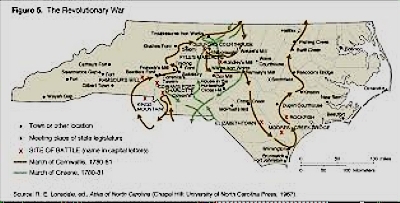
Major campaigns took place in the central part of the state and were fiercely fought. The east and west were spared the ravages of battle. ncpedia.org
The colonial navy was a fledgling operation compared to the mighty British Royal Navy that had protected American shipping during peacetime. Now, with cannons reversed, the high seas became the arena for David and Goliath.
But David wasn’t standing still. In March, 1776, the Continental Congress instituted privateering. Merchant ships became pirates with permits to prevent the British from provisioning their armies.
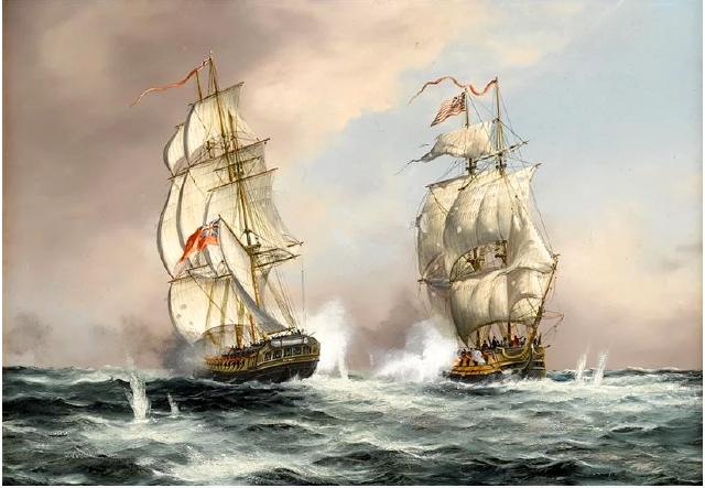
A Yankee brig vs a British frigate off Cape Ann, June 1776. Privateers could go out in any size or type of ship, but they all had to be skilled at outwitting their maritime opponents. Many a prize was won on a bluff. allthingsliberty.com
Bonds had to be posted to insure rules were followed, but all spoils belonged to Captain and crew. The purpose was not to enrich the colonial war chest but to break the back of English shipping.
Privateering became lucrative. It was so popular, about 1700 “permits” were issued and 800 privateers captured 600 British ships with a loss of about $18 million (value at the time). The English Navy could not support the troops on land. At home, the economy suffered and the war became unpopular with English citizens.
Individual colonies also had fleets of privateers.
For patriotic merchants in Edenton and New Bern privateering became a way to donate funds to a struggling nation. In eastern North Carolina, prize money was not necessarily split between captain and crew. Instead, portions were given to the state and its people, with merchants organizing the ventures.
The Albemarle area also contributed companies of volunteers and paid soldiers to the Patriot cause, including freed black men and slaves.
For instance, a slave called James from Perquimans County served as a sailor on a Continental ship and was captured twice by the British. After the war, he was freed by the Perquimans County court for extraordinary service to his country.
Slaves enlisted as runaways, as volunteers who expected freedom, as substitutes for their masters, or as government messengers and spies. African Americans had years of experience working Sound and rivers. They had a sense of the sea that they could immediately contribute to a newly formed Navy.
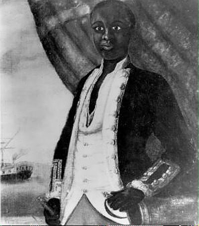
Portrait of a Black sailor serving in the Revolution, Unknown Artist, ca. 1780
The Fighting Men
North Carolina soldiers saw some of the most intense fighting up and down the coast from Valley Forge to Charleston. After Valley Forge, where 204 North Carolina soldiers died, regiments that should have totaled almost 5,000 soldiers were only able to muster about 1,000. In the battle of Camden (near Charleston) South Carolina, 3,000 North Carolina men were lost.
They must have fought fierce on the battlefield, though. About six months before the end of the war, after the battle of Guilford Courthouse near Greensboro, North Carolina, British General Cornwallis concluded that North Carolina is of all the provinces in America the most difficult to attack. He left North Carolina to skirmish in Virginia and surrendered at Yorktown in October, 1781.
The Independence Hurricane
Ironically, it was not the war but a hurricane that devastated northeastern North Carolina. In an odd turnabout, it bolstered the colonists’ cause.
The hurricane came after four days of heavy rain in early September 1775, several months after the first battles of the Revolution had been fought in Massachusetts. No one could predict its ferocity.
It’s called the Hurricane of Independence, or Independence Hurricane, and it’s considered by some to be the eighth deadliest hurricane in North Carolina’s history, probably a Category 4, with winds of about 140 mph. It tore across the barrier beach, sweeping towns away, tossing ships and their crews, destroying crops. Five schooners coming from England were lost.
Artist’s recreation of high seas during the Independence Hurricane
With equal fury it barreled through the Albemarle area, flooding towns, laying waste to an entire corn crop and killing over 100 people here. Tales are handed down, still told today, of dead animals and flotsam from broken up houses and barns floating down rivers into Albemarle Sound.
Was the tragic and violent storm that hit the English colony of Newfoundland a week later the same hurricane re-energized or an entirely different storm?
The American colonists were sure it was the same hurricane. In Newfoundland over 4,000 settlers and fishermen were said to have lost their lives. The fisheries industry was wiped out, a serious economic blow to England.
A storm surge of twenty feet drowned the coast. In The History of Newfoundland, the Reverend Anspach wrote in 1819:
“On the 12th of September, in the year 1775, this coast was visited by a most terrible gale. In Harbour Grace and Carbonier all the vessels in the harbours were driven from their anchors; but the inhabitants of the north shore suffered with still greater severity. They even now with signs of dread and horror, show a cove where upwards of two hundred fishing boats perished with all their crews.”
As stunning as the losses had been to homesteaders in eastern North Carolina, the far greater losses to England’s economy were perceived as an omen of good fortune, a sign that the rebel cause was just. It boosted flagging morale, even persuaded the doubtful to enlist.
In a gesture that acknowledged the grave losses in eastern North Carolina, the Second Continental Congress that would govern the fledgling nation for the next six years gave farmers 40 shillings each to start over — a precedent that would be repeated many times in the history of hurricanes.
Albemarle Sound: Voyage through Centuries Part VI
Navigating the Sound, the Rivers, and the Swamps
It was the greatest real estate hoax in history. Come to the New World and you will find a better life, glowing reports implied. If you took the bait, you spent months on a ship, then in a wagon or in a flatboat or on foot, only to land in uncompromising wilderness.
And then you discovered you had to build a boat to survive. The Albemarle was not movietone horse-and-buggy country.
Albemarle settlers were isolated by swamps, streams and muck. Overland travel was treacherous. Rivers and creeks became roads by default, and boats became the pick-up trucks of the day.
Boats carried buckets of fish or oysters for the family dinner, or they took families to church, or they were poled to trade farm produce or anything else a homesteader had for sale. If you needed a doctor, he came by boat.
Algonquian Boat Building
Algonquian tribes were the first sailors of the Sound, skimming its unpredictable waters in sturdy canoes hollowed out from regal old-growth white cedar boles that towered in forests.
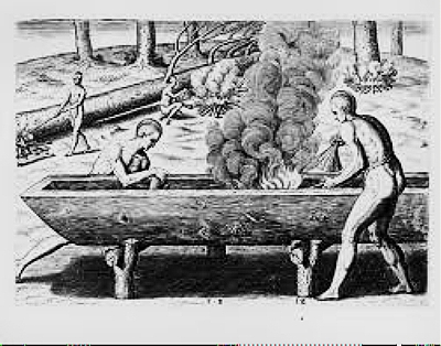
“The manner of making their boates” by Theodor de Bry after a John White watercolor. 1590. John Carter Brown Library at Brown University
Historians tell us these boats were crude, but creating a seaworthy hollowed-out canoe from a tree was a marvel of patient engineering that few of us could fathom today. Fire and scraping with oyster shell brought down a tall, straight hardwood tree weighing several tons. Fire and scraping with oyster shell sized and shaped the craft so it handled properly in the water. Animal grease waterproofed it.
Everyone was a Boat Builder
Colonists learned quickly. They borrowed techniques from Algonquians and from French Huguenot immigrants who constructed split log canoes.
Everybody became a builder of boats, adding flourishes to improve function and handling. No two boats were built alike, and the art of boat-building became part of life in the Albemarle, skills passed down from father to son. Today, the Carolina boat, product of generations of skilled boatbuilders is considered one of the finest for charter fishing and pleasure boating.
Modern Carolina Classic boat, noted for its ability to run in heavy seas and its sharp, deep V-hull at the bow of the boat that transitions to shallower hull aft.
The Kunner
But before there were modern Carolina boats, there were beginnings. One of the earliest boats on the Sound was the kunner (colloquial for canoe). This was the colonial workboat from the 1600s to the Civil War. Sturdy, small, about 15 feet long, simple to build with hand tools and patience, the kunner could be poled or paddled or rigged with a sail.
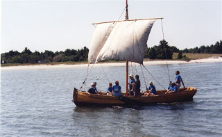
Reproduction of a dugout or kunner used by English explorers on Albemarle Sound before colonization. ncmaritime history.org
The kunner was a split-log canoe hollowed out of white cedar, a wood that is prized for its light weight and ability to resist rot. After the log was shaped, it was split down the length, and a separate wooden keel was inserted between the two shells, binding them together.

Model of a kunner by Mike Alford showing two halves joined by a keel. From David Cecelski’s blog
Of all the hand tools used in building a boat — the axe, the saw and the adze, the adze was the go-to tool for smoothing or carving rough-cut wood. It was also used for squaring up
logs or hollowing out timber.

An example of a modern adze. Heads of ancient adzes were bound to hafts by sinew
Some craftsmen could make that adze sing until wood was trim and smooth and right pretty. From the 18th century on, skilled workmen and their heirs would become specialists in boat building, as the economy moved from subsistence to specialization based on marketable skills.
Shallow-draft vessels like kunners and skiffs ( small, V-bottomed boats), and flatboats could push far up rivers. Farmers and planters could ship directly from private docks. Wide rivers and bays provided good landings for larger ships, and towns would grow up around them.
Shallow-draft schooners such as this pictured here plied the Sound along with steamboats and small craft
Building Roads
Trails used by Native Americans became paths for colonists. But even after almost a century of settlement there were few decent roads and no bridges.
Tricky business, this making roads through swamps. The lay of swampy land, the willingness of an owner to give up land, and the needs of the community all figured in. How much cropland would a farmer be willing to lose so his neighbors could travel more conveniently? And how much should he be re-imbursed?
Colonial justices approved or rejected requests for new roads but a jury of citizens would determine routes. In retrospect, this sounds like pretty democratic county planning, but, like all democracies, it was not efficient.
By the time swampy terrain, negligent overseers, and complaints from unhappy property owners were considered, it could take a year to clear a road. Still, by the Revolution rudimentary highways and bridal paths eased travel.
Most people rode horses, though poor people walked. Simple horse carts or ox carts were transportation for most. By the end of the century, specially made pleasure carriages were a badge of social distinction for the gentry.
Ferries and the Railroad
Ferries became links to settlements. In fact, some counties provided free ferries across rivers. They were simple flat boats that were poled across waterways or, less commonly, pulled by ropes or cables that were faster and more efficient.
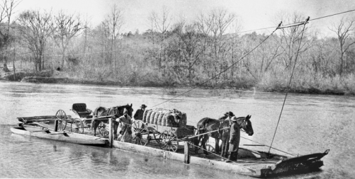
Hannah’s Ferry on the Yadkin River in western North Carolina is an example of a cable ferry ca. 1900. North Carolina Office of Archives and History
Ferries were normally large enough to hold a team of horses and a carriage or a wagon. Two cable ferries are still operating in the Albemarle area: Parker’s Ferry across the Meherrin River and Sans Souci Ferry across the Cashie River. Typically, these ferries carry two cars. To summon the ferry from the other side of the river you blow your horn. The shore-to-shore ride takes only a few minutes.
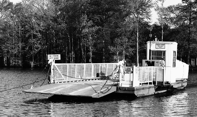
Parker’s ferry in more modern times. Murfreesboro Historical Association
By 1730 ferry service linked the north and south shores of the Sound, a run of about five miles that must have seemed like a carnival ride on windy days. A passenger paid 15 shillings for a one-way ride; if he had a horse, he paid 30 shillings.
Colonial justices set regulations for ferries. They dealt with petitions from ferrymen who wanted to increase fees and complaints from passengers who wanted better service. In 1758 magistrates ordered ferrymen to keep more boats to give better attendance for carrying over passengers.
Sail, steam, and finally diesel vessels that could haul mighty railroad cars gradually replaced the original flatboat ferries. A sign along NC 32 at NC 308 north of Roper commemorates this piece of history.

Historic marker on the south side of the Sound, one of several in the area commemorating historical events
By 1883 the Norfolk Southern Railroad linked Norfolk, Virginia with towns in the Albemarle region. In 1910 the Railroad built a wooden trestle across the Sound bridging the five miles south from Edenton to Mackeys Ferry and Plymouth. It operated through the middle of the century.

Norfolk Southern Railroad train crosses Albemarle Sound in 1918. Wikipedia
The trestle was eventually demolished in favor of a bridge across the Sound.
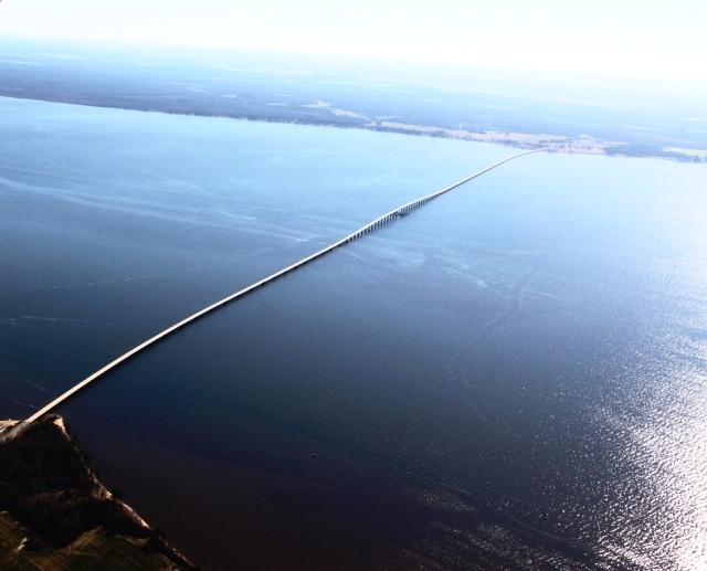
An aerial view of the bridge across Albemarle Sound, one of the prettiest five-mile rides over water. Photo by Frogs View
Steamboats and a Showboat
Ferries were not the only vessels on the water. During the 1800s the Sound was a busy thoroughfare. Coasters (small sailing vessels) carried cargo up and down rivers and between colonies. Larger craft bound for the West Indies loaded salt herring, lumber, tobacco, and corn in exchange for rum, spices, silk, and sugar on the return trip.
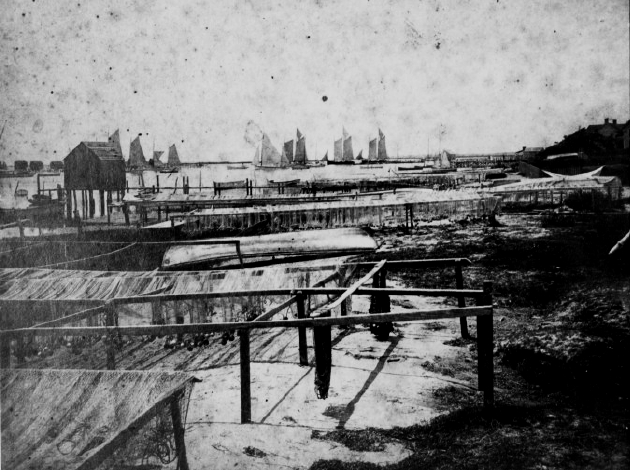
The harbor at Beaufort, a town south of the Albemarle region, shows the traffic you might see in Sound waters during the sailing days of 1890. Note varieties of sailing ships, drying racks for nets, net storage house to the left, and shad boat in foreground. State Archives of North Carolina, from David Cecelski’s blog
For almost a century, from the 1830s, steamboats linked small towns to the world beyond. Bi-weekly trips from Norfolk to Albemarle towns dispatched mail, passengers, produce and circuses.
With shallow draft, as little as 15 inches, and a 5 mph speed they were a grand replacement for flatboats that were poled — laboriously — far up river where masted ships with deeper draft would founder. Plantations had their own landings, where steamers were flagged from the shore by day with white handkerchiefs and by night with torches, lanterns, or fires on the bank.
This drawing of a steamboat along the Cape Fear River gives a general idea of steamboating in Albemarle waters. North Carolina State Archives
Even so, navigating rivers that wound through swamps could be tricky, and at times the cumbersome vessels had to be poled to avoid foundering. To assure unrestricted passage, state law prohibited felling trees into rivers.
Steamers regularly brought circuses and side shows to small towns for almost a hundred years beginning in the 1830’s. Big-time entertainment came to eastern Carolina and the Chesapeake in 1913 with the arrival of the massive, 128-foot-long, two-story, shallow-draft James Adams Show Boat.
The James Adams Show Boat. NC Historical Site
Residents would eagerly line the docks to watch the floating theater secure its moorings, then race on board to offer help in exchange for tickets to shows. Otherwise, they would pay ten cents to enjoy melodramas, singing, dancing, juggling and vaudeville routines in an elegantly appointed gold and blue 500-seat theatre.
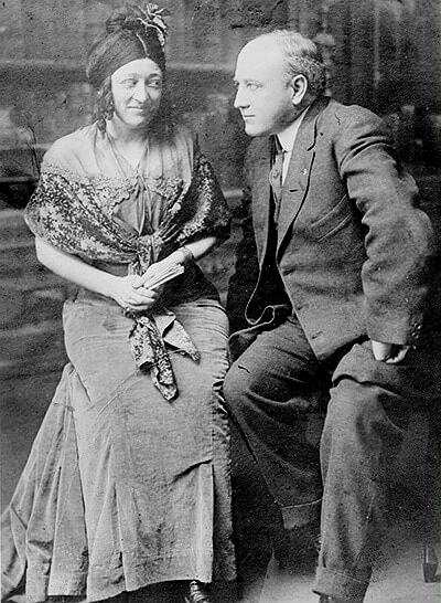
Scene from a melodrama. The Bellows, married, also played villains. No single women were part of the troop
Showboat entertainment delighted audiences for more than twenty years until attendance began to fall off. Movies, then in their infancy, enthralled patrons and became a regular substitute for the occasional showboat visit. Upkeep and repairs on the floating theater were constant. And the depression squeezed pennies.
The life and times of the floating theater was immortalized in Edna Ferber’s novel, Showboat, which was made into a Broadway musical and two movies.
Although the novel takes place on the Mississippi River, her intimate knowledge of showboat life came from living on the James Adams Floating Theatre and joining its crew for four days in 1925, until it docked in Elizabeth City, on the Pasquotank River in the Albemarle area.
It was, she wrote, the most leisurely and dreamlike of journeys.
The Beloved Shad Boat
And then the shad boat sailed in like cavalry to rescue an economy shattered by the Civil War.
Shad boats were built only for fifty years, from 1880 to 1930. They operated only in eastern North Carolina. Yet no sailing craft speaks of eastern North Carolina more eloquently than the shad boat. In 1987 the shad boat was designated the official state historical boat of North Carolina.

Out for a spin on a Sunday afternoon? ca 1900. Courtesy Earl Willis Jr
Watermen called the shad boat “smart”. It was fast and easy to handle, a thing of grace and beauty, with sleek curves and a shallow draft. It could maneuver treacherous shoals with confidence. It was powered by three sails–a main sail, a jib and a topsail.
Shad boats quickly became the choice for fishing and ferrying, and progging, vernacular for doing anything from loafing on the water to hauling fish or fowl or produce.
It happened that the shad boat made its debut when fishing was becoming more efficient. Mighty seine nets, pound nets, gill nets were laid down to round up herring and shad that swam into the Sound and up rivers by the millions to spawn each spring.
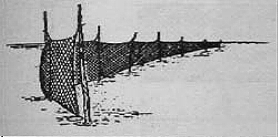
An example of a gill net that could stretch across a creek and trap large catches
It was a time of the great Albemarle fisheries, when fishermen worked day and night to land catches that would be exported to a nation clamoring for more and more fish, and still there would be plenty left to process for keeping people fed throughout the rest of the year.
And so the shad boat, sturdy and durable, was named for the fish it hauled. An 8-foot beam gave it stability, especially when handling heavy pound nets. The round bottom and the deep V-shaped bow could take on steep, choppy waves even when heavily loaded.
Smaller boats, like kunners and skiffs could not have handled enough volume to make the fisheries profitable.
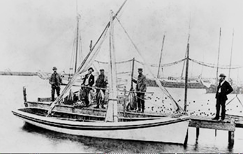
Shad boat and crew after a catch 1900. Note the low line of the rear of the boat to ease handling of nets. NC State Archives
Typically, a two-man crew, the captain who steered and manned the sails and his mate who bailed or adjusted ballast, kept the boat square in the water. Ballast consisted of dozens of fifty-pound sandbags stitched by women back home.
As the hold was piled with the day’s catch and sand bags (wet and heavy now) were no longer needed, they would be stacked on narrow side decks. (This was cardio in the days before gyms.)
Now we shall meet the original creator of the shad boat, George Washington Creef, or Uncle Wash, as he was affectionately called, gentle and sociable, tall, with large, graceful hands and a flowing gray beard.
Photo of George Washington Creef Sr, early 1900s. NC Maritime Museum
He was a fisherman and a boat builder, and he was loyal to the Union during the Civil War. In his words, I was employed by the U.S. Navy freighting coal in my own vessel.
After the Civil War, Creef had an idea for creating a stronger, larger boat, 24 feet long, that could haul large catches and handle well in unpredictable Sound waters.
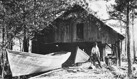
George Washington Creef and his shad boats, which he usually built in pairs, ca 1900. NC Dept. of Natural and Cultural Resources
His plan was to overlay the split-log construction of the kunner with planking and add interior struts for strength.
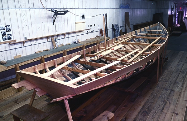
Extensive restoration of a 1904 shad boat built by Alvirah Wright, a logger, decoy maker and boat builder. The restoration showing interior struts is now complete and on display at the Museum of the Albemarle. Photo by Michael Halminski from his blog
Monumental effort went into building those first shad boats. And imagination, too, rooted in a deep knowledge of local waters. Creef and crew used basic hand tools, a hand saw, an axe, and an adze, to fell and prepare the cedar and cut and plane the planking, all held together with copper nails.
Then the hunt would begin for just the right cypress knees that would become curved ribs, or braces, for the interior of the boat. It could take days trekking through swamps to find a cypress stump that would yield a proper curved rib, or maybe two.
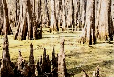
The search for cypress knees to determine which ones could be used, would be followed by digging and cutting from stumps.

This diagram gives some idea of how cypress knee (C), along with root (B) and stump (D), cut away from the tree in one piece, could be used as a strut. Treasurecoastnatives
The hunt for cypress knees could mean working knee-deep in water in early spring to beat bugs and snakes, hoping that one tool or another — a six-foot crosscut saw, an axe, an adze, wedges and a maul — didn’t fall into the swamp during use. Once extracted, the spurs were taken to a sawmill for finishing.
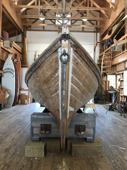
Bow view of the shad boat Ella View, built by George Washington Creef in 1883, in for maintenance, usually housed at the Roanoke Island Maritime Museum in Manteo. Photo by Tom Earnhardt
Local builders began to replicate the original shad boat in great numbers, though after the cedar forests were cut down, construction was modified to plank on frame.
Shad boats became an extension of a waterman’s life well into the 1930s and beyond. When engines replaced sails, around 1910, they became even more versatile in shallow waters.
It was the pick-up truck of its day, but its design elements live on in modern pleasure craft that enjoy smooth and seaworthy travel in Albemarle waters and beyond.
You can find original shad boats on display at the George Washington Creef Boathouse in Manteo, the Roanoke River Maritime Museum in the town of Plymouth, and the Museum of the Albemarle in Elizabeth City.
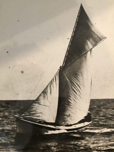
Shad boat flying its goose wing on Albemarle Sound around 1900. State Archives of North Carolina. Photo by Ralph Munroe,
Albemarle Sound: Voyage through Centuries Part VII
Antebellum Albemarle
America was riding its destiny. She had defeated the most powerful navy in the world, not once but twice. Cotton crops were thriving. Northern cotton mills were humming. Settlers were going west. Fish hauls came in as fast as you could bring ’em on land. Canals were opening. Ports were bustling and commercial ships crowded the waters. It was called the Era of Good Feelings.
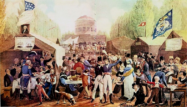
Independence Day celebration in Boston 1817 depicted in a painting by John Lewis Krimmer is infused with the optimism of the country
In the Albemarle and across the South, gifts from land and water, still largely unspent, were full of promise and ready to be plucked by freemen for profit and slaves for masters.
The Albemarle was still a rural backwater. Travel over land was tricky and lack of a deep-water port prevented large vessels from trading directly. But livin’ was easy, as Ella Fitzgerald sang in Summertime. Of course, how easy depended on your place in society: planter or merchant; yeoman farmer; slave.
Planters and Merchants
Planters were the elite minority. Many could trace their ancestry to aristocratic families in England. They owned the best land. With connections and credit they had acquired large tracts, anywhere from 500 to 1000 acres with discounts if they brought in indentured servants or slaves. Isolated because of large holdings, plantations were prosperous and as self-sufficient as small towns.
Scotch Hall Plantation in Bertie County was built in 1838 on 8,000 acres of land, worked by almost 300 slaves with an income of over $100,000. This was the Capehart family home. Much of the land is now a waterfront community on Albemarle Sound. Watercolor by Judson Newbern whose wife is a descendant of the Capeharts.
Plantation life was a clubby, closed-circle capitalistic operation. Rich soil and long summers with mild winters were good for growing cash crops that needed special care, like cotton, rice, and tobacco. When rice and tobacco languished in the Albemarle, cotton became the cash crop, especially after the invention of the cotton gin (cotton engine) that speeded separation of fibers from seeds. Slaves provided the power and the profits.
Planters became powerful members of state government, as much to maintain order in the state as to feather their own beds. Owning land was a requirement for serving in the legislature; at one point 85 percent of its members were planters, more than any other southern state.

No blossom represents the perceived romance of the south more than the evergreen magnolia (Magnolia grandiflora) that graced fine homes and plantations. Painting Shadow Dancer by Lorraine Ulen
This was a gay time for planters and their families, when even the humdrum took on a luster of romance. A tutor for the Capehart family wrote of afternoon visiting, fine dining, fishing and hunting, fetching mail at the post office, holiday festivities, and summer vacations on the beach in Nags Head.
Merchants were the other powerful class of people, and they usually lived in the finest houses in the community. They ran maritime empires that stretched from New England to the West Indies and across the Atlantic Ocean.
Here’s a small sampling of items offered by mercantile businesses: shoes, coffee, sugar, tobacco, horse powder, calico, jeans, soap, medicine, cheese, candles, salt, molasses, and bags of shot. Other profitable enterprises: credit to locals and shipping for commercial farmers.
If you were wealthy, you and your friends had special privileges. You could become part of the summer social scene in Raleigh to escape disease-carrying mosquitos that swarmed on the coastal plain.
Or you could retreat to the barrier beaches, where fresh sea breezes swept the pests away; where chartered packets brought in fresh produce twice a week; and where you could enjoy swimming, fishing, afternoon naps, and in the evenings, dancing to music at the hotel.

Dancing the night away. This romantic image is available in counted cross stitch and other needlework kits
The Working Man
Most people had no connections to aristocracy nor the wherewithal to form shipping empires or take vacations by the sea. Nor did they own the sizeable tracts of land that would allow them to have a voice in state government.
In 1837 The Fayetteville Observer wrote: The great mass of our population is composed of people who cultivate their own soil, owe no debt, and live within their means.
Yeoman farmers and free blacks lived on small farms, around a hundred acres or so. They did not grow cash crops. They grew corn and raised livestock and hunted to feed their families.
Deer were native and wild boar had been introduced in the 1500s by the English as a reliable source of food. Most livestock roamed freely, fattening on abundant mast from native trees, so little care was needed, except for keeping them away from the cornfield. Planters and yeomen alike dined on free-range beef and pork.

Early ears of corn were small but American Indians and settlers bred plants to produce larger ears. Pictured here is Flint, or Indian corn, which can be ground to produce a coarse corn meal. Picking corn was labor intensive, as was shucking. WikimediaCommons
In spring families caught enough fish to salt for the winter. They sold excess produce or a bale of cotton, picked up odd jobs to meet the tax bill and purchase necessaries or an occasional luxury.
Some time during the mid-19th century and into the twentieth century, the mule became a fixture on southern farms and in fisheries. They withstood the heat of summer, their small size fitted nicely into cotton fields, and they ate a lot less than a horse.
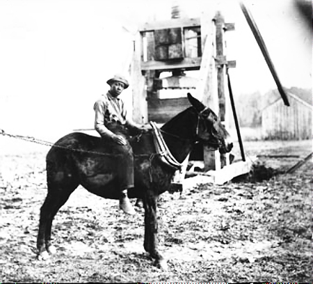
African-American young man riding mule turning cotton press, ca. 1890. General Negative Collection, North Carolina State Archives
An ambitious entrepreneur could add income by specializing in light industry: tanning hides; milling (75 to 80 cents to turn a bushel of corn into meal); fulling (cleaning and shrinking wool fibers); weaving cloth; cutting shingles and staves; and building boats.
Illiteracy remained high, because children were needed on farms. Still, a large majority of voters approved legislation to establish a public school system in 1839. Academies, forerunners of today’s high schools were founded at this time as finishing schools or college prep schools. Between 1789 and 1860 more than 300 were chartered in the state. Quality of instruction varied by instructor.
It was a peaceable life, called dull and even monotonous by one writer, punctuated by parties during the Christmas season, weddings, and eagerly awaited travelling circuses or musical revues brought by steamboats. Sale of liquor was overseen by the state, but merchants wholesaled it anyway and yeomen farmers produced liberal quantities in their private stills.
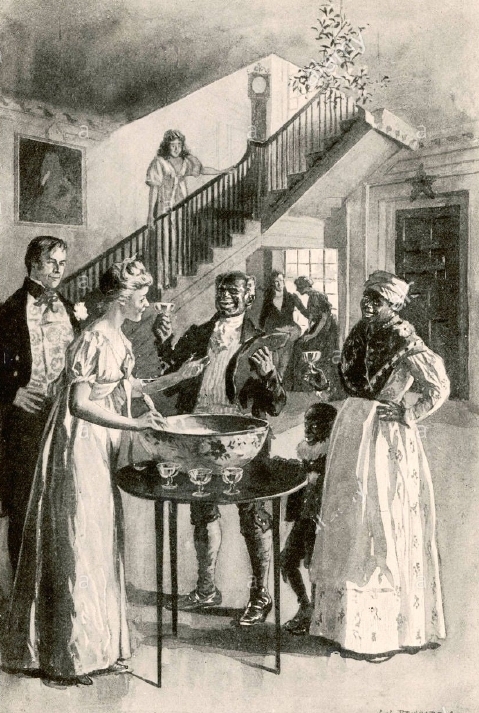
Christmas was a festive time on plantations and in farmers’ homes, and for slaves, too. Artist’s interpretation of a southern Christmas rendered a few years after the Civil War when there was a move to sanitize the issue of slavery
Still, people who lived on the edge and depended on gifts from land and sea could come into tough times if the environment dealt a bad hand. This was the case in 1828 after Currituck Inlet, the last of several inlets along the northerly barrier beaches, shoaled in.
Without regular exchange of ocean and sound waters, salinity decreased. Oysters and other shellfish that families depended on for food could not adapt to the change and disappeared. Mosquitos multiplied, and Malarial diseases. . . were much more general and more malignant.
The importance of oysters to early diets cannot be over-emphasized. By filtering water as they feed, like clams, oysters are valuable for keeping water clean. pewtrusts.org
Petitions to the federal government for relief from shellfish losses and disease made no headway. Dredging to reopen the inlet would have been futile in restless waters. The story of how survivors coped is not recorded.
Yellow fever and malaria were still common in coastal areas. Those who fell ill were treated in their own home by someone they knew, a family member or a neighbor, rarely a doctor. Sometimes patent medicines would be purchased from a storekeeper. Many housewives kept recipe books that included everything from baking an apple pie to making soap to remedies for croup.
The sick child, oil painting ca, 1850 by Johann Georg Meyer von Bremen
Slaves: Power Without Destiny
Few people who saw Gone with the Wind ever thought much about how a plantation functioned. The grand entrance and broad staircase, the canopied bed and velvet curtains, the crested silver and globe chandeliers were delicious distractions.
Behind the elegance and the romance of a plantation were hundreds of slaves, invisible.
Planting and harvesting crops; or clearing land; or digging ditches that drained the land; or digging canals that enabled shipment of produce to market; or preparing naval stores for export — these backbreaking tasks brought in the cash that made the romance possible.
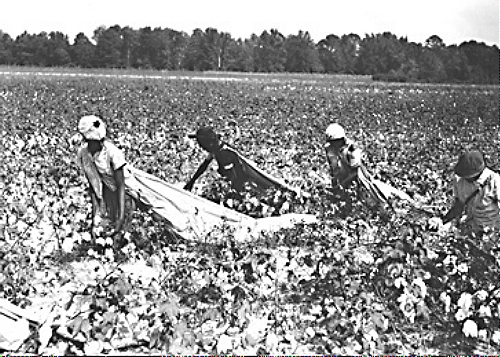
Picking cotton, photo after the Civil War. NC State Archives
But there were also carpenters, blacksmiths, wheelwrights, coopers, cobblers, plasterers, harness makers, brick masons, butchers, tanners, teamsters, couriers, bodyguards, nurses (midwives, too), seamstresses, cooks, laundresses, cleaners, hunters, fishermen, trail guides, boatmen, river pilots, lockmasters (for canals on rice plantations).
And The Nanny who was the comfortable face of slavery to the world.
Collectively, slaves powered life on the plantation. But they owned none of it.
They were valuable commodities to the planter, each with a price on his or her head, each a number on the planter’s balance sheet when the time came to figure assets and taxes. Yes, each slave had a tax value, and the balance sheet determined whether the planter retained or sold a slave.

Slaves Waiting for Sale, dressed up for buyers who would dicker for them. Oil painting by Eyre Crowe, 1861, from a scene in 1851 witnessed by the artist
Slave women were valued for their ability to beget new slaves. (The Marquis de Lafayette, respected military leader in both French and American Revolutions, on a cross-country tour in 1824 at President Monroe’s invitation, remarked casually on the change in the complexion of slaves from fifty years prior.)
A later painting by Eyre Crowe depicts the transport of slaves from Richmond to Ridgeway, North Carolina and points south. While, geographically, this is not directly related to the Albemarle, we include it because these two paintings strongly influenced anti-slavery attitudes in England and America.
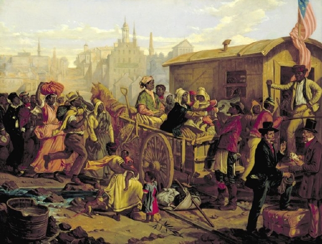
After the Sale, Slaves Going South from Richmond to destinations in the Upper and Lower South. Here they are being loaded onto railroad cars. Oil painting by Eyre Crowe 1854
How was humanity stolen from slaves?
In the early 1700s, the Albemarle was a patchwork of wilderness settlements. Slaves in the North Carolina colony, still limited to the coastal plain and rolling Piedmont, numbered about 800. It was not unusual for a settler to own one or two slaves for domestic or field work.
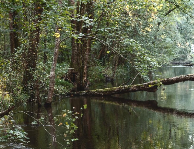
A modern photo of the Great Dismal Swamp by Andrew Woods mirrors the thick growth of woods and swamps in the 1700,s, only the trees were larger. wilderness.org
The owner-slave divide may have been firmly etched, but it was focused more on grubbing existence from a strange land than on amassing profits. Often bondsmen (euphemism for slaves) lived in the household, sharing their culture with the family and interweaving lifestyles in a cooperative venture for survival.
For example, it is possible that eastern Carolina’s vinegar-and-pepper barbecue grew out of culinary customs in the West Indies and Africa, where cooks used lime juice and hot peppers to season meat. It’s a short step to experimenting with vinegar, more readily available than limes, for a new twist that’s become a staple today on the coastal plain of the Carolinas.
Within several decades, the owner-slave divide had deepened: the Revolutionary era became a watershed for slavery in the Albemarle. Lack of a port city precluded slave trade here, except among private individuals, so slave owners purchased slaves in Virginia and transported them to North Carolina.
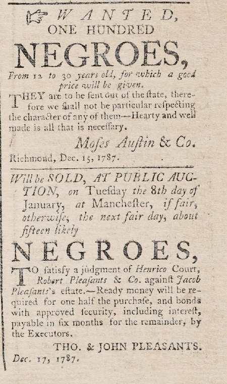
Examples of newspaper ads in Virginia. EncyclopediaofVirinia.org
This inconvenience did not slow the vast increase in slave numbers in less than a century. Slave population at the time of the Revolution: 100,000. Plantations were rising and fortunes were growing. Owning slaves became a path to wealth and would remain so until the Civil War. The relationship between master and slave was now and would continue to be based on exploitation. All men are created equal did not apply.
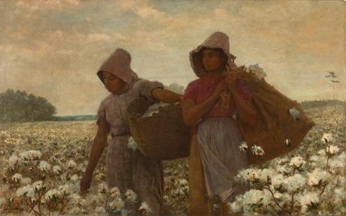
A moving but romantic impression of The Cotton Pickers by Winslow Homer. In the absence of clear-eyed photography, artists can dim reality
From a slave’s perspective, this oratory about freedom and the rights of man was simply hollow chatter, though many participated in the war, on either side, hoping for freedom from bondage somehow.
But talk of liberty stirred souls and a restlessness grew among many who were in bondage, stirrings that would lead to constant turmoil during this Era of Good Feelings and beyond.
Most slaves lived on plantations (though Albemarle plantations never reached the size of the vast plantations of the Deep South). But they also worked as domestic servants, skilled artisans, and field laborers on small farms and in towns and cities.
Treatment of slaves depended on the owner. As one traveler observed, The keep of a negro…does not come to a great figure, since the daily ration is but a quart of maize and rarely a little meat or salted fish.
Most owners realized that the value of their property could not be maintained on a poor diet, and there was always the whip to spur action. Daily allotments were supplemented with produce from slave gardens, which in turn saved money for the planter.
There was once an oft-repeated myth of the happy slave. Records of laziness, theft, arson, desertion, and murder bury that myth along with layers of passive aggression and outright anger. Newspapers frequently ran ads with descriptions of runaways.
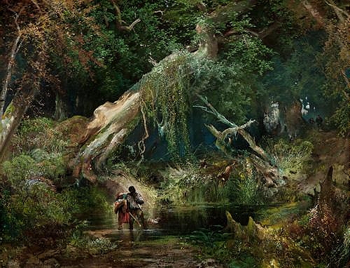
Slave Hunt in the Dismal Swamp Canal, by Thomas Moran 1862, accurately depicts the jungly growth in this area of Virginia and northeast North Carolina
Some sardonic observers commented that malingering slaves were only mimicking the behavior of their owners.
Planters disciplined minor transgressions; the courts meted out punishment for more severe crimes that might result in the loss of the right ear and fifty lashes. Troublesome slaves were conspicuously branded. Jittery communities felt they could keep slave society under control, but they were ignoring a deeper reality.
Religious Revival
Religious fervor would unexpectedly become part of the stirrings. Around the turn of the century, religious revival meetings swept through the country. The movement came to be known as the Second Great Awakening, one of four great awakenings that would boost Protestantism and religious fervor over the course of three centuries.
Methodist Camp Meeting, 1819 hand colored engraving
…There had never been anything like it. Here’s a meeting of 3,000 people out in a field, blacks and whites together, listening to a preacher who says, “Here in my message is a new life for you, here’s a new chance for you. Here’s a God who had your interest at heart. Here’s a God who may deliver you.” – David Blight, historian.
Many slaves who had clung to former religions were moved to abandon them and gladly accepted these new messages of spiritual equality before God. Methodists and Baptists especially welcomed converts from the black and white working population.
The Lord is my Shepherd by Eastman Johnson illustrates the deep belief of many slaves in a kinder, gentler God
Slaveholders Tighten Restrictions
But numbers of slaves tripled from 1800 to 1860 and embracing a kinder religion would not contain discontent. Slave populations in Albemarle counties were about 35 to 45 percent of total population. Further west, in some counties along the Roanoke River, numbers rose to 60 per cent.
The state of North Carolina passed several laws to protect the rights of slave owners and restrict the rights of slaves. Slave patrols were initiated, though it was difficult to round up willing participants. They were, after all, securing planters’ property, not necessarily their own.

A Visit from the Old Mistress by Winslow Homer. Was she counting numbers? trying to catch a thief? or . . .?
The restrictions on slaves spilled over to freed blacks. They lost their right to vote, along with other personal freedoms. However skilled as artisans, they were considered inferior to white craftsmen and were paid and treated accordingly. General harassment and loss of dignity caused many to migrate north or west or sail for Africa and a new life.
From the time of the American Revolution to the beginning of the Civil War white fear of losing domination over slaves invaded thinking and actions at all junctures in society.
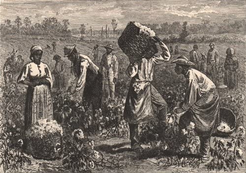
Scene on a southern plantation, from an 1862 print
Historians calculate that by 1860, four million slaves in the country were its greatest single economic asset, more valuable than land, railroads or manufacturing, worth more than $1 billion (almost $26 billion in today’s currency).
The Panic of 1819
As euphoria faded, unrest exploded in 1819. Factories closed. Unemployment rose. Banks failed. Mortgages foreclosed. Cotton prices plummeted. Investment in land collapsed. Deflation followed soaring inflation. Debt hung over the country from the Louisiana Purchase and the War of 1812.
Some historians call it the first Great Depression. Like a whirlwind, it seemed to have spun itself out by 1823, but damages to the fabric of society had yet to be repaired. Low crop prices and depressed land values hit eastern North Carolina hard, and many slave owners sold their slaves and farmers abandoned their land and headed west for virgin land and a new start.
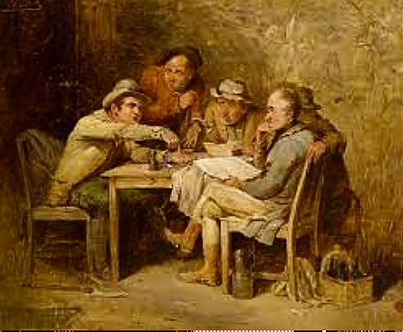
Detail from an 1819 painting by John Lewis Krimmer, Village Politics. Some Albemarle residents stood to lose because of plummeting cotton prices
Resentment was building in the middle class against banks and corporations. They saw these institutions as privileged monopolies, and conflict between creditor and debtor was splintering the economy.
The Era of Good Feelings would never return, but there were still profits to be made from the land.
Cashing in on Natural Resources
Gifts from land and water were still largely unspent before the Revolution. The environment was full of promise and ready to be plucked by capitalists for profit and slaves for masters.
Colonial settlers had used natural resources sustainably. This was not by philosophical inclination. Even the wealthy did not yet have the manpower nor the tools to make large-scale inroads on the environment.
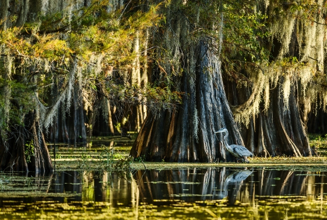
A 2700-year-old cypress still standing in a North Carolina swamp gives some idea of the magnitude of natural resources of the area
Remember the motto of the Lords Proprietors, the first governors of the colony back in the 1660s: The Taming Makes the Land. That idea was ingrained. After the Revolution the southeast would became the purveyor of natural resources to the world for the next two centuries.
Not until an army of slave power came on, could the land be tamed.
Fortunately, technology was not yet so efficient that wholesale destruction of resources took place during the nineteenth century. That would happen in the next century.
Logging the Forests
Shipyards from New England to Philadelphia and across the Atlantic were eager to expand their fleets. Virgin stands of North Carolina cedar, cypress, oak and pine were fed, board by board, into their ships.
Tar, pitch, and turpentine (naval stores) along with masts, staves and shingles: eastern North Carolina led the world in producing and exporting these for over a hundred years, until the great forests gave out and second-growth saplings took their place.
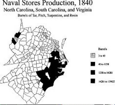
Counties on the south side of Albemarle Sound, where pine trees were thick, produced enormous quantities of naval stores
Pine trees were tapped for oleoresin that exuded from multiple cuts and was processed into turpentine. By 1840 eastern North Carolina produced almost all naval stores used in the United States. By 1861, 4,000,000 barrels of turpentine, worth $40,000,000 when distilled, were being processed annually by almost 5,000 laborers and 150 stills.
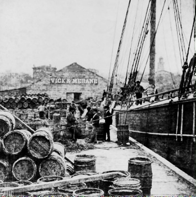
Barrels of pine resin being loaded on a German ship at the port of Wilmington in the early 1870s. North Carolina Collection, University of North Carolina at Chapel Hill Library.
Slave labor was crucial to profits. Collecting and distilling the resin was long and arduous. It was solitary work done in winter. Conditions were particularly harsh and workers would run away or set fire to the forest to avoid the punishing drudgery
(Of interest: Tarheel is a moniker from this period that has stuck to the North Carolina mariner. It may have originated from workers in tar yards who often got tar on the soles of shoes.)
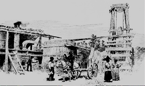
North Carolina turpentine distillery, 1884. North Carolina Collection, University of North Carolina at Chapel Hill Library
Farming On Grand Scale
Once cleared and drained, this was good land, wrote a colonist in 1654, with a most fertile, gallant rich soil, flourishing in all the abundance of nature…
This land would become the bedrock of fine plantations, but there were limitations to what the soils could give.
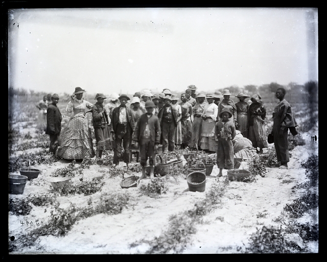
Cotton workers on the Avoca Plantation (pictured below), one of the largest in
Bertie County. NC Archives
Cotton was a small-time crop until 1793. It would take one farm hand 100 days to separate seed from crop in a single cotton bale. Said Moses Brown, owner of the first powered spinning mill in Rhode Island, The unripe, short, and dusty part. . . so spoils the whole as to discourage the use of southern cotton in the machines.”
Small jenny mills run by hand, mules or oxen produced crude yarn for homespun cloth, no match for the fine cotton imported from the West Indies. (Pre-revolutionary colonists wove and wore this rough cloth as a symbol of their patriotism, sacrificing the comfort and looks of the good stuff to avoid paying unfair taxes to England.)
Eli Whitney’s cotton gin (cotton engine) changed the game. It did the work of ten men and it removed the dust that clogged milling machines. By 1840 cotton was a leading cash crop for North Carolina farmers.

A simple but clever machine operated by two men that did the work of ten
Cotton grown in the Albemarle was hauled overland and on river boats to Columbia on the Sound’s south shore or to Elizabeth City on the Pasquotank River. From there it was shipped north to New England textile mills.

Bales of cotton prpcessed and waiting to be shipped north. SourceofWealth
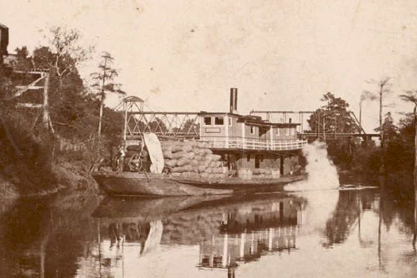
Steamer Shiloh laden with cotton. NC archives
Eventually, to keep profits on home turf, cotton mills would open in the South. Edenton and Elizabeth City operated cotton mills in the Albemarle.
Edenton cotton mill in 1910
Cotton was saving the South. The world couldn’t get enough of it.
But cotton is a heavy feeder. Soil here is rich when first lumbered and replenished by regular flooding of rivers. But the environment was being altered by logging and ditching.
Let’s look beyond the grand entrance to the plantation house and focus on the fields. At any one time, only about a third of a plantation was planted in cotton. The rest was a mosaic of woodlands and disturbed patches, recently cut over, vegetable gardens and facilities for repairing harnesses or building carts or plows.
To a northern farmer who was used to tidy rows, southern farms seemed helter-skelter. This mosaic was a primitive form of crop rotation. Untidy cut-over fields would eventually be cleared for planting cotton, and the spent field would lie fallow, possibly planted with wheat or cover crop.
While the Albemarle held its own, the growth of King Cotton throughout the South came from continually opening new land to cultivation.
Cotton production increased steadily until well into the twentieth century, though the boll weevil took a toll. By then, chemical fertilizers and pesticides were on their way. By 1925, North Carolina was producing 1,102,000 bales of cotton, including farms on the coastal plain and the rolling hills of the Piedmont to the west.

Modern mechanical cotton harvester in the 21st century
Returning to Antebellum decades, records show that in 1850 Avoca Plantation, situated on a peninsula flanked by the Chowan River and Salmon Creek in western Albemarle Sound, owned about 5,000 acres valued at $49,000, and 203 slaves. The farm produced 8,500 bushels of corn and 200 bales of ginned cotton that year, with livestock worth $4,000 and profitable fisheries off Bachelor’s Bay in Albemarle Sound.
East side of the Capehart family’s Avoca plantation house in Bertie County, circa 1877-1881. Courtesy, Smithsonian Institution Archives
Avoca Farms today is a multi-million-dollar company specializing in botanical and medicinal products.

Fields of clary sage used in botanicals, brighten roadsides in Bertie County with their rosy blooms.
*******************************
The Era of Good Feelings ended ominously. As class conflict sharpened, a crisis over slavery erupted like a firebell in the night, wrote Thomas Jefferson. He was referring to Missouri’s application for statehood and its implications for slavery in western territories.
Though the Missouri Compromise dampened angry spirits for the moment, John Quincy Adams predicted that it was only the title page to a great tragic volume.
Albemarle Sound: Voyage through Centuries: Part VIII
A War that Wasn’t Wanted
North Carolina did not want a fight.
South Carolina must have been itching for one because she seceded in 1860, before President Lincoln took office. She commandeered federal forts in the state, then dared Lincoln to provision the troops at an unfinished Fort Sumter by firing on it.
North Carolina was enjoying unprecedented prosperity.
Her economy was booming. Wealthy planters did not want to lose their investments or their power. Small farmers were doing well and weren’t interested in fighting to support planters’ interests. Lincoln didn’t seem so threatening, though he hadn’t even been on the ballot in North Carolina. And, generally, people liked living under the protection of the federal government.
Debate over secession could be acrimonious, but as late as February, 1861 the vote by the legislature in Raleigh (the new capital) was overwhelmingly pro-Union.
A month after the firing on Fort Sumter in April 1861 and Lincoln’s immediate proclamation to stop the rebellion, North Carolina became the 11th and last state to vote to secede.
She had no choice. She would have been at war with her neighbors, fighting her Sister States. The vote was unanimous.
Pro-Union sentiment was strongest in the eastern and western parts of the state. Many pro-union planters, fearful of ruin, moved family and slaves to the central part of the state; others aligned with the Confederacy.
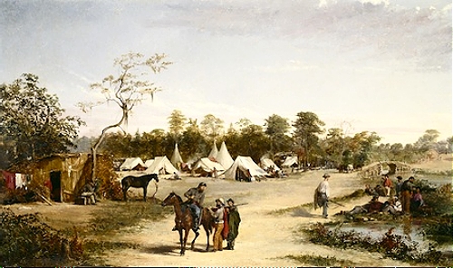
One of the finest painters of the Civil War was Conrad Wise Chapman, who actually fought as a Confederate soldier, Here is a rendering of The 59th Brigade, also called Wise’s Brigade, that fought in Virginia and Carolina
North Carolina had nothing to gain and everything to lose by seceding. And lose she did.
She sent 130,000 of her young men into the war. She lost 40,000, half to disease. More than any other confederate state on both counts.
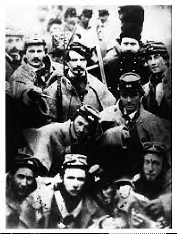
Confederate soldiers, from The Civil War, by Ken Burns
Albemarle counties raised volunteer units, many of whom saw the full brunt of the war, including the fateful Pickett’s Charge in Gettysburg. Captain Benjamin Skinner wrote of the constant whistle of the musical minnie… above our heads.
There was no standing army but each county had its own militia. It was not unusual for troops to be furnished with firearms purchased from private citizens. Sometimes daily rations amounted to as little as a few crackers and a quarter pound of meat, and men might go for a month without a change of clothes.
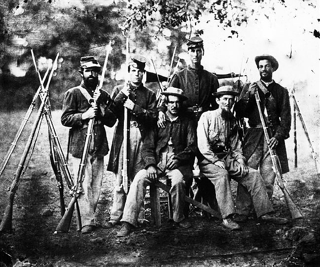
Photo of Confederate volunteers
Wrote the same Captain, Sufferings, privations & hardships have been endured such as no modern armies of their countrys have ever been called upon to undergo…but the… greater our sufferings now the more glorious will be our greater triumph…
Within a year, General Ambrose Burnside’s Expedition had captured towns in the east and established a blockade.

The Great Expedition under way, the Union armada to establish a blockade, sketched in October 1861, prior to a November hurricane
Control of Albemarle and Pamlico Sounds was firmly in Union hands in a bid to cut off General Lee’s southern supply routes to Virginia.
Hatteras had fallen. Roanoke Island was falling.
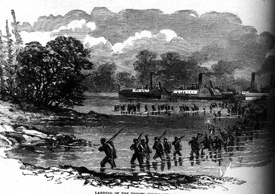
Artist’s engraving of Union troops going ashore on Roanoke Island to battle Confederate troops
Union troops and a fledgling Navy easily outmaneuvered seven small Confederate boats they called The Mosquito Fleet to capture the Island. On land volunteers tangled with Burnside’s men but were no match for the larger forces.
They were captured and three weeks later they were paroled. They then set about forming a new company with others and joined another regiment.
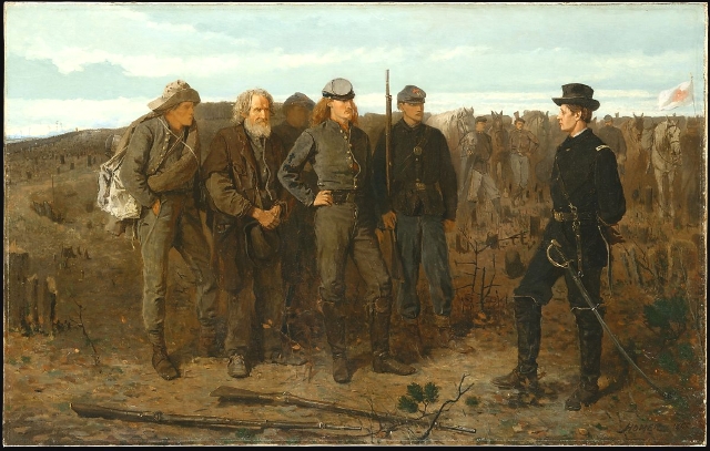
Confederate Prisoners by Winslow Homer, who had toured the South and sketched military and civilian life there during the war
Apparently the release of captives was common in the early years of the war. Prisoners of war would be held for a while, then freed, sometimes after taking an oath of allegiance to the Union. Whether they re-enlisted was an individual decision.
Life in Albemarle counties was overturned. Sound and rivers became thoroughfares for gunboats. Towns were shelled in skirmishes to maintain the Union blockade.
Confederate Steamship Eolus patrolled Albemarle Sound and rivers
To counter Union action the state authorized counties to form guerilla bands called Rangers to harass Union forces. Rangers in the Albemarle were most effective, since their members were so familiar with its forbidding terrain. They also prevented slaves from crossing Union lines and terrorized Union sympathizers.
Stating that they were virtually bandits, an angry Union commander threatened serious reprisals. Locals, too, were not happy with the depredations and the secretive nature of these bands.
Meanwhile, Albemarle residents had been smuggling supplies for Lee’s army. Provisions would be shipped from Norfolk Virginia through the Dismal Swamp Canal into northeast North Carolina.
From there they were ferried west through swamp and river, then back up north to Lee’s army in Petersburg, or further north to Richmond, Virginia. The hand-off of supplies was probably done relay-style, from crew to crew.
To stop the smuggling, federal forays destroyed bridges and roads but the supply stream did not stop. The Union then organized Negro troops to intervene, a move that was bound to incite citizens, particularly in light of reputed atrocities. It worked. Citizens were kept in a state of fear and panic.
A truce of sorts was arranged. The Union would remove Negro troops if citizens stopped the smuggling and the Rangers were disbanded. A jittery peace was restored, though it a Union captain acknowledged later that this circuitous supply route through northern North Carolina remained effective during the War.
Exports of cotton, lumber, ships stores and fishery products that were expected to pay the bills were halted by the blockade. Imports of necessary goods were blocked. Basics became luxuries.
From 1862 to 1865 prices soared because of profiteering by smugglers: a barrel of flour went from $18 to $500; corn, a staple, went from $1 a bushel to $30. Parched corn was used to make coffee and sorghum was grown and processed for sweetening, instead of sugar.
Wrote one resident, Sure this War is meant to check the profusion in which we have lived & to teach the rising generation economy & the employment of their resources.
Many southerners could not believe that slaves would want to escape bondage. They were quite sure that slaves felt such a strong attachment to their masters they would never leave, that they were being driven or enticed to federal camps. When slaves took advantage of the Emancipation Proclamation, planters felt betrayed.
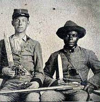
There were, however, blacks who remained loyal to the Confederacy
Yet as soon as Union troops arrived in an area slaves would follow their camps. Slaves that did not flee often piloted Union ships and revealed the location of Rangers.
The Freedman’s Colony
If you can cross the creek to Roanoke Island, you will find safe haven.
Roanoke Island became a refuge for escaped and freed slaves. Protected by the Union army, over 3500 refugees would settle there in a camp called the Freedman’s Colony where community life flourished: families could live as families, children could attend schools, gardens could grow and going to church was central to life.
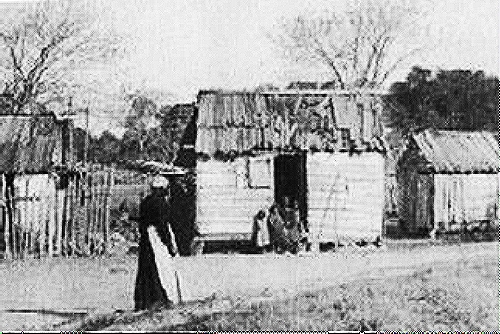
Photograph of housing in the Freedman’s Village
Some freedmen from Roanoke Island and other camps in eastern Carolina offered their skills to Union forces, or became spies, guides and scouts, built forts and bridges and served in four Union regiments.
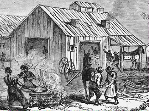
Blacksmith working in the Freedman’s village. There were at least two other similar villages in the east
After the war the land was returned to the original owners and colony members became refugees again. Reports of depredations by some of these refugees and others caused counties to establish militia to maintain control.
The Expedition Hurricane
It wasn’t all rosy for Union ships on Burnside’s Expedition. Bad weather plagued them in turbulent seas. In November, 1861, the Expedition Hurricane scattered a Union fleet of 75 ships off Cape Hatteras. Two vessels sank, and others were wrecked by Confederate forces. Storm surge was so high it inundated Hatteras Island.
Words from one sailor: Wind continued to rise till at 11 pm it blew almost a gale…The scene was fearful but magnificent. The ship was tossing and pitching…The waves were rolling at least 20 feet high.
Words from another: Last night was the worst I ever saw. I could not sleep for I had as much as I could do to hold myself in my bunk. Reynolds got thrown out of his…8 am Window in stern got stove in the night…water was three or four inches deep. Shoes, guns, knapsacks…floating round in fine style.
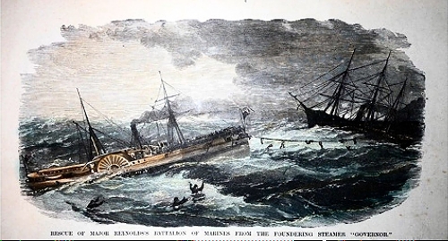
Rescue of a battalion of 485 Marines from the foundering SS Governor. Seven men were lost trying to jump toward the rescue ship USS Sabine
Then, on a stormy New Years Eve in 1862 the ironclad warship, the Monitor, sank in 300 feet of water almost 200 miles off Cape Hatteras, losing 16 of her crew. She had performed extraordinarily well in service.

The Monitor, foreground, sinking offshore. In addition to a revolving turret, many unique features had been included in her hull
The Merrimack and the Monitor
The first ever duel between ironclad warships had taken place near the mouth of the James River when the smaller Monitor clashed with the formerly wooden frigate Virginia. The Virginia had previously sunk, then was raised and re-outfitted as an ironclad and rechristened the Merrimack.
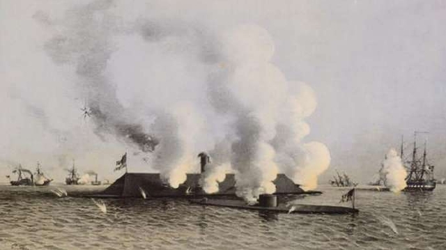
Battle between the Merrimack and the Monitor. The Merrimack looks like the roof of a barn; the Monitor sits low in the water, only 18 inches exposed
The Confederacy hoped to use the Merrimack to break the Union blockade, and before the Monitor arrived, she had already destroyed two wooden Union ships.
The battle ended inconclusively; the blockade remained. But the clash between two ironclads marked a major turning point in the history of naval warfare, and the two ships are memorialized in the names of Hampton Roads tunnels.
The Union and Confederacy had both developed steam-powered ironclads because ships built from wood could no longer withstand fire power from late-model heavy artillery. European countries took note of this battle and immediately stopped construction of wooden ships.
The Monitor’s location is a watery historic site, and the Mariners’ Museum in Newport News, VA tells the story of that time through exhibits and artifacts.

The Monitor in its national marine sanctuary. noaa.gov
Only a few months before the Monitor sank, the Merrimack was blown up by her Confederate commanders as Union troops approached Norfolk to tighten the blockade. She was heavily salvaged, so few remnants remain as relics.
There was only one major battle fought on Albemarle Sound, a year before the end of the war. Three confederate warships, including the Albemarle Ram, an ironclad built in a cornfield, and eight Union gunboats faced each other. The battle ended indecisively at sunset.
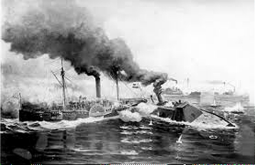
Battle of the Albemarle May 1864. Three Confederate warships, including an ironclad ram in foreground and sidewheeler in background engaged eight Union gun boats until sunset, when both sides retired. Weapons and Warfare
(During the Civil War, much action in the Albemarle centered on the rivers and towns north of the Sound and will be found in profiles of rivers as they are posted.)
Picking up the Pieces After the War
Left with a shattered economy and a broken society — devalued land, bearish cotton prices, a crumbled plantation system, destroyed homes and businesses — citizens began to find ways down new paths.
The social fabric of the community had been frayed. Soldiers came back wounded, or they didn’t come back at all. Families were broken by death and disease. Livelihoods were cobbled together by every member of the family.
Going to school would not put food on the table. Money was so tight that the personal surety bond, a sign of trust that was used regularly before the war, was replaced by the mortgage.
The country store and gristmill, many now in disrepair, had offered antebellum farmers more than essential goods and services. Along with churches, they had been the nucleus of community life. Rural folk, whether landowner or tenant, free black or white, converged to purchase supplies, have their corn ground, or simply visit with neighbors and friends.
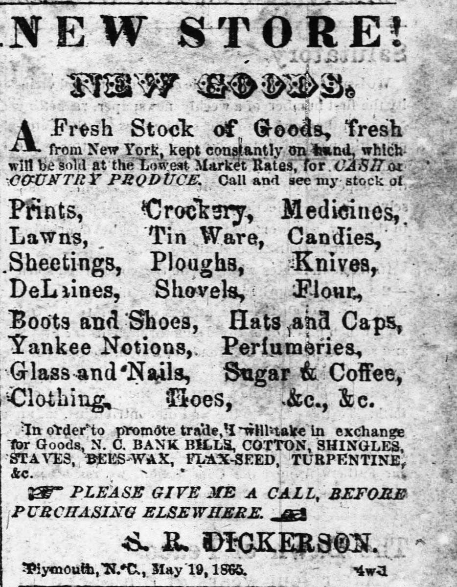
A Grand Opening in Plymouth on the south side od the Sound, 1865
The structure of county government changed. Instead of Justices being appointed to manage affairs, county commissioners were elected to govern, a more democratic process that allowed for participation by blacks, who now voted and began to hold county offices.
Heavily in debt, Albemarle’s county governments struggled to provide aid to the poor, repair bridges, roads and ferries and restore public schools that had been closed early in the war.
Loss of labor, unstable race relations, and an uncertain political future reduced the wealthy to poverty. The Capeharts of Scotch Hall whose plantation had been bringing in $100,000 a year were left with $1200. Still, that was a tidy sum compared to assets of most people.
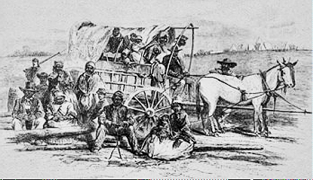
Freed slaves, now refugees, looking for a new home. Harpers Weekly, 1863
Class and color remained strong points of division throughout the century. Planters had trouble accepting the new equality enjoyed by blacks, and especially the idea of blacks holding public office. Blacks aligned with republicans, putting democrats in the minority.
The Perquimans Record opined in 1892 that the white element in the Republican party is the best class of our people, wealthy, Intelligent and refined.
Democrats worked very hard to gain the majority, presupposing that once in power they could reduce the Negro to his former subservience. The rise of Populism that attracted many farmers, slowed them down, but by the 1900’s they were firmly entrenched with a racist agenda.
Cotton and corn crops were good that first year after the war. They fetched high prices. People were optimistic. But rains brought poor cotton crops the next couple of years, and there was barely enough corn for bread.
Spring plowing, the beginning of a new season of hope
The 1870 census revealed devaluation of farm acreage, livestock and crop yields. Cash value of farms dropped by half or more.
Freed slaves and poor whites lacked the money to purchase even devalued farmland and supplies to start them on a new life. Planters were so deeply in debt that they could not pay workers up front, so they divided up their property and worked out a system of sharecropping or tenancy.
Tenant farmers rented the house and the land they tilled. They had control over what crops they grew and how they were sold. Out of the cash they received they paid the planter and any merchants the money due for rent and supplies and kept the rest.
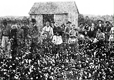
Picking cotton a tenant farm
Sharecroppers seldom owned anything. They rented the land and the house they lived in, along with all supplies needed for farming. They were told what to plant and had no control over sales. After harvest the planter took what was owed to him and paid what was left to the sharecropper.
Most bought supplies from local merchants on credit with the hope that they could pay off their debts after harvest. For many it was an endless cycle of debt and poverty, reminiscent of the miner in the country-western song, Sixteen Tons, who owed his soul to the company store.
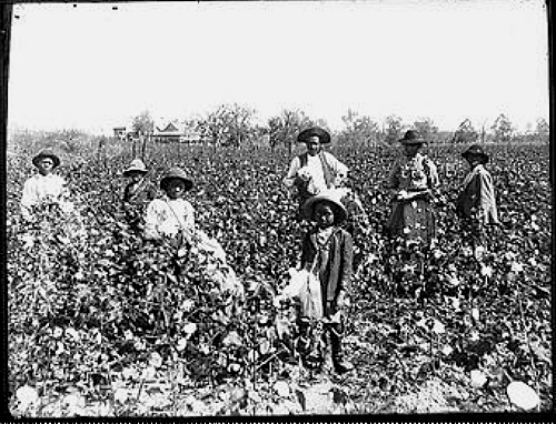
Sharecroppers in the 1890s
Sharecropped farms occupied about 35 percent of farmland north of Albemarle Sound, much less in counties along the south shore. Easing the penury were gifts from Sound and rivers, the dependable, annual running of herring and shad that could be freely taken.
The prosperity of antebellum years never returned to the Albemarle. Post-war industrialization elsewhere in the country did not reach here and farmers still planted their crops and watched the weather.
Those swamps, managed to keep the world away. A low population and lack of an industrial base protected the environment from smokestacks and warehouses. This watery oasis was not seen as a destination for building a bustling metropolis.
Future threats would come along and would-be moguls would try to exploit the environmental wealth, but they did not succeed with any permanence, even in the twentieth century.
This lack of commerce and industry created some of the poorest counties in the state. Yet there was not a vast exodus of African Americans from the Albemarle during either wave of the Great Migration during the twentieth century.
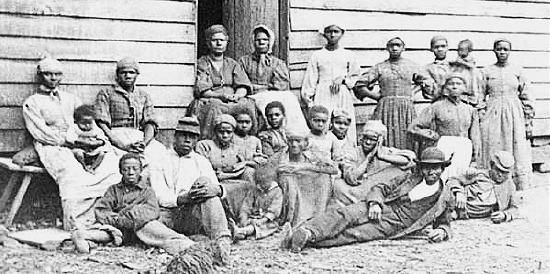
They chose to stay
Families with long lineage here, black and white, close-knit and close-by, have given support and comfort to each other through centuries, and a relatively benign climate eases life.
Lack of heavy commerce maintained a relaxed pace of life that allowed for neighborliness, deferential respect, and time-honored values of God, family and country. In fine weather or flood, people count on each other for help.

Shoreline along the Albemarle Sound, one example of the appeal of the region
Whatever hurt remained from the war, every spring communities could look forward to those heady days when the fish swam up rivers. And they knew that life in the Albemarle would be sustained for yet another year.
Albemarle Sound: Voyage through Centuries Part IX
The Mighty Herring Fisheries
When the shadbush bloomed in spring, the hard work and celebrations began. Schools of shad and river herring teemed in from the ocean through inlets and into the Sound and up rivers, bound for their birth places to spawn a new generation.
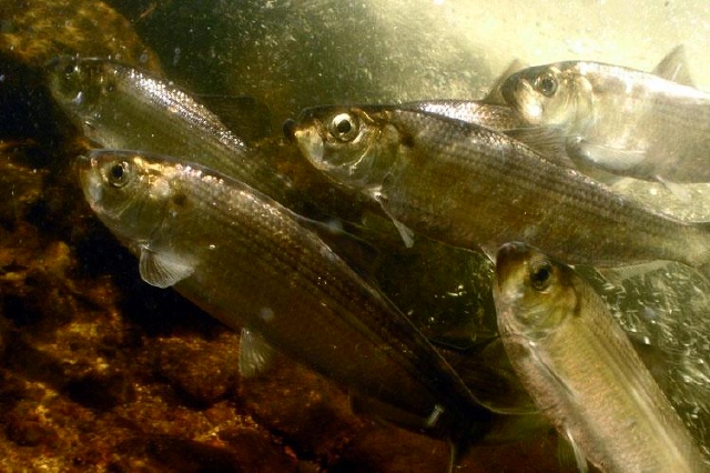
Alewives, one species of river herring. Jerry Prezioso NOAA
At a time when people lived off the land, these silver fish brought great joy and the promise of full cupboards, a fine reason for exuberant annual celebrations.
Buckets, baskets, nets, poles. Families scooped up fish that would feed them throughout a long winter. Shad had to be kept on ice to stay fresh, so it was eaten immediately, but the oily flesh of herring lent itself to salting, pickling and drying that would preserve it for a year or more.
(Well into the twentieth century you could find community celebrations of herring runs — and barrels of corned herring in country kitchens.)
Fishermen cast their net baskets off a bridge in Martin County late 19th century
Around the end of the 19th century, herring could be purchased on river banks in spring for as little as one dollar a thousand, though the average price was $2.50. A dollar a month, wrote one Chowan County native, would procure for a person the most usual diet of much of the population — herring, cornbread (corn was 40 cents a bushel) and tea brewed from native yaupon holly.
From the 1760s on, commercial fisheries were operating on Albemarle rivers, catching fish in cunning, labyrinthine weirs of poles and reeds. Pickled herring were shipped up the coast to Baltimore, New York and Boston; west to the Great Plains; and south to the West Indies. By sail. By steamer. By rail.

Salted herring packed in wooden bins for shipping. Smithsonian Institution Archives
A century later, about the same time shad boats were first skimming waters, the pound net was introduced, while huge seine nets were catching vast numbers of fish with breathtaking efficiency.
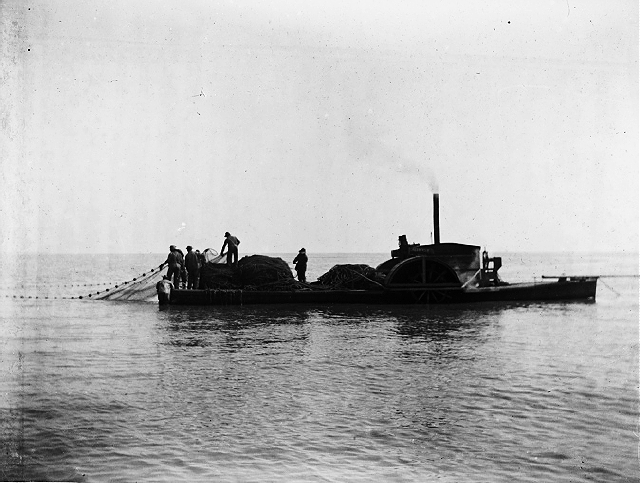
The Seahawk herring boat piled high with fish, on Albemarle Sound
Every plantation had a shoreline of smooth sand where fish were landed and processed. Capstans, or windlasses for hauling seines in, salting houses, processing sheds, and offices created a mini fishing town.
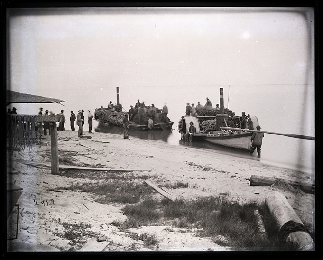
Fishing flats Avoca
During fish hauls, two ten-oared boats would carry a seine more than two miles long and several feet deep off shore. Boatmen would row in opposite directions extending the seine, which had a line of corks on top to keep it afloat and a line of lead weights on the bottom to sink it. The seine would be strung out in a direction to block the herring as they swam upstream to spawn.
In 1861 Harper’s Weekly published a moment-by-moment rapid-fire account of hauling in a catch. Here is an excerpt. It begins after the fish have been caught in the seine and the seine is attached to capstans.
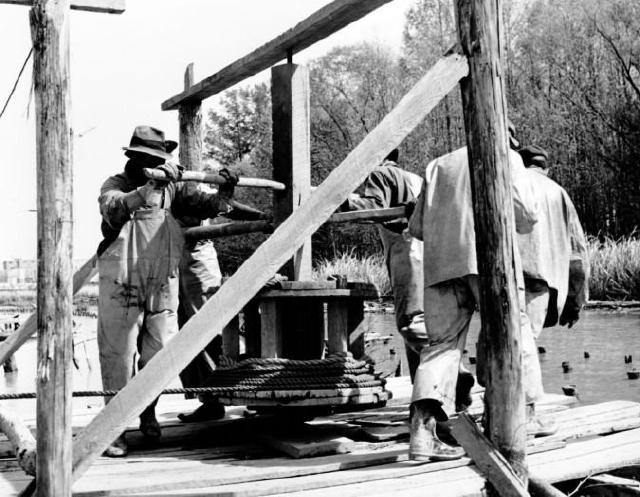
Capstans could be turned by men, mules, or eventually, by steam in order to tighten the seine
In this instance, mules are used to turn the capstans to tighten the seine until the fish are crowded and surrounded by net on shore.
Fifty stalwart men rush into the water, waist-deep. The captains shout and swear, the gulls and eagles scream, and dashing into the melee, audaciously snatch their share of the spoil.
A few minutes of heavy dragging and the flashing, wriggling mass is rolled upon the beach; a line of wide planks is hastily staked up behind, the net withdrawn, and the boatmen again put off cheerily to repeat the haul.
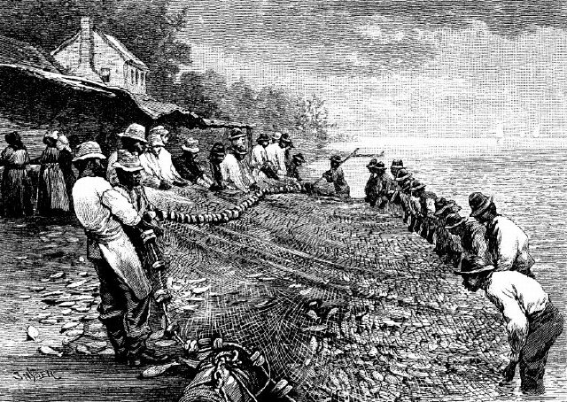
Hauling the catch, engraving from Harper’s Weekly i879
The women and boys now rush knee-deep into the gasping heap. The shad are first counted into baskets and carried to the packing-house; while the herring are headed, cleaned, and thrown into tubs, ready for the salters—all of which is transacted with merciless coolness and the most wonderful celerity.
It requires from five to seven hours to complete a haul ; and as there is no respite by day or night, three and four hauls are made within the twenty-four hours. The only time allowed for eating and sleeping is during the odd hours snatched by the different classes of workers when their especial branch of service is suspended. When the hauls are not heavy the cleaners and salters have an easy time between landings. The boatmen sleep while the mules wind in the net; the mules browse and bray while the boats are out.
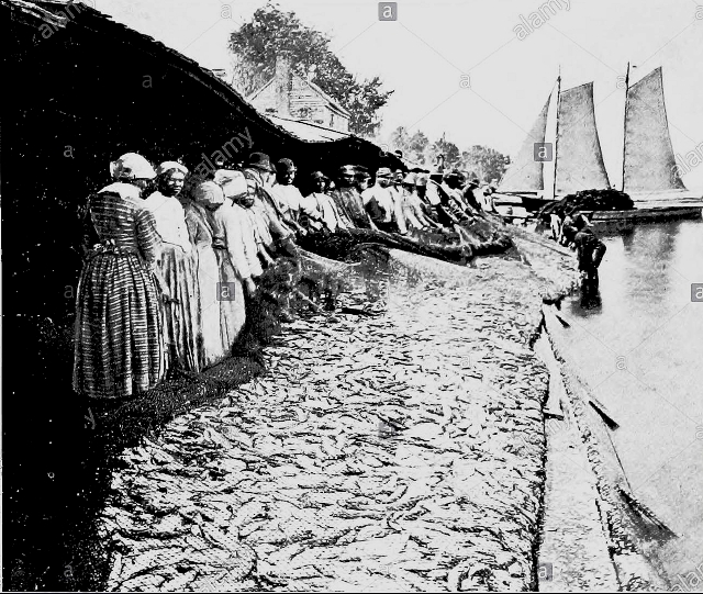
Black women waiting to sort, gut. head, salt and pack fish. By the time they finish one haul, another will come in. A seine is piled on a fishing flat in the background. Smithsonian Institution archives
A first-class fishery employs from eighty to a hundred bipeds, and a dozen or twenty quadrupeds, and the labor during an active season of six weeks or two months is equal to that of a brisk military campaign in face of an enemy.
Of all the striking views of this exciting and picturesque business the night-haul is pre-eminent in interest. Here the lively scenes of the day are reenacted amidst the glare of pine torches, which exhibits the wild figures of the fishermen and the death-struggles of the finny captives in the most dramatic light possible.
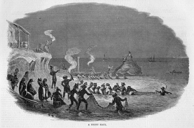
Fishing at night was common during herring runs. Torches kept boats from losing their way. Fishermen’s night songs, hymns. chanteys, or old slave songs could be heard from across the water, “nothing more stirring than those crews singing on a moonlit night” recalled Col Capehart, owner of the fishery. Engraving from Harper’s Weekly
Besides needing captains and crews, cleaners and packers, skilled seine menders were valued for keeping the seines, which had to be tarred, in top shape. Holes in a net meant lost profits. Coopers made barrels for storage. A manager attended to details on shore and sold to customers on the beach.
Even children who were hanging around would be put to work where needed; their pay would be a bucket of fish for supper. Regular workers were paid a share of the profits.
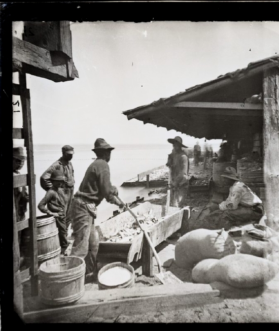
Salting the herring for dinner at the fishery. Much larger troughs are used when salting for shipping. Smithsonian Institution Archives
It was not uncommon to take a hundred thousand river herring in a haul, though most hauls were smaller, five thousand up to thirty thousand. Since it cost between five and ten thousand dollars to establish a fishery, only wealthy planters could afford the upfront costs. The vast majority of farmers gathered their fish for personal consumption in dip nets or bow nets.
Every river had its haul of fish, though uniqueness of terrain and flow created differences in the personalities of rivers.
By the end of the 19th century the herring and herring roe of Albemarle Sound had won widespread fame. In a world where herring fisheries ruled, Albemarle fisheries were king.
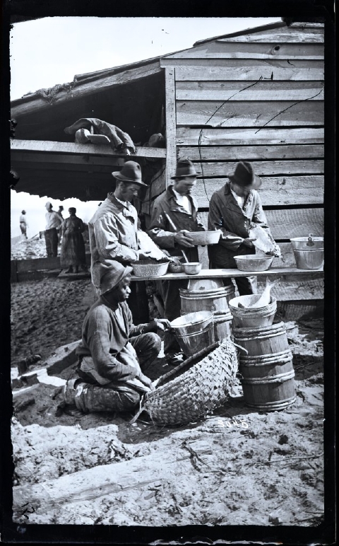
Extracting shad roe 1877 at the Capehart fishery on Albemarle Sound. Smithsonian Institution archives
In a curious twist, settlers here — laboring mightily in an inhospitable but richly endowed land, living on the edge, isolated, self-reliant, insular — grew to have standing on the world map. Markets in New England, Europe, the Caribbean, even Russia eagerly sought their fish, their naval stores, their cotton and produce, their lumber.
We are fortunate today to have a rich photographic record of this era. During the 1870s the U.S Fish Commission sent scientists into the field to document fisheries nationwide. They produced a multi-volume report; the photographic collection is housed in Smithsonian Institution archives.
The North Carolina History Museum in Raleigh also houses archival photographs. Historian David Cecelski has reproduced many of these photographs in his blog posts about the herring fisheries. He tells an insider’s tale of coastal North Carolina life and fishing traditions.
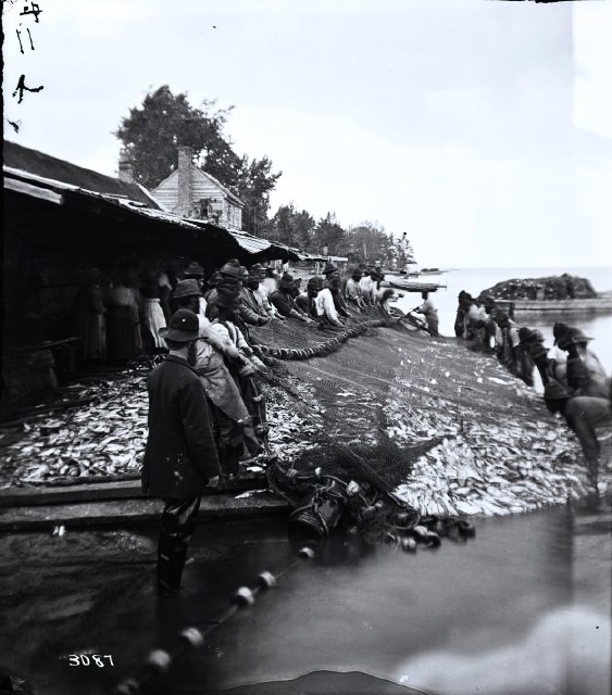
At least thirty men heave thousands of fish onto the beach at Avoca in Bertie County 1877. Smithsonian Institution Archives
And Then the Fish Stopped Coming
As far back as the 1840s, a few prescient people sensed that the fishery could not last under such colossal landings. But it did not occur to most people that there could ever be an end to this bonanza. They simply assumed they could count on these fish to arrive on time each year, in the millions, as expected, forever.
Even the eminent scientist, Thomas Huxley, president of the Royal Society in England, saw no reason for concern. I believe, then, that the cod fishery, the herring fishery…and probably all the great sea fisheries are inexhaustible…(1883)
By 1896 0ver 1100 pound nets in Sound and rivers had replaced the labor-intensive haul seines, and fishermen were landing over 20 million pounds annually.
So many pound nets blocked passage of river herring that the state enacted the Vann Law in 1905 that required fishermen to leave a channel in the Sound to allow fish to migrate to their natal waters for spawning.
Still, the fishery continued to decline in the twentieth century. During the 1950s total catches were about 11 to 12 million annually. By the 1970s they had dropped to about 8 million, and in 1993 came the crash, down to one million.
Northeast North Carolina was not the only area that suffered losses. In 1965 the entire range of Atlantic states harvested over 64 million pounds. Forty years later total harvest for the combined area was under 100,000 pounds, almost a 99 percent decrease.
The fishery had died. In 2006 a moratorium on commercial fishing was declared in North Carolina. Three New England states, Connecticut, Massachusetts and Rhode Island, joined the moratorium, but other coastal states did not. The fish did not come back.
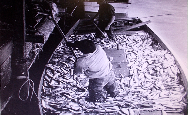
Fishermen once unloaded boat loads of herring at fish houses like Perry Wynn’s on the Chowan River. North Carolina Wildlife Resources Oct 2007
The demise of the river herring fishery has vast implications for life in the sea. It is, for instance, probably responsible for the weakening of the cod fisheries in New England and Canada.
The river herring, after all, is low man on the food chain. It is born to be eaten. Half of a herring’s year is spent out in the Atlantic Ocean, anywhere from Canada to South Carolina or Florida, being eaten by the big fish that count on the silvery slivers swimming in massive schools.
For eons the silver slivers have been dinner and dessert for big creatures of the ocean like cod. Without them and their cousins the food chain collapses and nobody gets dessert.
In the Albemarle river herring are the preferred food for the rockfish, or striped bass, another great Albemarle fishery whose story most appropriately belongs to the Roanoke River. Can you imagine the turmoil, the frenzy, the catching and losing, as river herring and striped bass jostle in that race of millions to find their particular spawning grounds?
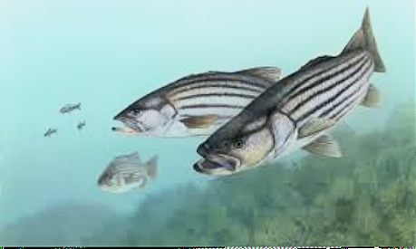
Striped bass, or rockfish, are the tigers of the Sound. In the days of big herring catches, landings of rockfish could weigh thousands of pounds. It was not unusual for a single rockfish to weigh a hundred pounds. Wikipedia
Let us return for a moment to the first American settlements when tools were few and simple, and survival depended on the wit, skill, and hardiness of those early men and women.
The environment provided everything they needed if they learned its ways. And if the rains failed one season, or a drought or a flood came along, well, they would have to work harder, and they might lose anyway.
They were conservationists by default because they could tame the environment with only their sinew, and maybe a mule to help them along. They could not claim control over the land.
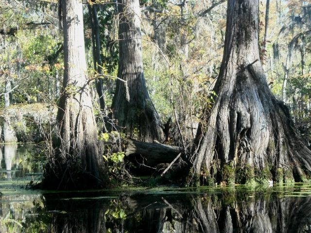
Giant tupelo and cypress trees in Merchants Millpond State Park in the flood plain of the Chowan River are suggestive of the swamps the settlers encountered. aheronsgarden.com
Then we developed bigger, more efficient tools, and the search for ease of living and profits replaced survival with two hands. (Can you blame us?)
We pursued technology that would control the environment and meet our needs and expectations. (Can you blame us?)
We thought our rational approach would solve problems, so we substituted that for an intimate understanding of wild ways, a knowledge that is only gradually acquired, with patience, a knowledge that doesn’t lend itself to committee meetings and graphing.
We set no boundaries. There was great good, but there was greed…
We lost touch with the ways of the land, and we did not know what we were losing. Not just here in the Albemarle but all over the country.
Progressive loss of touch and delight in progress undergird the loss of the river herring fishery–and many more losses.
When losses became too great, we woke up. We studied. Lots of studies. One is of particular interest because its scale had local and national focus.
Urged by a generation of activists who came along after the first Earth Day in 1970, farsighted congressmen took note of declines in fisheries across the country. In the 1980s they sponsored legislation that would fund major studies of estuaries.
The Albemarle-Pamlico Estuarine Study (APES) was born. Scientists, government officials and private citizens cooperated to explore reasons — and seek solutions — for declining catches.
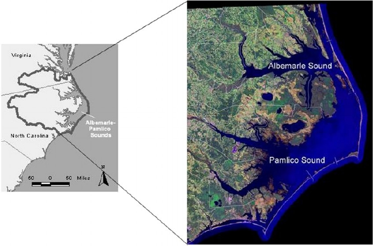
The study area, the Albemarle-Pamlico Estuarine System. EPA and US Geological Service
Turns out these little ten-inch-long fish that weigh half a pound have had the book thrown at them.
Here is how we messed up and how we are trying to reconcile the damage:
Decades of overfishing.
- In times past there was a balance between juveniles and older fish in schools of river herring.
- Juveniles need to wait three or four years before they can spawn, and their first year of spawning is usually only a warm-up.
- Older females become more and more productive with age and can release up to 100,000 eggs annually. However, they are exhausted after spawning and vulnerable to predators. They return to the ocean to recover and refuel.
- If you decimate either class, you lose the future. Hence the moratorium on commercial fishing for herring in 2oo6. It is still in place.

Spawning herring. Milt from the male turns water milky, while females lay eggs on the substrate. Alaska Fish & Game
Activity in the Atlantic Ocean.
- During the late 1960s and early 1970s fleets of foreign trawlers with mammoth nets were intercepting herring out in the Atlantic Ocean on their way to the Sound, 24 million pounds caught in 1969 alone.
- In 1977 the Magnuson-Stevens Act forbade fishing within the 200-mile band of waters called the Exclusive Economic Zone of the United States.
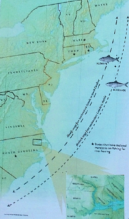
Bluebacks and alewives, collectively called river herring, are anadromous fish. They spend much of the year in the North Atlantic, then migrate south to the brackish water of the Sound to spawn. Their lives outside the Sound are a mystery, except that they are eaten by big fish and sea birds. NC Wildlife Resources Oct 2007
Barricades block fish migration
- Nets once reached across rivers until regulated.
- Dams alter river flow.
- Streams are forced into culverts as roads are built across them.
- Today, where possible, bridges replace culverts and dam-flow is altered to aid spawning (with mixed results in the Roanoke River)

Water exiting a culvert at a road crossing. Fish do not like the turbulence inside this giant tin can, nor do they like brushing against cold steel instead of soft sand
Loss of Habitat
- Wetlands ditched. Woodlands clear cut. Pavement laid down. Development favored.
- Streams rerouted. Riverbanks reworked.
- Rainwater that once seeped lazily into streams pulses unchecked into waterways that become an open fire hose flushing larvae and young fish.
- Today, permits are necessary for work done near water courses that are protected under the Clean Water Act. Not all of them are protected and permitting can be sketchy.

Wetland that has been ditched on North River Farms. NC Coastal Federation photo
Pollution from Agriculture
- Sediment that runs off farms and construction sites clogs gills and buries larvae.
- Nitrogen and phosphorus in fertilizer runoff cause algae to bloom. When algae die, they break down, robbing water of oxygen, causing fish kills. (A particular problem in the Chowan River).
- Best Management Practices (BMPs) used on farms and forests reduce runoff, minimize erosion.
- Integrated Pest Management on crops encourages farmers to use less pesticide (which saves them money, too).
 Algal blooms on the Chowan River
Pollution from Municipalities and industry
- Toxic organics, heavy metals, and oil from roads and parking lots.
- Nutrients, bacteria, heavy metals, and chemicals from the sewers of industries and cities.
- Updated treatment plants treat waste water from municipalities and industry. (Fortunately, minimal urban sprawl and industry here has limited pollutants.)
Street-side swale and pervious concrete sidewalk that allow rain water to seep into the soil are ways to control urban run-off. Wikimedia
The great herring catches are shadows now. We are trying to mend damages from two hundred years or more. We have removed too much critical habitat for the great fisheries to be reclaimed, but we have shifted toward conservation.
Wildlife refuges, state and county parks, and game lands protect land and provide habitat for wildlife and outdoor experiences for people.
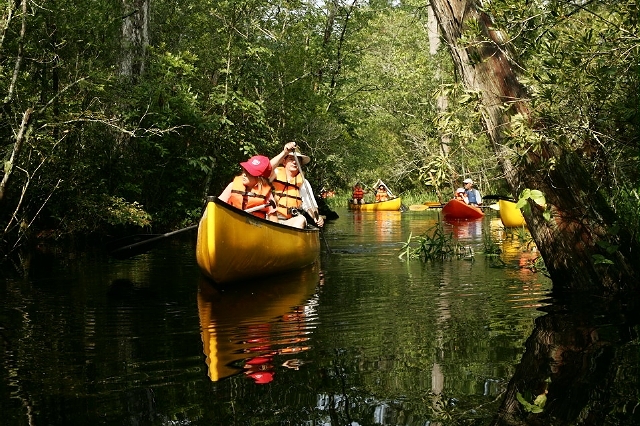
Kayaking in the Alligator River National Wildlife Refuge
People must feel that they have a stake in protecting the vitality of land and water, their land, their water. Public education must focus on developing an understanding of natural cycles and how we can live in harmony with them.
The Albemarle-Pamlico National Estuary Partnership (APNEP) is doing just that as today’s successor to the original estuarine study (APES).
As its name implies, it partners with a variety of groups to support research, restoration and public education. It is a comprehensive approach to protecting our land and water.
Monitoring water quality, Daniel Zapf
This coastal plain where the rivers meet the sea is still compelling, still beautiful, still a respite for many. With care, it can continue to be so.
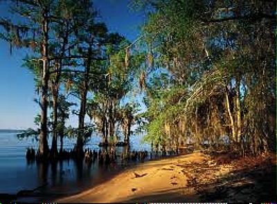
Albemarle Sound: Voyage Through Centuries Part X
Legacy
Some of the counties surrounding Albemarle Sound are among the poorest and least populated in the state. They are also the most vulnerable to rising seas, as we shall see in the final chapter.
Poverty and isolation are not particularly evident to a casual observer because families and communities are close knit. But outside interests have coveted resources here with little regard for the future.
Logging, farming, and intensive silviculture have taken precedence over environmental values.

Forestry is big business in North Carolina. It provides jobs and boosts the economy. Intensive silviculture in Albemarle wetlands requires extreme modifications to the land that are not natural. Photo from NCSU Extension Forestry
Fighting Environmental Justice
There was a time, several decades ago, mostly forgotten now, when the wetlands south of Albemarle Sound were considered ideal for a hazardous waste incinerator.
After all, when you fly over this land, what can you see? A few clusters of houses, a lot of farmland with manmade ditches, maybe some ducks or geese, tangles of swamp that defy GPS, just a bunch-a-nuthin to a fly-over.
The Hazardous Waste Incinerator Indeed, this looked like an ideal place to build a regional hazardous waste incinerator. Not enough people around to make a difference. No matter that these wetlands are prone to hurricanes and floods.
Technology will take care of any problems that crop up. Massive roads. Rumbling trucks with poisons. Belching of tainted air. Even a poisonous spill that would infiltrate wetlands and networks of ditches that flow to native waters.

This state-of-the-art incinerator opened in Arkansas in 2016.With rotary kiln, spray dryers, scrubbers and filters it promises relatively clean emissions. Thirty years ago the technology was not as sophisticated
Residents fought this injustice. How they fought it! Through public education and public meetings, and presentations to county commissioners who saw the incinerator as a plus, a way to bring jobs to a community that desperately needed them.
The people prevailed. Their inherited lineage, their love of the land, overrode any modest income offered by the outsiders. No, thank you, they did not want the menial, and perhaps dangerous, jobs that came with this intrusive behemoth.
A Noisy Airfield There was a time, in 2001, when the United States Navy eyed this good-fer-nuthin place with a few people and a lot of birds as a good prospect for an OLF, an Outlying Landing Field for pilots to practice on a new line of fighter jets housed at its Oceana base in Virginia Beach.
Residents in Virginia objected to noisy take-offs and landings near their communities.
Exporting the deafening noise to this nowhere land around Albemarle Sound seemed like a good idea to the Navy and everyone else who did not live in the Albemarle.

F-i8 flying over farmland that seems empty in Washington County. Photo by Drew
Wilson. Virginian Pilot
Residents of this land of black bear, snow geese and tundra swan, residents who are serenaded by choruses of crickets and katydids on summer evenings, were appalled.
This was a David-and-Goliath battle without the promise of a quick victory, or any victory at all. It was automatically assumed The Albemarle could not prevail because it had no political clout. It became a thirteen-year battle.
Residents lived on tenterhooks. They set aside their lives, met often to plan strategy, held rallies and pig pickins, organized post-card-writing campaigns, all the while haunted by the sacrifices people would be compelled to make and the losses to community life in exchange for the bones the Navy was prepared to throw into the pot.
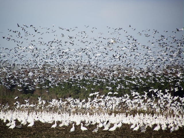
Crowds of snow geese, tundra swan and ducks inhabit the area in winter. During a demonstration flight flocks of birds rose up amid the planes and shaken pilots refused to continue flying. Photo from Visit Elizabeth City
After eight years, the Navy lost its case in court and the voluminous environmental statements prepared by a firm in upper New York State were declared flawed. The Navy came back for another round that lasted five years, before finally giving up on the ill-fated proposal and quietly retreating, giving residents their lives back and leaving black bear and tundra swan and katydids in peace.
During all those years of campaigning and lobbying lawmakers, activists conducted themselves with grace and dignity. There were no arrests for disorderly conduct or property damage. There was simply respectful patience and determination.
Both the incinerator and the outlying landing field were prime examples of environmental injustice.
A hazardous waste incinerator is never located near an affluent community.
Nor is an OLF.
Creative Approaches to Conserving Land
We’ve come a long way since those decades when wetlands were nuisances, and the coastal plain was prime ground for exploitation.
Ironically, it was back in the 1930s, during the depression, that land conservation began, strictly to protect threatened waterfowl. The efforts proved to be a godsend to desperate residents, too, who were given jobs by the Civilian Conservation Corps (CCC) to clear brush, build roads and construct impoundments for the new refuges.
By the 1970s, after those first heady Earth Days, we had learned that preserving ecosystems as entire units, instead of trying to save limited habitats for threatened creatures was a better way to protect the environment.

Miltail Creek in the Alligator River National Wildlife Refuge. This large Wildlife Refuge is an example of preserving an entire ecosystem instead of small areas
In the Albemarle this meant purchasing land to forestall development and accepting donations of land from corporations who no longer had interests in the Albemarle. It meant cobbling together donations of land, brokering property exchanges, and guiding land divestments by corporations. Who were the players?
- The Nature Conservancy
- The Conservation Fund
- The Richard K. Mellon Foundation
- The State of North Carolina
- The US Department of Interior
- And even the IRS (to evaluate tax consequences of corporate donations)
Thanks to their creative diligence we have a mosaic of national wildlife refuges, state parks and wild game lands that add up to more than half a million acres. Within this acreage, agencies are working to reforest woodlands and restore wetlands if necessary.

Water control structure installed with help from The Nature Conservancy in the Pocosin Lakes National Wildlife Refuge to control drainage
Alligator River, Pocosin Lakes, Mattamuskeet and Roanoke River are some of the National Wildlife Refuges here, administered by the US Fish and Wildlife Service. As for state parks, Pettigrew, Dismal Swamp, and Merchants Millpond are some examples.
They are oases in the Albemarle for all of us and a small hedge against rising seas.
Identity Change Develops Momentum
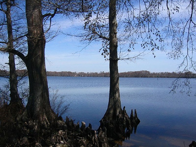
Perquimans County shoreline. Photo by Lauren King. Virginian Pilot
There is a highway along the south shore of the Sound that used to be considered a tedious miles-long pass-through for vacationers hurrying to a sparkling ocean and a lively Outer Banks (OBX) tourist scene worth a billion dollars annually.
Today, people are stopping along that highway south of the Sound and other highways along the north shore of the Sound.

The Museum of the Albemarle in Elizabeth City tells the story of the Albemarle with photos and artifacts, including a historic shad boat. NCDNC
The Albemarle area is developing its own identity; it is becoming known as the Inner Banks (IBX). It’s a special place where vacationers can slow down and discover a venerable part of the country that has been — well — forgotten by the outside world.
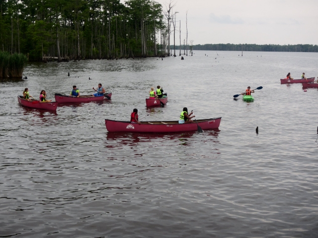
Canoeing on Salmon Creek, a newly opened recreation area in Bertie County fostered by the non profit group, Tall Glass of Water
Communities in northeast North Carolina are capitalizing on their history and their roots. Towns have visitor centers, friendly museums or nature centers, galleries and arts centers featuring local craftsmen, boardwalks, river views, walking tours or tram rides, even tree houses for rent. Ice cream cones, too.
Port o’ Plymouth museum on the Roanoke River explores the history of the area and the Civil War. Pictured is a replica of the CSS Albemarle Ram
Here you can find an intimate step back into the history and environment of the earliest pioneers in the country.
The Newbold-White House sits on land high above the Perquimans River, a reminder of some of the earliest settlements in the Albemarle
The Albemarle is not glitzy. There are no fern bars. It’s inviting and comfortable and unhurried. And there is good fishing.

Otter catching a prize. Two-legged anglers enjoy fishing in these waters, also. Photo by Meekins USFWS
Natural areas — a network of wildlife refuges, state game lands, state parks, community parks offer visitors a place to have a picnic and photograph wildlife, or a chance to linger along a creek or hike a trail, or join a guided tour for hands-on experiences.
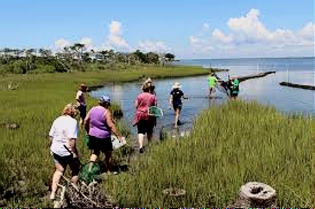
A group studying water quality and biota of the marsh. SeaGrant
These collective invitations to explore the Albemarle come from loose consortiums of public and private agencies.
Non-profit groups like The Nature Conservancy and North Carolina Coastal Land Trusts acquire and broker land for conservation.
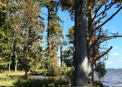
Land along the Salmon Creek was acquired by the NC Coastal Land Trust, then folded into conserved county, state and federal lands. Portfolio Coastal Land Trust
NC Land of Water, Roanoke River Partners, and Bertie Water Crescent promote eco-tourism.

Boardwalk and camping platforms in the wilds of the Roanoke River flood plain. Roanoke River Partners
Coastal Wildlife Society, NC Coastal Reserve, and the Red Wolf Coalition are among many that work to conserve eco-systems.
Support comes from federal and state initiatives. Recent rollback of protection for streams and wetlands under the Clean Water Act has been reversed.
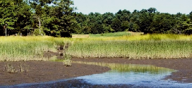
More streams (18%) and wetlands (51%) will be protected under re-instated directives of The Clean Water Act. US File Photo
Oysters. once a staple of life in Albemarle waters but now struggling, partly because of changes in salinity and water quality, are being given helping hands. Oystermen are helping with initiatives, and, in the process, helping to promotethe industry.
Cultch planting, that is, dropping shells and stones into coastal waters creates a reef of sorts for oyster spat to attach to and grow. NC Coastal Federation
Funding through the North American Wetlands Conservation Act, matched by partners in North Carolina, will conserve habitat for waterfowl and shorebirds.

The elusive king rail will be protected under acreage added to Currituck National Wildlife Refuge. USFWS
The state is generously appropriating money for parks and recreation and clean water trust funds. Town and county governments are seeking funding and working with non-profits to promote eco-tourism.
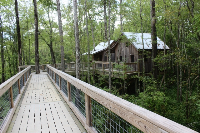
The town of Windsor conceived of and received matching funding for constructing treehouses and raised boardwalks for campers along the Cashie River, part of the Roanoke River system
Seeking Green Industry
But to preserve society here, the soft tread of ecotourism needs to be augmented by green industry. Renewable energy featuring wind farms and solar arrays are punctuating the landscape, bringing income to farmers and the community.
Offshore wind farms, not offshore oil-drilling platforms, make sense to most. Technology has brought the costs of solar and wind power into competitive range, and the environmental and human losses created by, devastating oil spills would become sad memories, not future threats in hurricane-prone seas.

Yes, you can farm crops on a wind farm. Continuous blinking lights on blades warn birds during night flights
To move forward, there must be political will that overcomes regressive political and industrial moves. Piping in natural gas or replacing coal facilities with fracked-gas facilities, or building small nuclear plants are environmentally unsound, now that wind and solar power are cleaner and becoming more affordable.
With its climate and topography, North Carolina, and especially the Albemarle, can become a leader in producing renewable energy.
There is much progress to be proud of, but we face an unsettled future, as we shall see in the next part of this series.

The future is of little concern to this alligator loafing on the water with friends in Merchants Millpond State Park. Photo by Chuck Richardson
Albemarle Sound: Voyage Through Centuries Part XI
Rising Seas and Sinking Land
Nathaniel Batts may have been a recluse when he died in 1679, but he was a virtuoso wheeler-dealer in his younger days as fur trader, land owner, pardoned murderer, serial debtor, swindler, explorer who discovered an inlet, and friend of people in high places. (A prenuptial agreement forbade him to use his wife’s fortune to satisfy his debts; he found forgiveness elsewhere.)
Section of a 1775 map showing Batts Grave south of today’s Yeopim River
Batt’s colorful life surely deserves a ten-part mini-series, but for now we are more interested in his grave as an expression of what has been lost to rising seas and sinking land.
The North Carolina Gazetteer says that in 1749 the island called Batts Grave was 40 acres in area and had houses and orchards on it; by 1756 it had been reduced to 27 acres.
By mid-twentieth century Batts Grave was reduced to a fly-speck on a map. Today it is gone.
Rising seas, hurricanes and nor’easters ate at the island. Sinking land played a lesser but inexorable role. These geologic forces are continuing today.
In fact, rising and falling seas that seem so dramatic to us today have been changing coastal landscapes for eons.
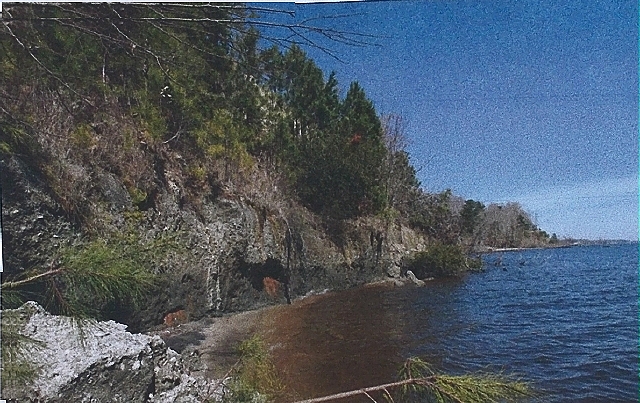
This photo by geologist Stan Riggs pictures a terrace in west Albemarle Sound that was once an old shoreline It adjoins the Suffolk Shoreline
The Suffolk Shoreline referred to in the caption of this picture is the remains of an old shoreline that existed when the earth was much warmer than today, around 100,000 years ago. Sea level was 25 feet higher then.
The entire Albemarle area was below water, a shallow continental shelf. The barrier islands that we know today did not exist.
The map below shows that the coastal plain (Inner Banks) at just a few feet above sea level will begin to flood as polar ice caps melt.
Further rise in sea level will bring sea water up to the Suffolk Shoreline, already discussed, is 25 to 50 feet above sea level, drowning the Inner and Outer Banks. The Suffolk Shoreline will flood if the ocean reaches the Fall Line.
The Fall Line, in black, is where the rolling hills of the Piedmont begin. Interstate 95 generally follows this ridge, which is about 150 feet above sea level today. If both polar ice caps melt, the ocean would rise to the Fall Line.
All land east of the Fall Line would be flooded. Millennia before glaciation, when temperatures were higher and the world was a warmer place, the ocean reached the Fall Line.

The Albemarle area today showing the coastal plain vulnerable to sea level rise, the old Suffolk Shoreline at 25 to 50 feet above sea level, and the Fall Line (in black) where the rolling hills of the Piedmont begin. NC Land of Water
Our lives are so short we can only observe nannoseconds of geologic change. We are lulled into assuming that the land always looks the same, unless we change it. Yet change is constant. We simply don’t see it.
Let’s look more closely at why the coastal plain is slowly sinking. In a word, past glaciation is the cause. How can that be, you ask, when this land was never glaciated?
During the last Ice Age, 20,000 years before present, glaciers extended as far south as Long Island. Tons of ice from these glaciers compressed the land beneath, pushing it down. In response, unglaciated land to the south (the Inner Banks) reacted by easing upward. (Like a slo-mo see-saw.)
As climate warmed and glaciers finally melted, the land that had been compressed under them was released and began to rise. Land to the south (the Inner Banks) reacted and is still reacting by sinking to previous levels. (Now the slo-mo see-saw has changed direction downward for those living on the Coastal Plain.)
This action takes centuries. We are only seeing some of the results of this geologic change today, and lately the changes seem to be measured in decades.
Where decades ago, land seemed dry, today, there are puddles and flooded streets after storms, worrisome to anyone living in a vintage family home where water now encroaches on the front porch during rainy times.
But this is only a small part of the story.
Let’s go back in time, say 15,000 years ago when glaciers are beginning to melt, and ocean water is still bound up in glacial ice.
The ocean is about 400 feet lower than today. Land would have extended some fifty miles east of today’s shoreline. A barrier beach, like the Outer Banks, if it existed, would have been just east of that. The Outer Banks, as we know it today, would not form until sea level rose to today’s levels.
The land is tundra-like, but warmer than you might expect because of the Gulf Stream that slides along the periphery. As climate warms, lush marshes and swamps will grow up, wonderful habitat for ice age mammals and birds — and early man.
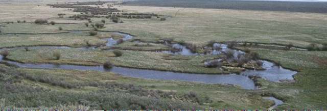
An artist’s view of tundra on the continental shelf miles off today’s shore line. As climate warms, marsh and swamp will develop over thousands of years, then migrate west as sea level rises. NOAA
As the earth warms and sea level rises, the shore line is flooded by the ocean and pushed westward. Marshes are flooded and die and are born anew on higher ground. They replace swamp forests whose trees have drowned but scattered seeds that will take hold on higher, dryer land.
As sea level rises, there is an inexorable migration of water and life to the west.
How long did this take? How far out on the continental shelf did early man live? These are questions that cannot easily be answered.
The Albemarle area holds a plethora of fluted points and artifacts, including a dugout canoe from about 6000 years ago. But artifacts of Paleo-Indians could date from 15,000 years ago, or earlier, and these are drowned in open seas today, so we can only imagine the extent of their occupation.
Let’s look at life from the perspective of Early Indians. They were hunter-gatherers who followed the food. They did not have vested interests in real estate and infrastructure. They accepted what the land had to offer, and moved on when necessary. You could say they were resilient.
It wasn’t necessarily an easy ride. There were great storms and droughts, and floods and freezes and forest fires, even a mini-ice age that lasted almost 1500 years.
Fossils of plants and animals and micro fossils of pollen tell stories. By analyzing and carbon dating the kinds of life found in core samples of strata, scientists can read the ancient waves of climate change.
Coring on Roanoke Island by the NC Coastal Geology Cooperative reveals a combined rate of sinking land and rising sea level as follows: Only three inches prior to the 19th century. Seven inches by the end of the 19th century. A whopping 16 inches by the end of the 20th century.
Can this be possible? Remember Batts Grave. Our own casual observations of water levels on our bulkhead tell the same story: about 6 to 8 inches rise in thirty-five years.
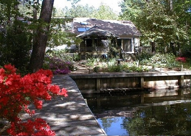
Photo of our boardwalk circa 1988. Note mini-dock we had for disembarking canoes and horizontal timber visible to the right. Today these are totally submerged except on rare occasions when the wind blows steady out of the north and water is pushed to the south. aheronsgarden.com
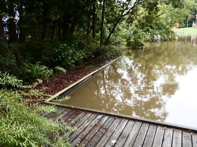
It’s not unusual for a storm to cause water to rise to the top of the bulkhead. After most storms some parts of our woodlands flood. aheronsgarden.com
Albemarle lands are among the most threatened in the country by a combination of sinking land (subsidence) and rising seas.
Do you remember the Suffolk Shoreline that rises west of Albemarle Sound and was under water 100,000 years ago?
As earth continues warming, rising seas are expected to reach the Suffolk Shoreline sometime in the next 100 to 500 years. We are seeing the beginnings today with consistent flooding of roads, farms and yards. The earth’s climate is constantly changing.
What Do We Do Now?
Where scientists could not persuade, hurricanes, flooding, loss of low areas and the appearance of ghost forests are turning skeptics into believers in sea level rise.
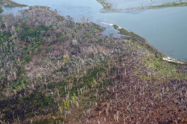
As sea level rises, salt water, from overwash of hurricanes, for instance, can kill plants that are not salt tolerant. These ghost forests are occurring on the Albemarle/Pamlico peninsula today. Mark Hibbs, South Wing SCRO
How will communities respond to threats to their way of life?
We are beginning to realize that we can no longer do battle with rising water and storms. Past knee-jerk reaction has been to harden structures — create seawalls, build jetties, erect bulkheads, pile on the rocks, or the sandbags — to keep that water in its place.

Sand bags scattered on the barrier beach after a storm. Not working too well, judging from the flooding. NC Coastal Federation
Such efforts cannot be maintained in a dynamic environment where change is coin of a watery realm. Water will always win.
Tuning in to the natural world, and working with it, is the best way to preserve our well-being.
All that we have done to the land — ditching, draining, clear cutting the magnificent forests, building dams, laying down pavement — all this speeds up and re-routes the natural flow of water and makes the land — and its people — more vulnerable to the forces of climate.
Spongy wetlands allow water to seep ever so slowly through the landscape. Mighty trees in acres of forests have vast networks of roots that drink copious quantities of water. Once removed, water quickens, and erosion and puddles and muck follow. Ugliness, too.
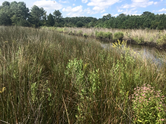
This former farm has been converted to wetlands. Rainfall once took only two minutes to run off into nearby waters, carrying pollutants. Now it takes more than two months to seep slowly into ditches and streams. NC Coastal Federation
New ideas must bubble up through collaboration of scientists, government and communities. Like paleo-Indians we need to develop resilience, a concept that has been adopted by many planners.
Resilience to storms: Are we just mopping up after storms, or are we making decisions that will reduce future damage?
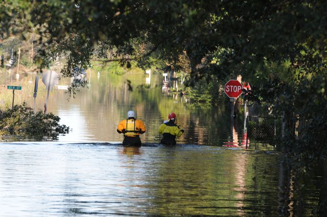
Managing flood waters after Hurricane Matthew. Almost one and a half billion dollars has been spent to clean up after Matthew and Florence alone. Photo by Leticia Samuels, USCG
Communities need help in planning, developing shovel-ready projects that can put fixes in place immediately after a government call for proposals.
Resilience to rising sea level. Close kin of resilience to storms. We need to accept that we can’t prevent sea level rise, but we can develop long-term strategies tailored to sites and community needs.
Even small projects like planting a rain garden will help. NC Coastal Federation
Some examples that emphasize natural solutions:
- moving homes to higher ground
- planting trees whose roots are efficient at absorbing water
- removing impervious pavement
- removing ditches to promote more natural flow of water
- making ground more spongy so rainwater percolates slowly instead of running off
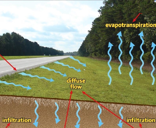
Wide swales on the side of a road diffuse runoff of rainwater and sediment, further helped by woodlands that transpire moisture. On grand scale, this is a technique that would mitigate runoff from miles of impervious roads, driveways and parking lots. NC Dept of Transportation
The mills of government can grind slowly. Rising seas do not wait.
As we already know, it is people brainstorming who will find ways to protect our environment and care for human needs.
People are our most precious resource.
Jess lives on a 75-acre farm with a Charlotte’s-Web roster of chickens, ducks and geese, and a 250-pound pot-bellied pig who once singlehandedly chased four bears that dared to trespass.

Jess, lover of woodlands and wildlife. aheronsgarden.com photo
A few years ago her family grew corn, wheat and soybeans on ditched and drained land. Now their fields are part of the federal Conservation Reserve Program. In exchange for rent, they have dedicated their land to hardwood trees, not crops.
In time these young trees will have deep and wide-ranging roots that will drink up rainwater and begin to take the land back to the days when mighty forests reigned.
With political will and dedication and support from communities, we can tackle the tasks before us and make sensible plans that will take us into the future.
We can’t know all the answers because we can’t predict the curve balls to come, but we can develop the resilience that grounded those Paleo-Indians long long ago.

They will thank us. Photo of baby otters by Meekins USFWS
We thank the many career professionals and dedicated volunteers who are helping to protect Albemarle Sound, its land and rivers, and its wildlife.
This Voyage grew exponentially out of a grant the Albemarle Environmental Association received from the Albemarle-Pamlico Estuarine Study thirty years ago to produce a series of Profiles of Albemarle Sound and its rivers. The original versions can be found on the website AEA on the Web.
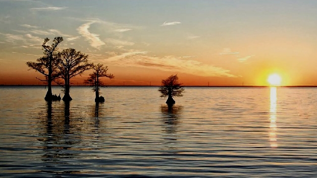
Sunrise over the water with cypress. Photo by Stan Riggs
