. . .One Beauty. . . that delighted the Eye, tho’ at the Expense. . .
Three centuries ago an aristocratic Virginia planter, Colonel William Byrd came south to survey land in eastern Carolina, including the Pasquotank River. He immediately reassured settlers that the river’s dark and impenetrable swamps were not home to any of the fanciful creatures conjured by local lore.
But, he wrote, the swamps had…one Beauty…that delighted the Eye, tho’ at the Expense of all the other Senses; the Moisture of the Soil preserves a continual Verdure, and makes every Plant an Evergreen, but at the same time the foul damps ascend without ceasing, corrupt the Air, and render it unfit for Respiration.
He called the land The Great Dismal. The name persists today.
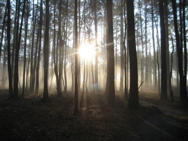
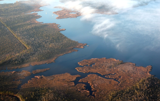
Foggy morning in the Great Dismal Swamp showing second and third growth. US Fish& Wildlife Service
Despite this forbidding description of a river and its swamps, the land became a destination for generations of settlers and slaves, seamen, farmers and merchants, and the largest commercial center in the Albemarle. It has also become a destination for tourists.
Vital Statistics
Out of the depths of the Great Dismal Swamp the Pasquotank River rises in Virginia. Dark languid streams with names like Moccasin Track and The Horseshoe seep from peaty wetlands and merge to form a deep sliver of a river that flows south to Albemarle Sound.
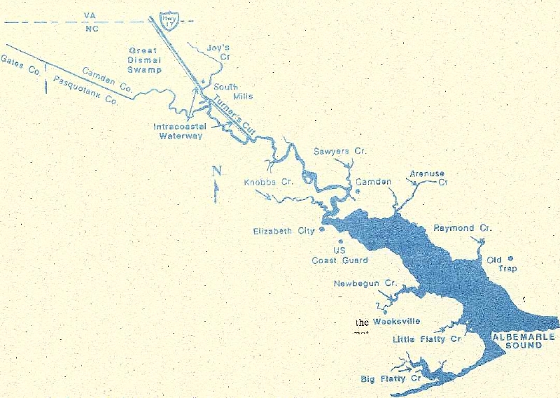
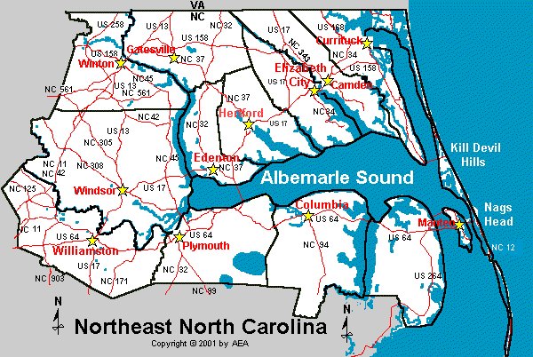
The Pasquotank River is the eastern boundary of Pasquotank County. Map by Elaine Roth

Map of northeastern North Carolina shows rivers flowing into Albemarle Sound. The Pasquotank is located between the Little River and North River. Map by Elaine Roth
Near the Narrows, only a fifth of a mile wide, where Elizabeth City is located, the river swings through giddy oxbow bends before it straightens and spreads out for the last twelve miles of its flight to Albemarle Sound..
South of Elizabeth City, the wide Pasquotank is governed by wind tides that may sweep water upstream, downstream, or cross stream. Salinity rises downstream as river water mixes with ocean water from Oregon Inlet.
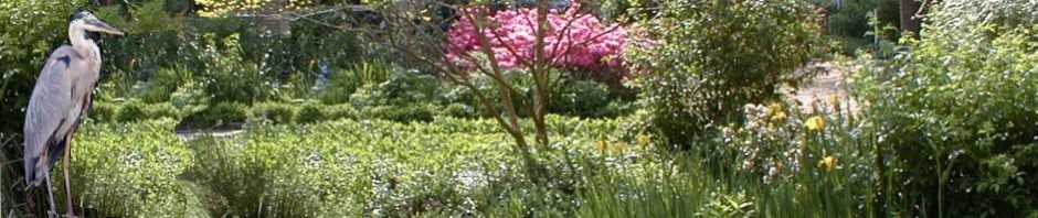
Baldcypress fringe the river’s shores, where bald eagles once nested in old aeries, some now claimed by osprey.
Cypress trees on Camden Point at the confluence of the Pasquotank River, North River, and Albemarle Sound. Karl Bowden/Frogsview
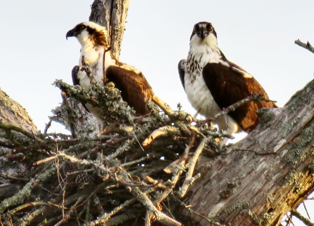
A pair of ospreys in their aerie. Pairs and their young can be found all along the shores of Albemarle Sound. Donna Smith
Before the first settlers tentatively put toeholds onto this land of swamp and water, the Great Dismal claimed between one million and one-and-a-half million acres of land in North Carolina and Virginia.

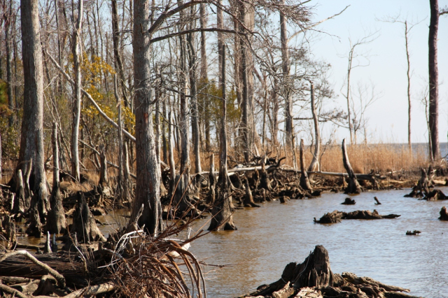
Ancient scarred cypress mingle with young trees and their “knees”.US Fish and Wildlife Service
A glorious paradise, George Washington called it, because of its abundant wildlife. (Apparently, he was not as offended by its miasma as former explorer Byrd).
Untamed by man, acres of these wetlands may periodically be destroyed by storm and fire, usually caused by lightning. Despite insults from unpredictable weather, wetlands have the resilience and genetic ability to recover and thrive. The million or so great dismal acres in both states remained in tact for centuries.

Smoky fires are caused by lightning strikes. US Fish and Wildlife

This lightning strike in August 2011 occurred three years after a devastating fire had already charred the land. US Fish and Wildlife

Peat deposits underlie the swamp and smoky fires from this fuel can continue for months until heavy rains or hurricanes extinguish them. US Fish and Wildlife Service
For thousands of years acreage remained relatively stable, but by 1860 the Great Dismal had been whittled to less than half the original size. Harvesting timber, building a canal, and clearing and draining land for farming consumed the rest.
The Great Dismal Swamp National Wildlife Refuge in Virginia protects 113,000 acres.
North Carolina’s 14,000-acre Dismal Swamp State Park in Camden County represents only a small fraction of the original acreage, but it is home to one of the few stands of white cedar remaining on the east coast.

Atlantic white cedar was a dominant tree in the swamp, its resistance to decay prized by colonists as they converted the great trees to shingles and ships
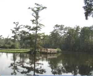
The park is also still the haunt of wild creatures. A 300-foot boardwalk and sixteen miles of hiking and biking trails take the visitor deep into the swamp-forest for a possible glimpse of elusive wildlife: frogs, turtles, snakes, birds, even occasional bear or bobcat.

Unexpected glimpse of a migrating warbler in a pine. Donna Smith
Access is also provided for canoes and kayaks. For information and a Trail Map check the Park’s Visitor Center five miles from the state border on US Route 17, adjacent to the State Rest Area.

Who is enjoying this kayak outing more: man or dog? Jeff Byrd
The Fabled Fisheries
For almost two centuries the Albemarle and its rivers were celebrated for massive catches of herring. The fisheries created capitalists and supported families who worked for the capitalists. Albemarle herring was shipped all over the world, prized for quality and quantity.
Technically, fish shouldn’t be able to reproduce in the tea-colored waters once sought by seamen for their keeping qualities during long ocean voyages. (Yes, this swamp water is naturally potable, barring permanent manmade changes to the system.)
Low levels of dissolved oxygen caused by naturally decaying detritus can make it hard for fish to survive, especially in warm weather. But they do — if waters are not polluted and natural flows of creeks are not diverted by ditches and channels.

River herring making their annual pilgrimage up the rivers of the Albemarle. Robert Michelson
For centuries herring and shad by the millions came in from the sea, came back to their birth places to spawn here. Locals greeted their arrival with buckets and nets and poles and pails, and exuberant celebrations. Salted and cured, stored in barrels, these fish could feed families for a year.
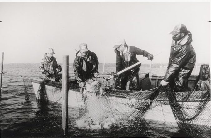
An example of fishing with pound nets in the 1970s. Photo from David Cecelski’s blog
The herring are pretty much gone today, but a network of quiet creeks along the river provide an afternoon of good fishing for striped bass, large mouth bass, croaker and white perch. Mullet barbecued on wood skewers is a longstanding local favorite, and old-timers once considered creeks around Old Trap a bass fisherman’s paradise.
Charting their Destinies
Back in the 1650s persecuted refugees, scoundrels, hunters, traders, adventurers. and settlers were lured south by reports of rich bottomlands and virgin forests around the Pasquotank River. They wanted a chance to start fresh and create better lives for themselves.
They came in small groups, plodding south along two Indian trails through The Great Dismal, seeking relief from oppressive governance in Virginia. They were people with a sense of rugged individualism who, in isolation, would happily shrug off the yoke of government or the constraints of society.
They met small tribes of Algonquian Indians, the Perquimans, the Yeopim. and the Pasquotanks, or pasketanki, which means where the current divides. As Europeans usurped the land, their numbers dwindled but their legacy remains as names of local rivers.

Colonists, some of whom had never farmed before, learned much about growing food and surviving in a strange country from the Indians they met. John White watercolor of Algonquian Indians 1585
Wrestling a living from swampy land, isolated from other families, armed with only simple tools and help from natives took fortitude and faith.
Eventually, self-sufficient family farms produced corn, potatoes, wheat, flax and cotton on small scale, and tobacco as a cash crop.
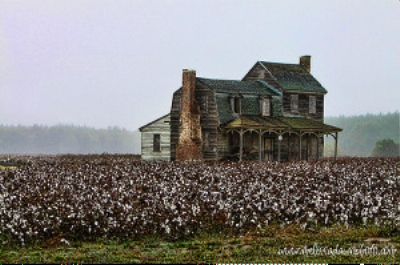
The 1786 Pendleton House in Nixonton, Pasquotank County, still has cotton fields surrounding it. Melissa Dawn
The Pendleton House (shown above) is probably one of the oldest in Pasquotank County. Nixonton was the first settlement in the county, established on the Little River, about a mile from Hall’s Creek. Zachariah Nixon provided 162 acres for homesites and farms, and in 1785 the town became the capital of the county. By 1789 there were 20 homes and 70 people living there, with landings and warehouses along the river.
Halls Creek today, a quiet spot forlaunching a boat. Aheronsgarden photo
Of all crops, corn was the most reliable, and early guidance from Indians assured reasonable success unless bad weather intervened. During the Revolution Albemarle farmers happily sold corn and hogs to British and American soldiers alike.

Traditional maize, or Indian corn in days before hybridization. Wikimedia Commons
Pork was a daily staple — free-roaming hogs fattened easily on wild chestnuts and acorns. and often, annoyingly, on produce from the family farm.
Early farm implements like this plough, were simple and required muscle-power. They were used after big trees had been brought down with fire and channels had been cut into swamps to drain them. NC Dept of Cultural Resources
Farmers weren’t just farmers. They put to sea, made shingles, fished the spring runs of shad and herring, or hunted deer and other wild animals, and gathered oysters.
By the end of the 18th century, small plantations thrived, producing fine crops of cotton, grain and tobacco. One of these was Bayside Manor, a three-story Greek Revival plantation house built in 1856 by Christopher Hollowell. Originally 700 acres of farmland, today it is surrounded by ten acres of woodlands. Its elegance epitomizes antebellum prosperity.

A lovely home, remodeled whose fame was enhanced when it was purchased by Wayne Newton
During the Civil War Hollowell supplied the Union army with provisions of corn, wheat and fodder and also gave aid to hungry and wounded southerners. In 1863 he implemented a wage-labor system for his slaves that proved crucial for keeping the plantation productive. Artifacts from the estate became the foundation for the Museum of the Albemarle in Elizabeth City.
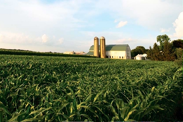
Today endless fields of corn and soybeans line the roads with silos for storage, and despite its small size, Pasquotank County is seventh in the production of corn in North Carolina.
Wheat, a staple since early days, is also a profitable crop. Karl Bowden/Frogsview
Everyone Had a Boat
It’s unimaginable today — the isolation early settlers must have felt as they hacked through swampy, roadless country to build homes, plant crops, barter produce for necessities.
But streams and creeks that seemed to be barriers to travel were so numerous they linked the rivers of the Albemarle. You could travel from the Chowan River in the west to the Pasquotank and Little Rivers in the east via these shallow streams that became marine highways through swamps. It didn’t take colonists long to figure out how to get around.
Everyone had a boat, most likely built by its owner who quickly learned how to cobble together a navigable craft, less likely bartered for crops, or even less likely, bought and paid for with cash. In pioneer country real money was short.
First lessons in boat building came from Indians who hollowed out logs of rot-resistant white cedar to create what we call a dugout canoe. They were masterpieces and some still survive today, having been sunk for centuries in that potable water rich in tannic acid that preserved them.
Some of them were large and sturdy enough to ride the waves of a capricious Albemarle Sound. No metal tools were used during building, a feat that most impressed the colonists.
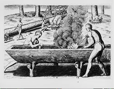
Everything except finishing touches on the canoe was done with controlled burning and patience. The tree was gradually felled by fire; the tops and branches removed, and most shaping and hollowing was done by careful burning. Engraving by Theodore DeBry from artwork by John White 1590
As decades and centuries passed, settlers designed a variety of boats suitable for shallow water. These rode the creeks and river. Two examples are shown below.

The shad boat, beloved by watermen, maneuverable in shallow water and roomy enough to carry a family to church or fish to market. Designated North Carolina’s state boat.

The sharpie schooner, with many of the same characteristics as the shad boat,
Eventually, ferries were added to the mix of craft on the river. The first official ferry crossed the wide, three-mile Pasquotank River between Arenuse and Newbegun creeks.
Since the first courthouse was on Newbegun Creek, eastern Pasquotank residents had to ferry across the river during boisterous weather..
The first ferries were little more than barges with scant protection from open water. NCPedia
Winds whipping up waves could mean rough trips. Court days were special for colonists. Never mind legal business, social events drove the schedule. Entire families made the trip to meet neighbors for a drink or two, exchange news, air grievances. and market their produce (a pig bartered for cloth, perhaps, though tobacco was always a welcome trade). Missing court days would never do.
The courthouse and ferry moved further north. Sawyer’s ferry, chartered in the late 1700s, crossed a much narrower river at Camden and continued operating until a bridge replaced it in 1911.

Aerial view of Sawyer’s Creek and Pasquotank River. Karl Bowden/FrogsView
Eventually, the river won. Pasquotank County was split and land to the east of the river became Camden County with its own courthouse.
Curiously, the arduous task of grinding corn led to new roads.
Water mills were eventually replaced by more efficient windmills but not before the tops of milldams were converted to roadbeds. Today, Highway 343 paralleling the east side of the river in Camden County crosses the sites of three early milldams.
Late into the nineteenth century, after the Dismal Swamp Canal opened transportation to Virginia and beyond, steamships and large sailing ships would navigate the Pasquotank’s winding creeks to load cargo.

Sidewheel steamer the Nanticoke that operated on the Chowan River is an example of steamships that sailed the Pasquotank River
Eventually a draw bridge would cross the Pasquotank River from Elizabeth City and marry the two counties. A causeway and double drawbridge replace the original structure today.
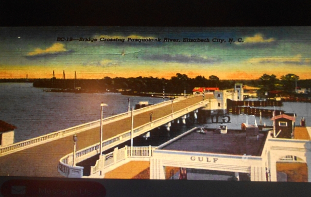
Photo of the bridge built from Elizabeth City in Pasquotank County to Camden County in 1931, from a post card of the era
Managing, or Mismanaging, a Colony: The Heady 1670s
Though settlers had been arriving here for decades (in 1660 the King of the Yeopim signed a deed granting the entire tip of Pasquotank County to Nathaniel Batts), it wasn’t until 1663 that formal government was introduced to the Albemarle colony.
King Charles II, the Merry Monarch, magnanimously rewarded his supporters with land in the Carolinas (and beyond, for good measure). Lords Proprietors, they were called and they were to lay down the law and enrich the Crown, and, incidentally, themselves.

King Charles II of England
An executive council and an elected assembly under an English governor comprised the Grand Assembly of Albemarle County. The first meeting took place on February 6, 1665 on a little knoll overlooking Hall’s Creek, about a mile from Nixonton.
Its first known action, recorded in September 1666, prohibited sowing, planting or tending tobacco from February 1667 to February 1668. Tobacco prices had tumbled because the market was saturated. Managing the value of commodities seems to have been an issue even back then.

Historical marker of the first meeting of the Grand Assembly
Weather woes may have rendered the resolution moot. Major August hurricanes in 1667, 1669 and 1670 and three months of drought in 1668 followed by a full month of rain in August destroyed crops and eroded farmers’ income.
Despite farmers’ struggles, government by the Lords Proprietors was fitful and unsympathetic. The Crown’s Navigation Acts imposed new restrictions and heavy taxes on shipping. The Indian Wars during the 1670s had to be paid for, and colonists resented additional high tax levies.
Corruption, power plays, and wrangling marked the decade of the 1670s.
Meanwhile, back in England, no one seemed to know quite what was going on in the colony, or who was in charge. Pleas and letters went unanswered.
Thomas Miller, Collector of Customs, was the focus of controversy. A shady character, he aspired to be governor of the colony.
At the same time, he was so intimidated by an unruly populace he relied for protection on 30 to 40 bodyguards, men of ill repute, who were run out of Virginia after participating in Bacon’s Rebellion.
Fearing uprising, Miller ordered disgruntled settlers to surrender their arms to him. It’s doubtful that they complied. In general, they were a sober, industrious lot, but they resented oppressive government.
Miller had alienated colonists by rigging elections, cheating them of payments for tobacco, over-taxing them, and shorting the county of customs money. A particular sore point was the tax levied to pay his thuggish bodyguards.
The pot boiled over in 1677. Culpeper’s Rebellion was a bloodless revolt on the banks of the Pasquotank River.
Historical accounts of events are patchy and details vary depending on the source. The Rebellion was probably a roisterous affair, and with little documentation, historians did not begin to consider it a Rebellion until a century or more had passed.
Nevertheless, the cast of characters that played out the turmoil of the decade could headline a swashbuckling television mini-series.
Miller, now acting like governor, lit the match when he arrested outspoken dissenters. Among them was George Durant, an influential Perquimans County resident whom he threatened with hanging because he publicly objected to shoddy governance and unfair taxation.

State historical marker in Elizabeth City
John Culpeper, a bit of a roustabout, and cohorts forcibly freed the prisoners and turned on Miller. They arrested him, put him on trial with a rigged jury who were happy to rubber-stamp a guilty verdict. Miller was thrown into a prison specially built for him on Durant’s property.

A gentlemanly representation of the rebellion. WilliamDentonblog
A duly elected assembly, albeit a rebellious one, appointed Culpeper Customs Agent, a powerful position. He took the reins and managed the colony for two years, apparently quite satisfactorily. . .
. . .After which, he went to England to plead the colonists’ cause. Meanwhile, Miller escaped from prison and was also sailing to England to accuse Culpeper of treason.
Culpeper expected the worst. Instead, the Proprietors leaned on shaky technicalities to judge the case. Miller had never been appointed governor, and Culpeper had been duly appointed to his position by a (rebel) Assembly.
The charges against Culpeper were dropped. Quashing negative publicity about strife in land that was billed as paradise overrode legal challenges.
Culpeper returned a hero. In the interim, John Harvey (of Harvey’s Point in neighboring Perquimans County) had become acting governor.
That nobody in England knew much of what was going on in the colony during this period rather suited the settlers.
They were succeeding in a hostile land by dint of hard work and swamp-smarts. Families lived and worked together in austere simplicity. They did not have time for book learning, but they were grounded in practical experience and problem-solving.
True, they were short on religion, but they seemed not to mind. Clergy rarely traveled to the colony, so weddings were simple affirmations with witnesses. When formal services finally took place, it was not unusual to baptize the first child of the union at the same time.
The 1670s were a wild ride for Albemarle residents. In its way it was every bit as turbulent as the wild west would be two centuries later.
The Proprietors never made a profit. They sold their shares back to the king. Once the Crown provided some stability and efficiency to colonial government, the next forty years brought prosperity and rapid growth well into the 18th century.
Elizabeth City Becomes a Hub
Shingle Landing the docks at The Narrows of the Pasquotank were informally called. Deep water on the west bank made this a natural location for loading and offloading vessels.
In 1764 a law designated The Narrows of the Pasquotank as an inspection station for hemp, flax, flax seed, pork, beef, rice, flour, indigo, butter, tar, pitch, turpentine, staves, leading, lumber and shingles. The wide-ranging list of commodities gives some idea of how colonists were succeeding in living off the land.
Here a tavern was operated by Adam and Betsy Tooley. It was a convenient stopping point for travelers and a place for stagecoaches headed for Virginia to change horses. Gradually, a few houses appeared beside the storage sheds, and a town began to grow in competition with the town of Nixonton.
Fifty acres were purchased from the Tooleys and streets and 1/4 and 1/2- acre lots were platted. By 1801 the town was formally recognized as Elizabeth City and became the county seat, with a population of 70 whites and 58 slaves. Its population in 1950 was 12,685.
With river depths of ten feet or more close to shore, Elizabeth City proved to be a fine natural harbor for four-masted sailing ships, steamers and pleasure craft. By the time the Dismal Swamp Canal was completed, the town had become a hub for shipping, an economic center, and the largest town in the Albemarle, surpassing Edenton in port traffic.

Engraving of artist’s impression of Elizabeth City’s harbor in the 19th century
Over a hundred ships called Elizabeth City home port, trading cedar shingles and barrel staves for molasses, rum and sugar. Regular steamboat service connected the Albemarle to points north and south.
Massive catches of herring caught on Albemarle waters were cured and salted and brought to Elizabeth City for shipment north via the Dismal Swamp Canal, or south to the Caribbean, or across the Atlantic to markets in the Old World.

Catches of herring from rivers across the Sound would be salted, put in barrels and transported to ships in Elizabeth City.
Necessaries and luxuries, and critically needed ice to preserve fish that could not be readily cured, came down from the North. The huge blocks of ice were then loaded on ships in Elizabeth City for transport to the great fisheries on the Albemarle.
The Civil War was a low point for Elizabeth City. Most of the city burned, torched by the inhabitants themselves to keep the Yankees from looting. While much was destroyed, the Old Brick House still remains from the 1750s, recognizable by its twin chimneys, unusual for the time.

Built around 1750, considered the oldest building in the county, a large and fine house for its time, known for its quality interior woodworking which has unfortunately been sold off

The Old Brick House as it looks today. Library of Congress
During the next several decades, the city was rebuilt with many fine homes and a neoclassical courthouse.
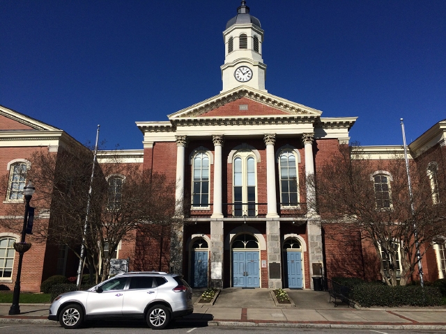
The courthouse is part of historic downtown Elizabeth City
Industry thrived. By the 1880s a cotton mill, grist mills and a soda bottling plant were operating. Some of these buildings still survive. Early in the 1900s the Wright Brothers stopped at Elizabeth City to stock up on supplies before they sailed for the the Outer Banks to test their aircraft.
As the 19th century drew to a close greater emphasis was placed on higher education and schools for African Americans. Elizabeth City State University had its origins in 1891 as the State Colored Normal School that trained its students to be teachers .

The first graduating class of the State Colored Normal School
Across the river in Camden, the McBride Colored School opened in 1928, one of 800 Rosenwald Schools built across North Carolina to educate black Americans. The program was conceived by Booker T. Washington with matching grant funding by Julius Rosenwald, the President of Sears Roebuck and Company.

Rebuilt in the 1990s, the school has become the Rosenwald Community Center open to all for social events. Daily Advance photo
By mid-20th century the US Coast Guard had established its largest base in Elizabeth City, eventually encompassing over 800 acres. The facility played a major role in World War II rescuing people from torpedoed ships. The base is recognized today for its intrepid search and rescue missions by highly trained corpsmen.
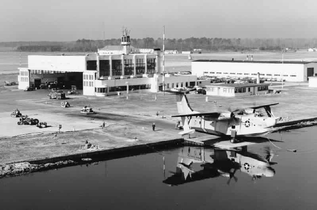
Largest US Coast Guard base and air station on the east coast
The rotating crew of about 800 coasties brings new people from all over the country into the area to enrich life in the City. Many return to retire here and contribute their energy to the city’s life.
In Weeksville, near Elizabeth City, is a hanger that the US Navy once used to maintain blimps that patrolled coastal waters for enemy ships and submarines during World War II.
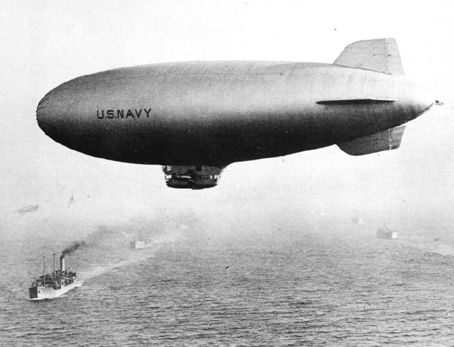
Navy blimps patrolled the sea coast during World War II when Germans threatened coastal shipping. Wikipedia
Private companies eventually took over the production of blimps and Albemarle residents were sometimes treated to skyborn craft being tested above the treetops.

The blimp hangar was a popular destination for tours when it was producing aircraft for private industry
All this history comes alive in the Museum of the Albemarle, where artifacts and elegant exhibits present a seamless story of the past.

Museum of the Albemarle, located on the city waterfront tells the story of the region and features special exhibits about little known events and people
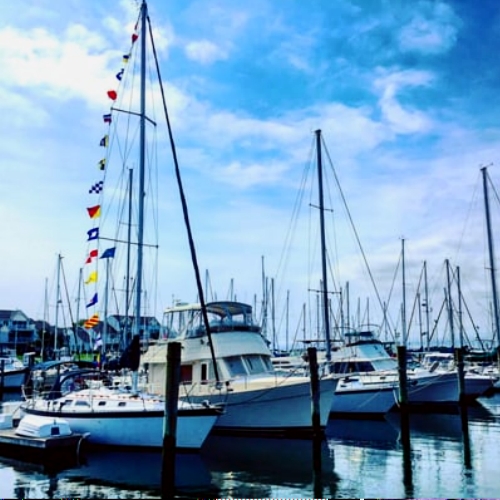
Today Elizabeth City is known as a Harbor of Hospitality. For many years, volunteer Rose Buddies, celebrated ambassadors for the city’s waterfront, would greet visiting boaters with a rose and some wine and cheese. The city still offers free 48-hour boat dockage to travelers from around the world.
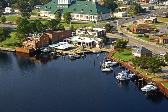
Above is a view of Mariner’s Wharf on the harbor, with Museum of the Albemarle in the background and restaurants along the water. Friday nights are lively with special events. Photo by Kurt Bowden FrogsView
Despite rapid growth and development, Elizabeth City’s waterfront remains one of the most inviting of any city.
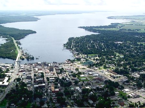
Aerial view of Elizabeth City looking generally south showing the causeway to Camden that replaced the old bridge and the irregular shoreline of the Pasquotank River as it widens. Karl Bowden FrogsView
Historic markers on city streets commemorate special moments in the history of the Albemarle.
The Great Dismal Swamp Canal: Like the Streets of a Populous City
The Dismal Swamp Canal shattered the logjam of isolation that paralyzed the Albemarle. Finally, northeastern North Carolina would have ready markets for its produce and fisheries
An 1850s public school textbook reflected the optimism and excitement of the era:
The road and canal. . .are like the streets of a populous city; they are crowded with people from end to end, and the traveler is never alone. An enormous amount of produce goes over this canal, and it is the best stock in the world.
In fact, in a single year, 1819, Albemarle counties shipped 770 hogsheads of tobacco; almost 2,000 bales of cotton; almost 3,000 barrels of flour; 2500 barrels of fish; 30,000 bushels of corn; over a million staves and 14 million shingles to the Port of Norfolk. From there, cargo went to northern states, Europe and the Caribbean.

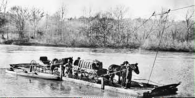
The steamer Shiloh laden with bales of cotton is an example of traffic on the canal
Steamships brought visitors from faraway places, new ideas, and a glimpse of the outside world. A golden age of prosperity had begun.
But for much of its early life the canal was viewed as little more than a muddy ditch. That it was ever completed, given the challenge of the enterprise, is a testament to ingenuity, perseverance, adaptability. and slave labor.
It was George Washington who suggested draining and lumbering the swamp and connecting Chesapeake Bay to Albemarle Sound. Together with Albemarle and Virginia merchants he formed the Dismal Swamp Canal Company in 1784. The state gave authorization to dig in 1790.
The Pasquotank River would be linked to the Elizabeth River in Virginia via a 22-mile canal. No tariffs would be levied on goods originating in either state. Landowners were required to sell acreage needed to the company for a reasonable sum.
In 1793 digging began by hand at both ends of the canal with plans to meet in the middle. Cutting through cypress swamps and shrubby tangles of pocosins lying atop peat that could be twenty feet deep was done not with spades, but with axes, saws, and mattocks.
Snaky buggy work in hundred degree weather or freezing winters in the foul damps (that) ascend without ceasing, corrupt the Air, and render it unfit for Respiration. . .

A wilderness of swamp in which to chart a course. APNEP
Slaves were rented for the heavy work from nearby farms, stipends paid to their owners for their labor.
It took 12 years to dig 22 miles of canal. An observer from France noted that no engineer was overseeing the work, that the number of locks was not planned in advance (there would be seven in the new canal), so there could be no accurate estimate of costs.
After three years and 11 miles funds ran out. Energy shifted to building a toll road to connect the two sections. The toll road generated enough money to complete a rudimentary canal over the next nine years.

Carting shingles along the toll road. NC Archives & History
By 1805 flat-bottomed boats could finally maneuver the shallow ditch. A toll road, forerunner of US Route 17, paralleled the canal, .

Poling a barge along the canal, little more than “a muddy ditch.” NC Archives & History
When the British blockaded coastal shipping during the War of 1812, the canal was hastily expanded to allow the first large sailing vessels through. Although the completed canal was still little more than a muddy ditch, by June 1814 a 20-ton vessel carried a cargo of bacon and brandy from the Roanoke River through the canal.
At about the same time, digging for a feeder ditch to siphon water from Lake Drummond into the canal was begun. So-called reasonable value of the needed land was set by the sheriff as a penny an acre. The canal company paid the owner $1.25 for a strip 300 feet wide and 3.5 miles long.
Widened and deepened in 1829 by slave labor, the busy canal came of age. A fully loaded 35-ton vessel could finally run the entire length of the canal. By 1853 the annual value of merchandise shipped both ways totaled 3.5 milliion dollars.

Ships waiting to be towed. From a 1906 post card
Meanwhile, at the state border the Line House (as it was called on maps) had become a lively stop. Couples who were eloping could take advantage of lenient regulations in North Carolina. Duels were fought, and if a sheriff came around, criminals could evade capture by stepping over one state line or another.

Lake Drummond Hotel at the state line with the Lady of the Lake Steamer passing by
The steamship called Lady of the Lake was the stuff of romantic legend that drew tourists of the day. They heard about the tragic tale of love lost in dark waters, of the forlorn lover seeking his missing soulmate. And perhaps they hoped for that rare sighting of the Lady’s mysterious form in white among murky waters.
There was entertainment, too. From 1914 to 1940 the James Adams floating theatre, on a barge that drew only 14 inches of water, was eagerly anticipated at Deep Creek and South Mills, the locks at the north and south ends of the canal. Twice a year it would perform at each stop, thrilling local theatre goers with its performances.

The novel Showboat was born during a voyage over Albemarle rivers that Edna Ferber took on the James Adams Theatre . Photo from Chowan College 1928 yearbook
During the Civil War, the Union controlled the canal. Despite being blocked by downed logs, the Confederates operated a busy smuggling business.
And during World War II, when German U Boats threatened shipping in the Atlantic the canal was used as a freight corridor.
The canal is the oldest, continuously operated artificial waterway in the country. Water levels in the canal and its locks at each end, South Mills in North Carolina and Deep Creek in Virginia, are maintained by the US Army Corps of Engineers. Except in extreme drought, the canal runs about six feet deep, with a main channel 50 feet wide.
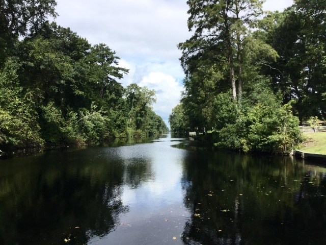
A moment of solitude along the canal. Internet photo
Sometimes extreme maintenance is needed.
Hurricane Mathew wreaked such havoc in 2016 that the canal had to be closed for repairs for a year. So much sand from the Lake-Drummond feeder ditch had seeped into the canal it was only a foot deep in places. 350 downed trees had to be removed.

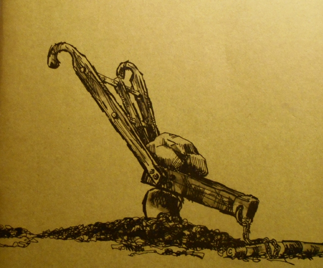
Aerial view of equipment for clearing the damage from Hurricane Mathew

Crane lifts a log from the feeder ditch
Today, you will find mostly pleasure boats along the canal, which is part of the Intracoastal Waterway, a 3,000 mile inland waterway along the Atlantic coast and Gulf of Mexico.

Sailors docked at the North Carolina Dismal Swamp facility. Corinne Saunders
After the Albemarle & Chesapeake Canal opened almost half a century later, much commercial shipping was diverted to that canal. Instead of entering Albemarle Sound via the Pasquotank River, vessels saied through Currituck Sound. This route is also part of the Intracoastal Waterway.

Logs being rafted down the Albemarle and Chesapeake Canal at Coinjock, NC 1901 Admiral Ross
Family living along the North Carolina Cut in the Albemarle Chesapeake Canal 1901 Admiral Ross
During the late nineteenth century, railroads, faster and more convenient, opened land to logging and development and the canal lost more traffic.
But the history and lore of the canal remains integral to eastern North Carolina and Virginia.

The Intracoastal Waterway diverges into two routes as shown. The Dismal Swamp Canal is Route 2. Note feeder ditch from Lake Drummond. Route 1 is the Albemarle Chesapeake Canal that runs into Currituck Sound
Canal Visitor Centers in North Carolina and Virginia recount this complex chapter in the country’s history that illustrates ingenuity and enterprise and hunger for prosperity and, as we shall see, the price that was paid in human lives.
The Great Dismal Swamp: Refuge and Railroad
A brief excerpt from A Free Man of Color, the autobiography of Willis Augustus Hodges who worked on the canal gives some idea of the brutal working conditions that would provoke a man to simply vanish into the swamp.
Hearing that they wanted some laborers on the canal.. . .(I) hired out to work on the canal for twelve dollars a month. . .The bell would ring at daybreak, at which we would form on both sides of the road. Being five hundred men we made a pretty long string. All were slaves except twelve. . .A very hard and cruel taskmaster made the men work from sunup to sundown, flogging them often.
Hodges was fortunate. As a free man, he could and did leave.
From 1810 to 1860 about 30,000 freedom seekers lived in or moved through the Great Dismal Swamp to escape bondage. Figures vary because of the clandestine nature of the movement, but the US census records only about 6,000, a vast undercount. (One wonders how such information would ever find its way into the books of a white male census-taker in the first place.)
People knew as early as the 1760s that runaway slaves headed to the dismal swamp. Ever since the Revolution, unrest and rebellion had grown. Persistent talk of runaways living in the Great Dismal kept white citizens on edge, especially after Nat Turner’s insurrection in 1831 and its dramatic reprisal in southern Virginia.
Antebellum newspapers regularly carried ads posted by owners asking for information about runaways. Rewards were offered ranging from a dollar to more than a hundred dollars. The ads described physical characteristics, such as scarring, skin color, clothing, demeanor, and possible destinations.
(Aside: The prevailing attitude toward slaves with spirit is illustrated by the ad below. The owner offered twenty-five dollars for a seventeen-year-old slave provided he was brought back dead. If the teenager was brought back alive he would give not a penny more than five dollars, as this slave was an impudent rascal.)

An ad in a Halifax County newspaper illustrates the attitudes of owners toward their property
The freedom-seekers, young and old, those who stayed and those who left, reveal a yearning for freedom that we take for granted today. To succeed in their escape they needed wit, tenacity, resourcefulness, and often a helping hand.
Those Who Stayed: The Maroons
The dismal swamp’s mud and peat, teeming with thick clouds of mosquitos, poisonous snakes, bobcats and bears, wild cattle and hogs, snarled vegetation and the feared panther became home to people who had nowhere to go and who chose to live independent lives in truly formidable conditions. Their stories are only recently coming to light.

Plants were either thorny or poisonous, or edible, medicinal, useful. or a combination. The thorns on Hercules Club (Aralia), also known as Devil’s Walking Stick, a plant that spreads enthusiastically in swamps, will tear at you with vengeance if you intrude, but its inner bark will numb a toothache
Maroons, they were called, people who slipped out of shackles and melted into the unforgiving wilderness and survived by learning to live in a hostile but richly endowed land.
Historians believe that thousands of maroons may have lived here between about 1680 and 1860. Native Americans preceded them, pushed out of their ancestral homes by encroaching settlers. Opportunistic maroons used the tools and flints they left behind until they were worn to the nub.

Artist’s romantic interpretation of fugitive slaves living in the Great Dismal Swamp. Wikipedia
Frankly, few people believed that anyone could live for long in this hostile land. But they did. Here is testimony.
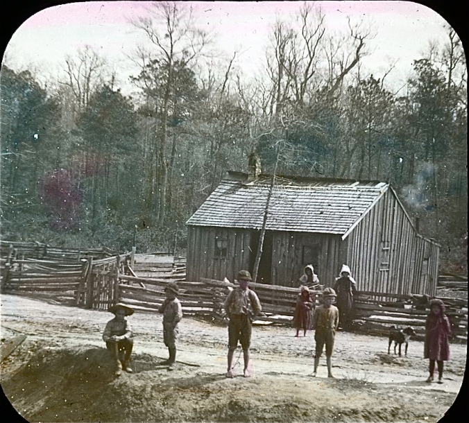
A British traveler in 1784 wrote: Runaway negroes have resided in these places for twelve, twenty, thirty years and upwards, subsisting…upon corn, hogs and fowls…On higher ground they have erected habitations, and cleared small fields around them.
Even earlier, 1728, the aristocratic William Byrd, quoted at the beginning of this piece, wrote, It is certain that many Slaves Shelter themselves in this Obscure Part of the World. . .Never was rum, that cordial of life, found more necessary than it was in this dirty place.
There are about 200 islands of high ground hidden in the swamp. They are solid under foot. Their trees and shrubs are adapted to dry ground. Like a devilish moat, the swamp surrounding them kept slave catchers and bloodhounds away.

The watery swamp is a challenge to explore without dropping into a hole
For there was no way of knowing if you would sink into oblivion except by testing the waters with each wary footstep. Slave catchers preferred not to do a whole lot of testing. And they got tired of machete-ing through brier and battling clouds of mosquitos.
So the maroons were left mostly on their own. Over time they created stable communities that lived on for generations until they dispersed and melted into society after the Civil War, leaving almost no tangible records.
One of these hidden islands, about twenty acres, was discovered by an archaeologist who dared to test the waters and wield a machete. Here the maroons built homes, some with raised floors and porches. He found traces of post holes from houses, the largest of which would have been 15 by 20 feet.
Fragments of bowls, weapons and white clay pipes, broken bones and gunflints have been unearthed during digs that yield solid physical evidence most everywhere on the island. Still, the range of evidence is scarce, for maroons used mostly organic materials in their lives, and these break down without much trace.

Generations of escaped slaves, some as far back as 1680, created communities on islands in the swamp. Mathew B. Brady photo
Charlie, an ex-maroon who lived in Canada, remembered maroons making furniture and musical instruments. And tending gardens. And fishing.
According to Charlie, living was communal and centered around farming, as it would in Africa. Maroons made most everything they needed, as they had little or no access to money. Everyone contributed and received enough food and supplies to survive.
Maroons living on remote islands may never have seen a white man until the Civil War.

This book by Daniel Sayers was inspired by his archaeological work in the forgotten communities of the maroons
Some maroons lived in less remote locations, near the edges of the swamp, or close to the canal. They had more opportunities to interact with the outside world, which may have made life easier but more treacherous.
As logging opened the land and more canals were dug for drainage, slave catchers could infiltrate the swamp more easily.

Living and working near the canal. John Boyle O’Reilly
Before he became a landscape architect and designed Central Park in New York City, Frederick Law Olmsted visited the canal and reported on maroons living near the edge of the swamp.
Some stole from farms and plantations and unwary travelers. Some worked for free black shingle makers and were paid in food, money or clothing. Some were employed by poor whites living at the edge of the swamp. And some were betrayed by their contacts.
Did locals ever shoot the maroons? he asked. O yes. But some on ’em would rather be shot than took, sir, was the reply.

An 1856 sketch by David Hunter Strother of an escaped slave called Osman realistically depicts the forbidding environment of the Great Dismal Swamp. The sketch illustrated his article, which appeared in Harper’s
During the Civil War some maroons emerged from their tangled refuges and formed bands of guerillas to attack Confederate troops. Many joined the Union army. Rebels with dogs tried to find the guerillas’ base camp but the forbidding terrain drove them off.
When freedom for slaves finally rang, the maroons seem to have left their islands and disappeared.
Those Who Left via the Maritime Underground Railroad
While many freedom-seekers chose to live as maroons, especially if relatives lived nearby, many others followed the canal in the wilderness as a way north to freedom. It is called the Maritime Underground Railroad, and it was the most arduous of all routes north.
If there were no trains, tracks or tunnels, why was it called an Underground Railroad? This complex journey in shadow was spoken of only in word-of-mouth code. The railroad was the secret route, the station, or depot, was the safe house, and a conductor shepherded freedom-seekers from station to station.
In 1830 Elizabeth City had one of the largest free black populations of any city, 900 individuals, many originally from Virginia. White citizens opposed to slavery were sympathetic to runaways.
By their actions, Quakers in Pasquotank and Perquimans Counties had exerted a measure of stability and religion among colonists. They were opposed to slavery and were a dominant political and religious force until the Anglican Church enacted the Vestry Act.
Quakers formally agreed that bondage was a sin and accordingly freed their slaves. Since freeing one’s slaves was against the law, the sheriff often made a point to recapture freedmen quickly. Sympathizers could help slaves avoid harsh capture by arranging for them to slip into the swamp.

Brushy undergrowth grown up along a canal after lumbering could cover a slave’s trail. State Archives of North Carolina
So it was natural for an interracial network of free blacks, slaves and white citizens to cooperate in finding ways to get freedom seekers on ships going north to free states or south to the West Indies.
Great numbers of slaves were seamen. In fact, 30 percent of seamen in Camden County, on the east side of the river, were either free blacks or slaves. They knew the waters and the swamps, and were often fluent in more than one language. Their travels kept them well versed in current events.
The railroad may not have had ETAs and timetables like those of today, but its conductors were imbued with good conscience, kindness and dependability, and a willingness to take heroic risks repeatedly.
Anti-Slavery Literature
Newspapers, periodicals, fiction, broadsides, were published by the hundreds depicting the abhorrent conditions of slavery and advocating abolition. Here are three examples with focus on slavery in the Albemarle.
Narrative of the Life of Moses Grandy: Late a Slave in the United States is an unflinching testament to the cruelty of slavery. Published in Britain in 1843, it is the autobiography of a highly skilled waterman in Camden/Pasquotank and Chesapeake, who had to buy his freedom three times because of deceitful masters.
His travels took him to London where an abolitionist wrote his autobiography as told to him by Grandy. Proceeds from its sales were paid to slave owners to release relatives from bondage. The brief book is available on the Internet.

This brief autobiography makes a powerful statement
Incidents in the Life of a Slave Girl, Written by Herself, by Harriet Jacobs tells of Jacobs’ harassment by her owner in Chowan County, of harrowing long years of hiding in her grandmother’s attic and of her fearful time in the dismal before boarding a ship to escape to Philadelphia and an uneasy freedom in the North.
Her book brings into focus the sadness and strain of separation from family and the particular stress of being an enslaved female.
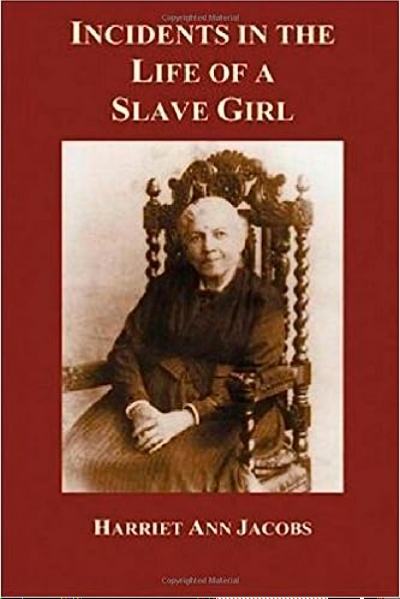
Published in 1861 in Boston, this book is the most widely read antebelllum slave narrative from a female perspective
Dred, a tale of the Great Dismal Swamp, published in 1856. is Harriet Beecher Stowe’s second anti-slavery novel. The main character, Dred, was inspired by the fugitive slave Osman, who is pictured above. But. unlike genial Uncle Tom, Dred is a revolutionary leader.
Stowe weaves a lively and telling picture of antebellum life into the novel, along with sharply etched descriptions of the characters and classes that existed in that society. The novel is set in Chowan County and the dismal swamp north of Edenton.

Harriet Beecher Stowe’s second anti-slavery novel
This sad era in American history has been sweetened by propaganda and shrouded in generalities that obscure the realities of life for bondsmen and fugitives. As scholars sift through scant records and unearth secrets from field sites, we will learn more about the society of maroons and the social networks that provided safe passage for freedom seekers in the Great Dismal.
Extensive interpretive displays at Visitor Centers along the Underground Railroad are a first step to understanding the turmoil and the terror..
The Civil War Brings Hardship and Terror
Although no major battles were fought in the Albemarle, the presence of Union troops on land and water, and guerillas in the swamps, kept families and communities in a fearful and anxious state.
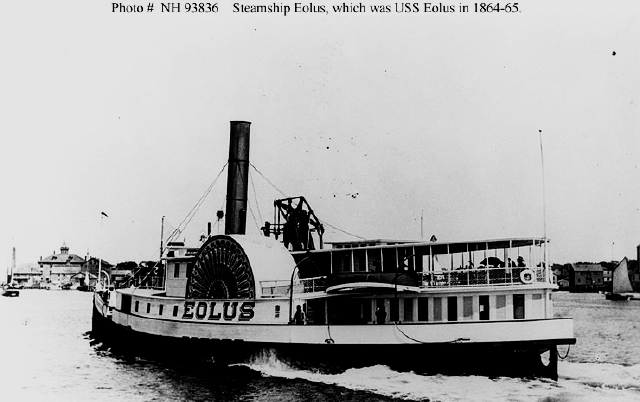
Union steamship Eolus patrolled Albemarle rivers during the war
During the early part of the war, a hastily assembled home guard (guerillas, the Yankees called them) was active, avoiding detection by melting into the dismals they knew so well.
These guerilla bands, called Rangers, authorized by the governor, took it upon themselves to harass Federal troops, prevent slaves from crossing Union lines, plunder, terrify and even murder Union sympathizers.

A recent photo of a land with no landmarks that allowed rebels to operate in secrecy, under cover of swamp. Karl Bowden/FrogsView
At the same time, Union sympathizers known as buffaloes were operating clandestinely in concert with renegade Union troops. They also committed atrocities on innocent people that left citizens frightened and horrified.
The outrageous and lawless behavior of both groups angered locals. Federal troops threatened punitive raids if the Rangers continued their cruelty, and citizen outcry was so strident that rebel groups were dissolved within a year, and buffaloes discontinued their raids and reprisals. But bitterness between the two sides remained.
Elizabeth City was the second town in the Albemarle to fall to the Union navy. Its capture was part of the Union’s Anaconda Plan to blockade and weaken the Confederacy.
Roanoke Island fell first to Union forces in 1862. Then the US Navy turned its attention to North Carolina’s small, fledgling navy, dubbed the Mosquito Fleet. Its purpose was to hold Roanoke Island and protect Elizabeth City, but it was so weak and ill-equipped it could do neither and was destroyed in the Battle of Elizabeth City.

Depiction of the Battle of Elizabeth City. Rebel Mosquito Fleet shown in red. NCPedia
The panic of Elizabeth City residents during the battle is vividly described in Grandfather Tales, written by newspaper editor, Richard Creecy.
While at breakfast, a servant ran into the room from upstairs saying with great alarm that the river was full of steamboats going up towards town, like a wedge, that there was more ‘n forty of ’em.. . .
All the people of the town were on the road, most of them were on foot, shoe-tops deep in mud and slush, muddy, bedraggled, unhappy, wretched. . .
They told us of the distress. That it was a dead town. That it was dead as a graveyard, that all had left, some never to return. . .They said that some had set fire to their houses. . .that others had done the same, and that the whole town was then on fire to spite the Yankees. . .
. . .that Reverend E.M. Forbes was staying in town to meet the Yankees. . . surrender them the town and ask for protection. . .that (he) was putting on his ecclesiastical vestments that they might respect his sacred office.

The Union armada approaching Elizabeth City may have appeared thus to observers. Nineteenth century engraving
Union troops offered to extinguish the fires, but by the time the fires were out, most of the houses were destroyed.
After the Emancipation Proclamation in 1863, black troops, freed black residents and those recently freed from slavery mingled freely on the busy wharfs of Elizabeth City.
Among them, a brigade of black soldiers, many previously enslaved, returned to the city under the command of Brigadier General Wild. In a three-week-long expedition known as Wild’s Raid, the brigade freed most of the remaining slaves in the city and surrounding counties, some 2500 people in all.
After the war citizens slowly mended their lives and began a long but ultimately successful road to development that would bring prosperity to the city.
An annual Emancipation Day parade to celebrate black freedom and achievements was organized by the black community. The tradition continued into the 1930s.
Moths Over the Water
In 1929 a sailor visiting Elizabeth City stopped in a boatyard for repairs to his craft. He wound up designing a tiny sail boat suitable for maneuvering in shallow creeks and rivers. It was no more than 11 feet long, 5 feet wide with a mast no taller than 16 feet 6 inches. It became an instant hit, inexpensive to build and fun to sail.
People watching the boats bounce over the water thought they looked like white moths flitting about, and so they were called Moth Boats.

White moths over the water. Internet photo
The Moth Boat gained international fame almost immediately after it was put in the water in the 1940s near Elizabeth City. Its popularity soared, and annual races on the Pasquotank drew 75 to 100 participants. Said one sailor and racer, It’s a simple quick little boat. Once you get it sailing, it becomes part of you. You can do what you want to.
Racing Moth Boats was celebrated until the mid-fifties, when interest began to wane. Lately, promoted by the Museum of the Albemarle, the races have resumed. Old moth boats have been brought out of garages and barns. Students in construction classes at Camden High School have learned to build them.
And the races are on!.
The Price of Progress
By 1881 rail lines linked Elizabeth City to points north and south and cemented the city’s position as an industrial center.
Forests in the area were among the first in the southeast to be logged intensively. Timber companies cut thousands of acres of white cedar and turned it into barrel staves, ship masts and house shingles. Land was being drained for farming.

Logging in the Great Dismal Swamp, second and third growth. Clarence Korstian NC Forest History Society
Natural resources of the Albemarle — fisheries, fertile land, and old-growth forests — were giving way to progress. The wetlands of the Great Dismal Swamp were being conquered.
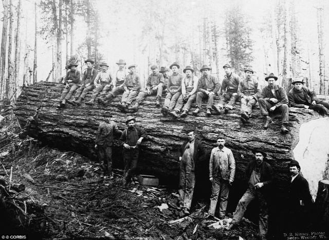
Lumbermen in camp. Note the size of this old growth tree
At one time a dozen canneries in the city processed oysters harvested from North Carolina waters. There is no substantial oyster harvest today because of overfishing and polluted water.
This is too bad. Oysters are nature’s eco-engineers. As they feed, they filter pollutants from sea water, leaving it cleaner than before, and their reefs provide homes to fish and other sea creatures. Further south along the coast, artificial materials are being sunk in experiments to attract young oyster spat that will attach themselves and build new reefs.

Oyster reefs were common in brackish water, and oystering put food on the table and became a profitable industry, Note tiny white spat on larger shell. Robert Michelson
Shipyards, textiles, and military installations contributed to the greatest concentration of population and industrial activity of any river on the north side of the Sound.
By the 1950s large quantities of untreated domestic sewage and industrial wastes were being dumped directly into river and creeks. Metal-plating operations discharged copper, chromium, and cyanide.

An example of effluent from municipalities and industry dumping wastes directly into waterways. This is known as point-source pollution
Sewage sludge lined river banks and the water was colored dark gray, with oil slicks, dead fish and other debris. After storms, a distinct odor of sewage pervaded Elizabeth City.
Since river flow was often sluggish, pollutants were slow to disperse. Chemical testing indicated low dissolved oxygen and high counts of coliform bacteria, making the river a public health hazard for swimming and water sports. In 1956 a major fish kill occurred.

Algae bloom. Fish kills can be preceded by algae blooms in warm weather. When the algae die and decay, the they use oxygen that fish need to survive. Or fish kills can be caused by poisonous chemicals
Changes were occurring in farming, too. High commodity prices during the 1960s and ’70s fostered a flurry of agricultural activity. Cypress was harvested up to river’s edge and cut-over swamps were ditched and drained for farming.
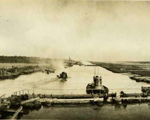
Tugboats on the Albemarle Chesapeake Canal showing land stripped of its trees and drained for farming. NC Naval Cultural Resources
Pesticides that did not exist before World War II were used on crops. These chemicals and fertilizers ran off into creeks during rains and further exacerbated water quality. Best Management Practices were introduced to farmers to control run-off, but they were voluntary and farmers were slow to adopt them.
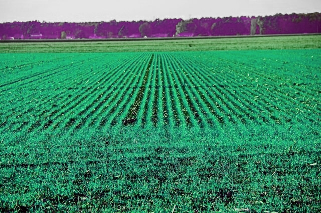
If runoff from this farm after rainfall is not controlled, chemicals will enter waterways. This type of pollution is called non-point source pollution
Streams where fish could once spawn because they were spanned by bridges and left untouched, no longer existed in their natural form. As population grew and roads were added or widened, streams were shunted into culverts, natural contours were straightened, or ultimately drained. Traditional spawning grounds were lost.
The herring catches of yesteryear are history.
A Change in Approach
Slowly the national philosophy of dilution is the solution to pollution gave way to urgent calls for cleaning up the nation’s waters. Great strides toward mending the Pasquotank River were made soon after the Clean Water Act of 1972 was passed. This federal law requires permits for discharging wastewater into navigable waters and puts limits on activities in wetlands.
But juggling economic needs with environmental safeguards is a delicate act.
A decade after the Clean Water Act, Congress passed broad legislation to fund targeted studies on the nation’s waters. In North Carolina the Albemarle Pamlico Estuarine Study (APES) brought state officials, scientists, and citizens together to produce a guide to protecting the waters of eastern North Carolina

The study covered waters in eastern North Carolina, showing the Albemarle and Pamlico Sounds and rivers. This system is the second largest estuary in the nation. APNEP
Locally, grass-roots activists formed the Albemarle Environmental Association (AEA). Working with communities. a hog farm and landfill in Camden County were successfully opposed, as were a hazardous waste incinerator in Tyrrell County, a mega-marina in Chowan County, and a Navy landing field in Washington County.
Large marinas can change the landscape of a river and be a source of pollution if not managed carefully. Internet photo
Under the auspices of Streamwatch, citizens and school children tested local waters and recorded chemical and physical data. Sponsored by the state, in the Albemarle area sites were managed by volunteers from AEA.
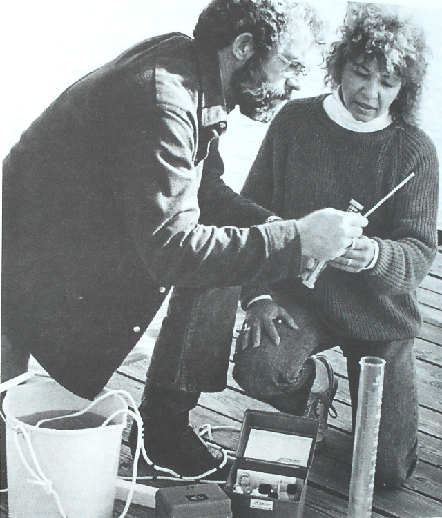
Jim and Linda Davis test water from the Pasquotank River off their dock. Streamwatch photo
The possibilities of Ecotourism were embraced. Vacationers who stopped here could find beauty, tranquillity, and rich history in a landscape that exists nowhere else in the country.
Ecotourism can protect communities and natural areas from unwanted change and put dollars in people’s pockets. Hiking, biking, boating and fishing can boost the economy and, at the same time, tread lightly on land and water because little infrastructure is needed to support them.
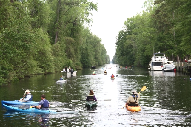
Paddle for the Border is an annual event: starting point the NC Dismal Swamp Canal Visitor Center; end point Virginia
Field trips and group canoe excursions led AEA volunteers to compose an interactive Green Guide to the Albemarle that features points of interest in each county, canoe trails and maps. Go to AEAontheWeb for more information.
Interactive Green Guide to the Albemarle can be found at AEAontheWeb.org
Challenges to Come
Like other rivers, the Pasquotank can accept only limited manipulation before it loses vitality. Wise planning that protects habitat for wildlife on land or in water is a master key to a healthy environment.
Modern methods of wastewater treatment are critical to preserving water quality, as is expanded use of agricultural Best Management Practices. This basic technology can control erosion and curb runoff of nutrients and chemicals into streams.
Aerial view showing blue waters and wooded areas of Camden County, which lies along the eastern shore of the Pasquotank River. Camden is one of the least developed counties in the state. Kurt Bowden/FrogsView
Rising sea level is perhaps the greatest challenge facing Albemarle Counties. Flooding has already occurred in the streets and parking lots of Elizabeth City after heavy rains.

Tide gauges at the Elizabeth City waterfront (pictured here) and South Mills measure fluctuations and crests in the Pasquotank River. NOAA National Weather Service
Sea level has been rising and falling for eons. We know from fossil records that plants and animals can adapt to the dynamics of change in their environment.

These cypress germinated on land but have adapted to growing in water. Eventually, if sea level rises, dramatically, they will die and islands of grasses may take their place. SeaGrant photo
This is the first time in earth’s history that populations and hard structures of modern cities and towns will be challenged by inexorable sea level rise.
Below is a map of eastern North Carolina that shows how vulnerable land is in the Albemarle area. The Suffolk Shoreline represents an ancient shoreline that existed not thousands or ten thousand years past, but eons ago, when climate was warmer than today and sea level was higher. Land to the east (in green, eastern Carolina), was under water as the Atlantic Ocean lapped the beaches of the Suffolk Shoreline.

Map Credit: NC Land of Water
When climate cooled, glaciers stole water from the seas to grow and sea level dropped to expose this low country of eastern North Carolina. The last glacier melted slowly about 20,000 years ago.
Sea level has been rising since then and will continue to rise until the earth begins cooling again. If you look back at earth’s geologic history, you will find cycles of ice ages punctuating warm periods.
We are living in a cycle of warming. We will have to toss out past approaches that say we can conquer the world’s natural cycles and learn to live in harmony with change. New technologies can help us find new approaches, but only if we become humble as we face the future.
Ultimately, the well-being of Albemarle counties and the Pasquotank River will depend on people who take the time to understand future challenges and make their voices heard and work sensibly to protect our valuable resources and accommodate to change.

Sunrise on the Pasquotank River
