
I seem to have stumbled on a new world, so wild a place. . .
Two centuries ago Henry David Thoreau wrote those words about New England swamps. Today they evoke the mysterious wetlands of the Alligator River and the Albemarle-Pamlico peninsula.
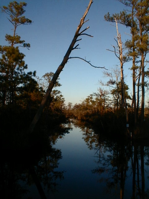
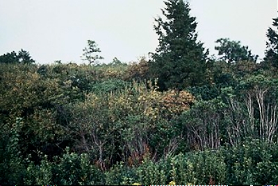
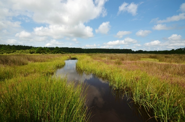
A fall afternoon along a creek in the Alligator River system. aheronsgarden.com photo
A Nuisance Wilderness
The vast Albemarle-Pamlico peninsula covers 3,000 square miles. It is a complex checkerboard of land tamed by men and environments still kept wild under the auspices of the National Wildlife Refuge system.
The Alligator River that courses through the peninsula is one of the wildest in northeast North Carolina, yet it is probably the most heavily traveled. As part of the busy Atlantic Intracoastal Waterway, the river becomes a link between Albemarle Sound to the north and Pamlico Sound to the south.

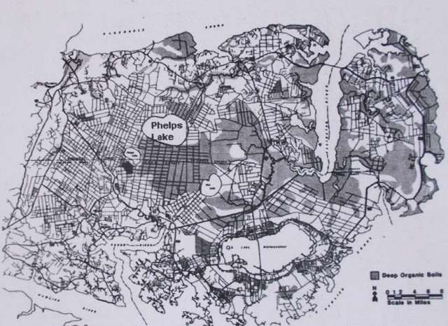
Map of Albemarle-Pamlico Peninsula showing wildlife refuges. The large, unnamed lake south of US 64 is Phelps Lake
It is a peninsula of wetlands that can absorb merciless pummeling from hurricanes, sponging up floods and filtering water, cleansing it of impurities.
For three centuries these wetlands, like others across the country, were considered nuisances, mucky, buggy, disease-ridden pieces of real estate, useful only if ditched and drained for farming and lumbering or anything else that could turn a profit.
So man has indelibly altered the dynamics of land and water and wounded the natural environment in ways that could not have been fathomed in their day. Climate change and rising sea level are adding urgency to the race to bind up the wounds.
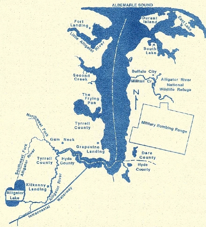
The Alligator River and tributaries. Not shown on this map are Lake Mattamuskeet to the southwest, and Pungo and Phelps Lakes to the west. Map by Elaine Roth
Life on the Peninsula
The Alligator River springs from lazy, winding streams, one from land around Alligator Lake (also called New Lake). Others from deep in broad, flat, low-lying wetlands of the peninsula, a set of lacework traceries that meander through modern farm fields and ancient wetlands, rich with wildlife. and scenic beauty for the venturesome canoeist.
Twenty miles from Albemarle Sound, the river gathers volume, widens and sets itself due north for the final journey.
Swamp forests of tupelo-gum, white cedar and aged bald-cypress fringe the river, purify water and buffer against floods.

Atlantic White Cedar, once the crown jewel of the peninsula, seen here in mixed woodlands along a black water stream. US Fish and Wildlife Service photo
Aptly named, the river was once the northernmost retreat for the American alligator.
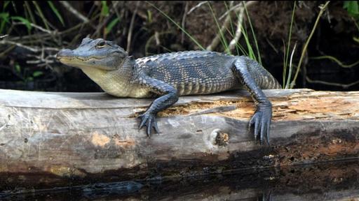
Alligators are seen occasionally by paddlers and have migrated across Albemarle Sound to as far north as Merchants Millpond State Park. US Fish and Wildlife Service photo
At one time, the Alligator River drained over a third of the peninsula. In vast sheets, rainwater leisurely fed the river and its tributaries as it flowed through millions of acres of wetlands: bogs, marshes, hardwood swamps and a strange type of wetland called a pocosin.
Pocosins. The Algonquians first used the word pocosin to describe this landscape of swamp-on-a-hill. They are ancient dome-shaped wetlands that you can find only on the coastal plain in southern Virginia and the Carolinas. The Albemarle-Pamlico peninsula is home to the largest concentration of pocosins in the country.
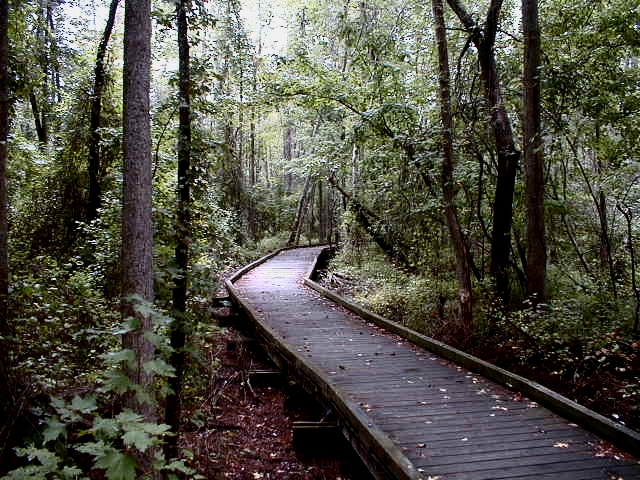
You can explore these wetlands by taking a walk through the Pocosin Lakes National Wildlife Refuge, headquartered in Columbia. aheronsgarden.com photo
Soils of pocosins are deep, acidic, sandy and peaty. The peat comes from muck compressed over thousands of years. The muck came from dead plants that decayed in swamps with little to no oxygen.
Pocosins: Impenetrable, mysterious reservoirs of peat. NC Division of Environmental Quality photo
These are not soils that foster the lush growth of ancient forests. They are acidic and stingy about releasing nutrients. They support scrappy pond pines and stands of gallberry, ti-ti, fetterbush, and bay that scrabble mightily for their share of a meagre offering. Where nutrients are more generous, trees are taller and more stately.

Stunted pond pine and shrubs rub shoulders in Pocosin Lakes National Wildlife Refuge. Note pitcher plants in foreground. US Fish and Wildlife Service photo
This tangled growth provides a retreat for black bear, gray fox, bobcat and the recently re-introduced red wolf who find the seclusion they need to survive and breed.

Black bear lounging–er — squashed on a branch. The largest specimens and the greatest numbers of black bear in the east are found on this peninsula. Photo by Lewis, US Fish and Wildlife Service
Migratory waterfowl flock here in winter. Tundra swans, snow geese, heron and over 20 species of ducks including wood duck, teal, mallard, and pintail spend days loafing on ponds and streams in wildlife refuges managed by the US Fish and Wildlife Service.
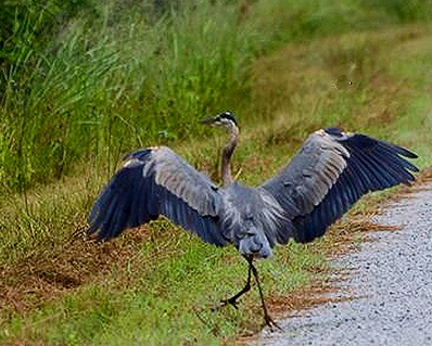
Dancing great blue heron, a resident species, along a refuge road. Photo by Jones, Washington Daily News
In fall, flocks of migrating birds seek cover in thick growth, feasting on berries, seeds and nuts, gifts from scraggly plants battling for territory.

Prothonotary warbler, the “swamp canary,” common near water is both resident and migrant . USFWS photo
This landscape of pocosins gives freely to wildlife, but it can be treacherous, too. The land is born of fire. It occurs naturally here, and plants have adapted to survive fire and set seed in fiery infernos. Fire here means renewal of life, but wildlife, too, must learn to manage.
Early Heritage
Impenetrable pocosins and labyrinthine swamps must have seemed forbidding to land-hunters who trekked south from Virginia and crossed Albemarle Sound and ventured up the Alligator River around 1700.
It’s so thick in there, according to an old-timer, my hound dog has to back up to bark.

The Moseley 1733 map shows level of settlement north of the Sound compared to the poorly explored peninsula Note missing lakes, which were not discovered until mid 18th century because they were perched above rivers and did not connect to them.(#1 today’s Scuppernong River, #2 today’s Pungo River, #3 Town of Bath, #4 Town of Edenton, early capital of Carolina territory.) Map from Cumming, 1966
The pathless land was a magnet for runaways, people escaping the reach of the law or the pain of an intolerable marriage, or overwhelming debt, or the yoke of slavery. They melted into forests. They were hardy, resourceful, opportunistic. They became invisible, settling in small wilderness communes.
Some may have sought shelter in Alligator Creek. Some started a community called Fort Landing. Since the warlike Secota Indians patrolled the area, settlers erected a makeshift stockade whose remains, a collection of logs, may still be seen at low water.

Second growth forest on the banks of Upper Milltail Creek gives an inkling of wilderness that settlers encountered once they left the rivers. Photo by roadsendnaturalist
Other pioneers ventured further up the river, but few cared to tackle clearing vast forests. They hugged navigable streams and perched on ridges of high ground known as chestnut oak islands.
By the 1750s the Gum Neck area and East Lake, best known today for its rye whiskey produced at Buffalo City during prohibition, had been settled. Kilkenny, settled in the early 1800’s by the Irish, was for years the last frontier in Tyrrell County.
Most people in those early days farmed a little, fished a little and made cypress shingles to sell for seven dollars a thousand to buyers who came up the river on flat boats.
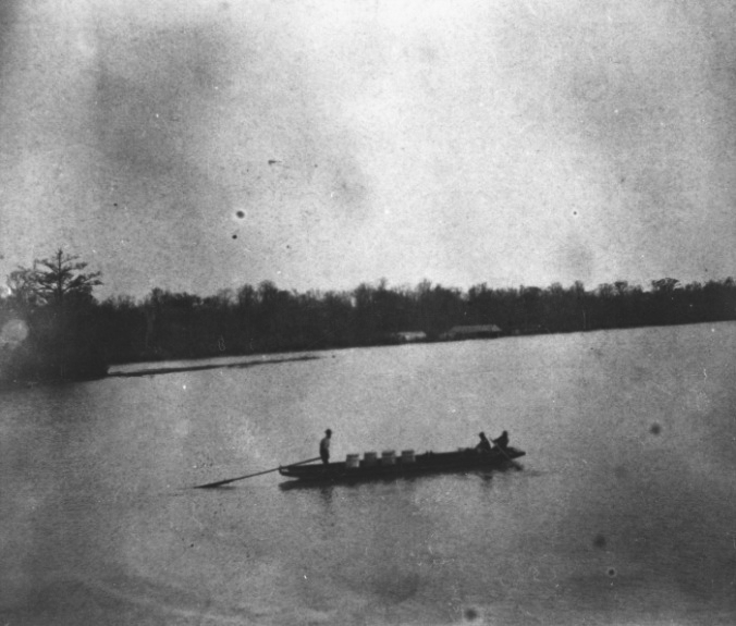
Flatboats indispensable for transporting herring and other commodities. Smithsonian Institute Archives
They dug canals through swamps to drain land for farming and aid navigation, or they built dikes to channel streams, laborious work, so changes to the land were negligible.
The Fisheries
Acidic, tannin-stained streams that laced the land were laden with decay from organic soils, The dark rich waters were host to river herring and striped bass that used to come by the millions to spawn. For centuries the river and creeks were nurseries for young fish that provided food and livelihood for native people and hardy colonists.
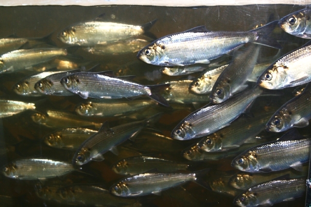
Herring spawning. Photo by John Burrows
The Frying Pan, a stubby thumb off the Alligator River, was long considered one of the best fishing spots around. During the 1800s through the 1930s profitable fisheries lined the shore.
Lights from lanterns would twinkle on spring nights as fisherfolk worked quickly and efficiently with special knives to process colossal numbers of herring on long piers built out over the water.

Example of herring stacked for processing. Smithsonian Institute Archives
Mounds of fish were high, work was fast, and alligators happily fed on wastes that spilled into the water during the frantic month or so when herring and striped bass were spawning.
Men would arrive at the fisheries in shad boats from Gum Neck on Monday mornings and remain at the Frying Pan till late Friday evenings. They cooked, ate and slept in dormitories adjoining an ice room, where 300-to-400 pound blocks of ice were delivered twice a week from points north via Elizabeth City to preserve bass and perch.
(Elizabeth City was a growing metropolis on the Pasquotank River across Albemarle Sound, almost directly north of the Alligator River and linked to points north by canals.)

Artist’s rendition of the shad boat, a small craft known for its speed and maneuverability, especially in shallow water. In a roadless society it was used to haul everything from herring to bootleg liquor. It is the official state historical boat
Dressed herring, drained, scaled, and salted, were thrown into barrels and loaded onto freight boats for Elizabeth City and beyond. A bonus for workers were the stores of processed fish they took home to help them survive lean winters.
When steamships replaced sailing vessels in the mid-1800s, reliable, fast transportation opened new markets. Necessary supplies, like the huge blocks of ice from up north, arrived at riverside communities, and prepared fish were sent off to markets in Elizabeth City, Norfolk, Baltimore, and as far away as New York’s Fulton Fish Market.
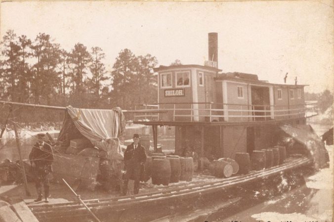
Steamer Shiloh in 1895, here carrying cotton, is an example of traffic on the waters
Business was good until the 1930s, when roads supplanted canals and the fishery, over-fished for decades, was declared “depleted.”
Plantation Life
Further west on the peninsula, plantations like Buncombe Hall near Roper and Somerset Place at Lake Phelps grew up in the second half of the 1700s. Forests were logged, and cleared land was ditched and drained. After the turmoil of the Revolution, naturally fertile soil and slave labor created a society unlike any other in the country.
The antebellum 1800s were golden decades for the Albemarle-Pamlico peninsula. Farmland was rich and productive. Fish were plentiful. Slavery powered the economy. Steamships linked the peninsula with markets up and down the east coast. No wonder the area had a reputation as the Venice of the West.
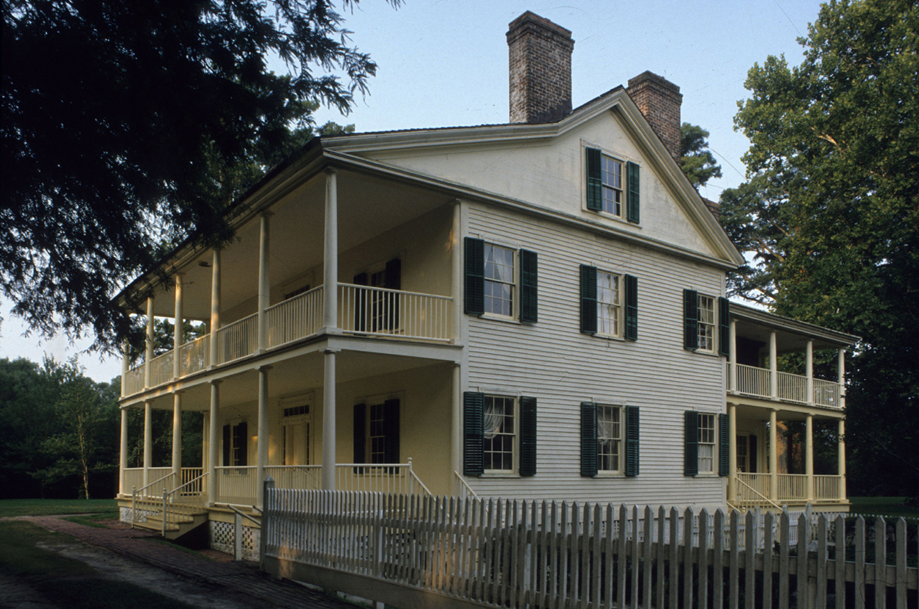
Somerset Place near Lake Phelps, one of the finest plantations in the South, was the third largest in North Carolina circa 1830. It is now a state historic site.
Descendants of slaves from Somerset Place have held reunions beginning in 1986. In her book, The Somerset Homecoming: Recovering a Lost Heritage, Dorothy Spruill describes her vision of life on the plantation.
I could see a completely reconstructed, working plantation rising from this ground. The barn rebuilt as it once was, with oxen once again pulling carts. Water, clear and strong, flowing once again through the canal. The gardens lush and full. The church standing once more, its pews as they were when my ancestors sat in them. The tools wielded by the black artisans in place again. And the homes of the slaves themselves, standing and glowing with the aura of life that once filled their rooms.
Canals crisscrossed the Albemarle-Pamlico Peninsula, all built by slaves. Slaves could spend days knee-deep in muck, brutal work, a constant struggle with snakes, insects, roots, stumps, and buried trees. Navigation canals were even deeper and wider than canals that drained land for farms, so the work was considerably more arduous.
(To folks who were not actually doing the ditching, the canals were considered beneficial. Most people believed that draining swamps improved public health.)
In early 1786 100 enslaved Africans were put to work digging a six-mile canal, 20 feet wide and four to six feet deep from Lake Phelps to the Scuppernong River, which feeds Albemarle Sound and using the spoils to create a road beside the canal.
In just two years Somerset Canal with its bankside road was moving produce and goods via flatboat and horse and wagon between the plantation and Albemarle Sound and beyond. The energy from the fall from canal to lake powered machinery, saw mills and a grist mill at Somerset.
Eventually, together with cross ditches, 100,000 acres of wetlands were drained to become fields where rice, corn and wheat could be grown by small landholders or slaves of large plantation owners.
Ditched and drained farms near Phelps Lake
According to records, by 1860, the Collins family of Somerset Place owned 4,000 cleared acres worked by 328 slaves. Josiah Collins III was one of the three largest slaveholders in North Carolina. (Interestingly, Collins strongly believed in slavery and the Union.)
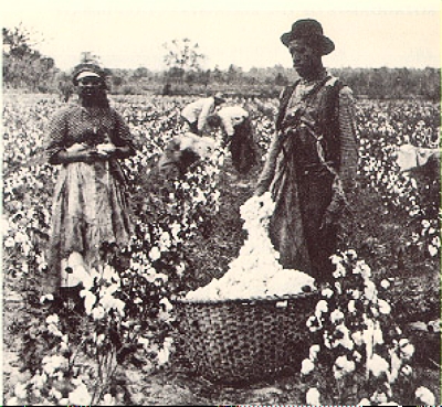
This 1886 photo gives an idea of antebellum conditions on fields in eastern North or
Truly, the antebellum 1800s were golden decades for the Albemarle-Pamlico peninsula,, or, as it was called, The Venice of the West.
But life would change for plantation owners after the Civil War,. Buncombe Hall, famous for its boundless hospitality, does not exist today, victim of slow deterioration. Somerset Place is now a historic site.
And by the end of the 19th century, soils were depleted and fisheries were less profitable. The heyday of reaping nature’s bounty without a care for the next generation was coming to an end and neither rivers nor land could sustain high yields. Logging held promise, but The Venice of the West no longer existed.
Entrepreneurs Descend
By the 1880s Atlantic white cedar was the tree of choice for lumbering. Its wood was strong, lightweight, and rot resistant. It could be used for boats and buildings, and hand-hewn shingles, too. It became a reliable source of income for yeomen and plantation owners alike. Lure of profits induced three mill owners from Buffalo, New York to purchase, unseen, vast acreage in Dare County.
They brought in Black laborers and Russian immigrants to log cedar, cypress and pine. Buffalo City, founded in 1885, became the largest logging operation in northeast North Carolina with its own post office and general store.

Main Street in Buffalo City
Workers were paid 50 cents a day in aluminum pieces that could only be used at the general store. Surrounded by alligators, bears, and soupy swamps with voracious insects loggers had little choice of where to spend their earnings. They were captives of the company and the environment.
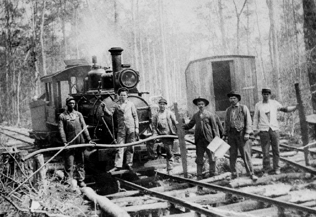
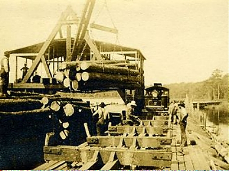
Miles of tram road were laid to move logs to sawmill and river for shipmentA hundred miles of tram roads crisscrossed the peninsula, moving lumber from the interior to Miltail Creek and from there, on barges, to sawmills in Elizabeth City. Remnants of tram roads can still be found today.
Sawmill in 1909
Like rivers and farmland, forests eventually gave out. As logging became less and less profitable, the economy of the area spiraled downward. By 1903 the Buffalo Timber Company had closed, though more brutal forms of lumbering would come later in the century.

Overlooking the river ready for milling and loading while logging was still profitable
Prohibition Saves the Economy
Prohibition to the rescue! Though it was not the intention of the 1920 law, prohibition lifted up the depressed economy in eastern Carolina. Almost every family operated a still, and so began a heady decade of grand-scale bootlegging.
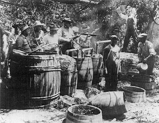
Bootleg whiskey had a long history in the south, even before prohibition made it especially profitable
Stills were usually deep in the woods and delivery of product was arduous and ingenious, overland by mule, then by boat to Elizabeth City.
Five-gallon jugs with waxed corks were towed underwater, secured to boats by trotlines. If a revenuer approached, trotlines were cut. Jugs would sink, to be recovered later. On the return trip, boats were loaded with the sugar needed to produce more whiskey.

East Lake saloon. Big business, tightly controlled
East Lake rye whiskey had a reputation as the finest, smoothest liquor produced, bottled under its own label, and preferred by — no, demanded by — speakeasy habitues in big cities like Washington, DC and New York City.
The prosperity was short-lived, but in retrospect, it could be argued that this outlawed pursuit caused negligible disruption to the environment compared with the legally condoned exploitation of the land that was to come.
Capitalism on Steroids
Less than a century after the Buffalo City venture, land ownership was consolidating. Major timber companies owned 44 percent of land on the peninsula, and large agricultural corporations owned 21 percent.
Only a third of pocosins remained in their natural state. North Carolina and other southern states had gained the reputation as the wood basket of the nation.

Schematic showing loss of forested land in less than four centuries. Minimal loss during the first two hundred fifty years of settlement, followed by major losses in the twentieth century
From mid-twentieth century on, a massive push to eradicate native forests took place. Huge, cleated rollers would excavate roots and tear them apart to prepare soil for tilling.
As farming became mechanized, clearings stretched from horizon to horizon and were likened to Kansas cornfields.
Corporate growers gradually bought up small farms. With compelling efficiency, factory-style production of corn, cotton and soybeans, cattle and hogs was exchanged for the kinder, gentler family farm and ancient, impenetrable thickets that once gave wildlife safe haven.

Soybeans ready to harvest. Once ripened, treatment with herbicides defoliates plants to facilitate harvesting. FrogsView photo
Ppine plantations, intensively managed, destroyed wetlands. Pines cannot survive high water tables, so lumber companies ditch and drain, euphemistically calling the procedure recontouring.
Forests of pulpwood for newsprint supplanted irreplaceable wetlands. While the land can’t easily be reclaimed, the use of Best Management Practices for forestry, now required by state law, helps control erosion and limits run-off.
But ditches remain, as many as 16 miles of drainage ditches per square mile of land, to speed collection of excess water and drainage. Water no longer seeps through land. It pulses through ditches as runoff carrying herbicides and sediment.
Vast network of drainage canals on the peninsula as seen in 1976 aerial photograph. Dark areas are deep organic soils. Map from Daniels 1978
Slugs of contaminated run-off force fish and shellfish out of traditional near-shore nurseries into less hospitable areas. Commercial fishermen blame plummeting hauls on ditching and draining.
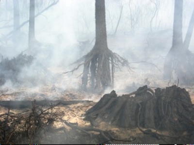
Fires Become Catastrophic
Pocosins, that swamp-on-a-hill, as we have said, are fire-prone, but plants have adapted to periodic invasions of fire. Usually, pocosins are saturated with ground water, so fires are not damaging. But during seasonal dry spells or drought, lightning strikes can ignite dry peaty soils.
If the land drains naturally, fires will consume small areas, maybe a few hundred acres, and vegetation will quickly grow back. But if the lay of the land has been altered by ditching and draining, smoky peat fires can linger for months
Ditching and draining have in fact been responsible for catastrophic wildfires after lightning strikes. In a healthy natural state, peaty wetlands would hold fast and rebound with minimal losses of acreage and immediate regrowth.

The Pains Bay wildfire on the refuge, viewed from Hatteras, on the barrier island (Outer Banks) forced closure of stretches of US 64, the major artery across the peninsula
In 2011, the Pains Bay wildfire burned more than 45,000 acres on Alligator River refuge land and the military bombing range within it. Drought had dried peat soils and water tables were low when lightning struck. Hurricane Irene finally extinguished it.

Smoke billows from the Pains Bay fire. NC Forest Service photo
Intensely hot and long-burning fires can eat away such deep reservoirs of peat that trees look like they are growing on stilts. Fortunately, deep penetration causes depressions that hold water — and that bring the promise of new growth.
Eerie aftermath of the Evans Road fire that burned peat deep underground, exposing roots of trees. USFWS photo
The Evans Road fire burned for seven months, from June 2008 to January 2009, consuming more than 40,000 acres of land, or about 40 per cent of the acreage in Pocosin Lakes National Wildlife Refuge. High-volume pumps moved two billion gallons of water from Lake Phelps to the site. The fire burned so deeply, it could only be extinguished by cooling the peat with standing water over time.
The Beginnings of Conservation
Let us go back in time to 1934 and the depths of the depression.
It’s also the year that Congress passes the Migratory Bird Hunting and Conservation Stamp Act. The Act provides money to purchase wetlands for migratory wild fowl whose populations have been decimated by sport- and market-hunting. President Franklin Roosevelt is enthusiastically on board.

John Clark Salyer, Father of the National Wildlife Refuge System. Wikipedia photo
This federal program will be the first step in shifting the trajectory of land use from exploitation to conservation.
John Clark Salyer is a biologist with a passion for conservation. He works tirelessly to assemble a system of refuges based on the habitat needs of migrating birds. By the time he retires, he has engineered the conservation of some twenty-eight million acres for wildfowl.
Meanwhile, the Albemarle-Pamlico Peninsula is hit hard by the depression. Timber mills on the peninsula are shutting down. The value of wetlands drops to pennies an acre and investors want to sell.
The Metropolitan Life Insurance Co. of Boston sees an exit from its failing investment in Dare County. It approaches Salyer and sells land that will eventually become part of the Alligator River National Wildlife Refuge.
The Pamlico Timber Company sells wetlands that will become the Swan Quarter National Wildlife Refuge. The government purchases another 50,000 acres that will become the Lake Mattamuskeet National Wildlife Refuge.
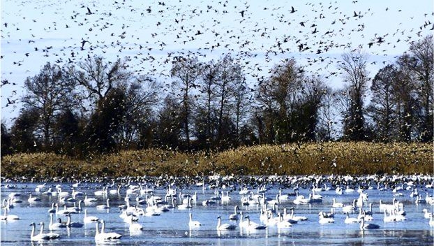
Tundra swans and snow geese and other migrants on Lake Mattamuskeet NWR in winter. This critical refuge is the last acreage along the Atlantic coast left to them. Military bases and urbanization have wiped out expanses of wetlands where they had formerly wintered, pushing them further and further south. Photo by Stewart, US Fish and Wildlife Service
On these lands the Civilian Conservation Corps makes improvements for wintering birds: impoundments, supplemental fields of grain, renovation, or razing of structures. It’s work that will endure, and it gives local families reliable income during the lean times of the 1930s. In many instances, this income saved families from starvation.
During the first half of the twentieth century. rehabilitation is beginning to balance exploitation
Corporate Exploitation
But corporate mega-destruction of habitat will invade the peninsula in the second half of the twentieth century.
Biologists are watching and they are worried. As old-growth cypress and Atlantic white cedar are clear-cut and pocosins destroyed, they raise their voices.
Enter First Colony Farms. At 355,000 acres it is the largest single-unit farm in the country. Its promised jobs are a welcome environmental trade-off for an economy that never caught up with the country.
Since peat does not make good soil for farming, First Colony teams with a company that proposes to mine the peat as fuel for power plants. The intended operations are harebrained and wildly destructive to land and wildlife.

Sunset over pocosins that were supposed to be mined for peat. Photo by April McNiff
But locals are delighted at the prospects. Caution! Caution! says a fledgling North Carolina Coastal Federation (today a powerful environmental organization). You will lose an entire ecosystem for a few low-paying jobs.
Activists work tirelessly to educate fishermen about the dangers of stormwater runoff to already precarious fisheries. Eventually, convinced and determined, communities successfully oppose the project.
At bottom is an inherited respect for the land and its resources that has been handed down through generations of families who rejoiced when the land gave freely and endured when the land withheld.
Necessary permits are denied. The grand profits do not materialize. First Colony eventually goes bankrupt, its last 93,000 acres sold at auction.

Carnivorous pitcher plants in pocosins. VisitElizabethCity.com
The Wildlife Refuges
Conservationists put in light years of work during the 1990s to put together the Pocosin Lakes National Wildlife Refuge on land available from the bankruptcy. Another 12,000 acres of refuge, already preserved as winter habitat for migrating birds, was added and called the Pungo Unit.

Snow geese loafing at Pocosin Lakes NWR. Photo by Richard Bernabas
Perhaps the crown jewel of preserves on the peninsula is the 150,000-acre Alligator River National Wildlife Refuge launched in 1984. The Nature Conservancy was midwife to its birth and remains a committed partner of the US Fish and Wildlife Service today.

Miltail Creek in the Alligator River refuge. US Fish and Wildlife Service photo
A military bombing range smack-dab in the middle of a refuge would seem like an oxymoron, but the base is preserving habitats. Most of the 43,000 acres of the Dare County Range is managed as wilderness, effectively protecting land that could otherwise be exploited.
This Refuge, critical habitat for black bear and river otters, the endangered red-cockaded woodpecker and two hundred recorded species of birds, is finally the people’s land. Hikers, kayakers, photographers, and birders use the Refuge all year, fishermen and hunters in season.
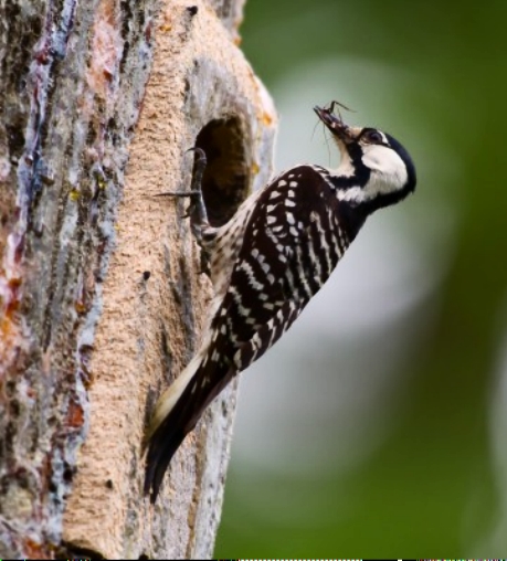
Endangered red-cockaded woodpecker makes its home in pines. Gum seeping from the rim of its excavated nest cavity deters snakes. Photo by Sam Bland
The refuge is also home to the world’s only population of red wolves. After the wolves were declared extinct on the peninsula, biologists began breeding them in captivity to re-establish them on the refuge. The popular Red Wolf Recovery program, begun in 1987, has been a resounding public relations success for the refuge.

After being released the red wolf has bred in the wild. US Fish and Wildlife Service photo
Visitors attending evening programs have come away with a new appreciation for these animals after hearing their haunting calls. Despite bumps along the way — budget cuts and landowner objections, bullets and highway accidents — the Recovery Program is still in place, though not as far along as expected. Convincing landowners near the refuge to accept and support this canine carnivore that roams widely is a priority today.
Other Fish and Wildlife activities on the refuge: Banding birds; replanting Atlantic white cedar stands; restoring habitat and drainage; monitoring wildlife; and offering recreation and interpretative programs. For visitors: birdwatching, photography, kayaking, hiking, and a chance to step back and tune in to life in a wild land.
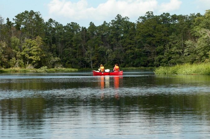
Kayaking, canoeing and fishing are favorite pastimes of visitors to the refuge
To cleanse the waters and bolster fisheries, the state has designated the Alligator River as Outstanding Resource Waters. Shoreline development and discharge of wastewater along the length of the river are limited.
The focus has finally shifted from exploitation to appreciation. During the last decade of the 20th century, the state looked at the peninsula as a fine place for a hazardous waste incinerator. The community fought it and won.
During the first decade of the 21st century the Navy looked at the peninsula as a fine place for an Outlying Landing Field (OLF) for its pilots to practice a stream of noisy landings and takeoffs. The community fought it and won.
Today, the Inner Banks, as these counties are called, are poised to attract tourism that treads lightly on the land and enriches an economy that will bring returns to its inhabitants. But the future will depend on a changing environment.
Ghost Forests and an Uncertain Future
The spectre of rising seas and changing climate hangs over this pancake of a peninsula. Extreme weather like major hurricanes and drought are forces for geologic change that we are witnessing today.

The Albemarle-Pamlico peninsula is particularly vulnerable to sea level rise. US Fish and Wildlife Service map
Storm surges push salt water onto the land and into ditches. Drainage ditches that were dug for farming on some of the richest soils in the state have now become conduits for salt water that penetrates into the heart of the peninsula.
Salt water intrudes in ditches like this. NC Coastal Federation photo
Some years drought dehydrates the land. Without fresh water drainage, salt water seeps invisibly into ditches. Given a 5-millimeter rise in sea level (the thickness of three quarters) salt water can penetrate five feet inland.
Shorelines shrink back. Swamp forests retreat. Marshes replace forests. Invasive grasses have opportunities to move in. The peaty soil disintegrates. Crops languish. The elevation of the land drops. And sea level continues to rise.

This photo was taken in 2009 by the US Fish and Wildlife Service. The red line indicates the boundary of the Alligator River NWR in 1984. Swamp forest is being replaced by shrubs. Trees are dying at the edges of the Sounds
Nitrogen and phosphorus, two nutrients responsible for algae blooms that cause fishkills, are abundant in peat. As water level rises, they leach from peat into the estuary. Peat is destroyed in the process and the cycle repeats, accelerating as years pass, gnawing further and further inland, enabled by manmade ditches.
Ghost forests now punctuate wetlands here and elsewhere along the Atlantic coast. It may take only three inundations of salt water from storms to kill a tree. Refuge scientists have calculated that eight to ten thousand acres have gone from forest to marsh in about twenty years.

Ghost forests on the peninsula. Photo by Merlin
Seepage of salt water invisibly permeates soil and kills seeds. Wildfires become destroyers instead of tough-love saviors. Seeds of Atlantic white cedar, the once dominant tree on this peninsula, and seeds of pond pines, whose cones open in fiery heat, are particularly susceptible to salt and cannot germinate. Large areas denuded by fire do not recover.

Will this burned pocosin recover? Photo by Linda Lee
Pumping, diking, or building tide gates can hold back the salt water, but these technologies are expensive and only temporary in the face of sea level rise.
Future Prospects
Farmers are comparing the tradeoff between doing nothing and losing land or making costly improvements to preserve their livelihoods for a while longer.
Refuge managers are trying to restore pristine wetlands, Scientists and environmentalists are engineering strategies that will slow run off after storms and restore lost land.

Water control structures installed on the Pocosin Lakes NWR
But counties on the peninsula do not have the funds to prepare for the future and will need help from the state. Tyrrell County, for instance, is one of the state’s largest, with prime agricultural land and fewer than 4,000 citizens. It is also one of the poorest, with average annual wages under $30,000. Encouraging eco-tourism will give the county a boost.
For the past half century communities on the peninsula have been working toward a balance between the traditional pursuits of farming, fishing and hunting, and modest prosperity from eco-tourism, to help to balance the budget.
Sunrise on Lake Mattamuskeet. US Fish and Wildlife Service photo
There is a special dance between land and water here. Visitors who want to slow down and recharge can paddle canoes, or mosey main streets of small towns, or appreciate wildlife. And they will come to understand the rhythms of this dance.
Managing this vast peninsula to keep this dance alive and promote economic security for those who live here will take determination and political will from across the state. How people will develop the resilience to cope with rising seas is perhaps the biggest challenge ahead.
*********************
The story of the Alligator River is intimately linked to the story of the Albemarle Sound and northeast North Carolina. For more detail on the environment, history, fisheries, and future outlook, see Albemarle Waters of North Carolina: Voyage Through Centuries.
